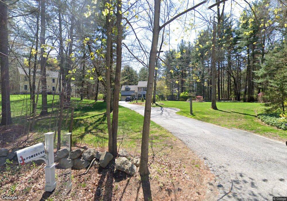
182 Powers Rd Sudbury, MA 01776
Estimated Value: $1,400,827 - $1,657,000
4
Beds
4
Baths
3,208
Sq Ft
$466/Sq Ft
Est. Value
About This Home
This home is located at 182 Powers Rd, Sudbury, MA 01776 and is currently estimated at $1,496,207, approximately $466 per square foot. 182 Powers Rd is a home located in Middlesex County with nearby schools including Josiah Haynes Elementary School, Ephraim Curtis Middle School, and Lincoln-Sudbury Regional High School.
Ownership History
Date
Name
Owned For
Owner Type
Purchase Details
Closed on
Jul 26, 2002
Sold by
Prudential Res Svcs Lp
Bought by
Bain Michael D and Bain Kristin A
Current Estimated Value
Home Financials for this Owner
Home Financials are based on the most recent Mortgage that was taken out on this home.
Original Mortgage
$573,000
Interest Rate
6.73%
Mortgage Type
Purchase Money Mortgage
Purchase Details
Closed on
Dec 1, 1999
Sold by
Wong Richard K and Wong Fiona P
Bought by
Briard Ernest B and Briard Susan E
Home Financials for this Owner
Home Financials are based on the most recent Mortgage that was taken out on this home.
Original Mortgage
$453,600
Interest Rate
7.86%
Mortgage Type
Purchase Money Mortgage
Purchase Details
Closed on
Feb 7, 1996
Sold by
Alyssa Rt and Kane Roger K
Bought by
Wong Richard K and Wong Fiona P
Create a Home Valuation Report for This Property
The Home Valuation Report is an in-depth analysis detailing your home's value as well as a comparison with similar homes in the area
Home Values in the Area
Average Home Value in this Area
Purchase History
| Date | Buyer | Sale Price | Title Company |
|---|---|---|---|
| Bain Michael D | $745,000 | -- | |
| Prudential Res Svcs Lp | $745,000 | -- | |
| Briard Ernest B | $567,000 | -- | |
| Wong Richard K | $422,000 | -- |
Source: Public Records
Mortgage History
| Date | Status | Borrower | Loan Amount |
|---|---|---|---|
| Open | Wong Richard K | $516,000 | |
| Closed | Bain Michael D | $573,000 | |
| Previous Owner | Wong Richard K | $19,000 | |
| Previous Owner | Wong Richard K | $453,600 |
Source: Public Records
Tax History
| Year | Tax Paid | Tax Assessment Tax Assessment Total Assessment is a certain percentage of the fair market value that is determined by local assessors to be the total taxable value of land and additions on the property. | Land | Improvement |
|---|---|---|---|---|
| 2025 | $19,360 | $1,322,400 | $456,400 | $866,000 |
| 2024 | $18,600 | $1,273,100 | $443,600 | $829,500 |
| 2023 | $17,473 | $1,108,000 | $412,000 | $696,000 |
| 2022 | $17,097 | $947,200 | $379,600 | $567,600 |
| 2021 | $16,194 | $860,000 | $379,600 | $480,400 |
| 2020 | $15,867 | $860,000 | $379,600 | $480,400 |
| 2019 | $15,403 | $860,000 | $379,600 | $480,400 |
| 2018 | $15,138 | $844,300 | $403,600 | $440,700 |
| 2017 | $14,575 | $821,600 | $384,800 | $436,800 |
| 2016 | $14,158 | $795,400 | $370,800 | $424,600 |
| 2015 | $13,619 | $773,800 | $357,200 | $416,600 |
| 2014 | $13,629 | $755,900 | $347,200 | $408,700 |
Source: Public Records
Map
Nearby Homes
- 2 Skyview Ln
- 1201 Old Marlboro Rd
- 42 Dakin Rd
- 8 Snowberry Ln
- 56 Seymour St
- 367 Powder Mill Rd
- 57 Longfellow Rd
- 96 Forest Ridge Rd Unit 96
- 40 Rookery Ln Unit 5
- 72 Rookery Ln Unit 3
- 377 Willis Rd
- 32 Bolton St
- 401 Emery Ln Unit 304
- 56 Rookery Ln Unit 4
- 108 Hawks Perch Unit 108
- 132 Williams Rd
- 100 Harrington Ave
- 89 Mattison Dr
- 1844 Main St Unit 1844
- 23 Deer Path Unit 5
- 188 Powers Rd
- 24 Barnet Rd
- 2759 Old Marlboro Rd
- 30 Barnet Rd
- 10 Barnet Rd
- 11 Barnet Rd
- 19 Barnet Rd
- 1445 Old Marlboro Rd
- Lot 2 & 3 Nolan Cir
- 29 Barnet Rd
- 5 Nolan Cir
- 175 Powers Rd
- 59 Hunters Ridge Rd
- 1421 Old Marlboro Rd
- 126 Willard Grant Rd
- 169 Powers Rd
- 118 Willard Grant Rd
- 45 Hunters Ridge Rd
- 151 Dakin Rd
- 310 Old Pickard Rd
Your Personal Tour Guide
Ask me questions while you tour the home.