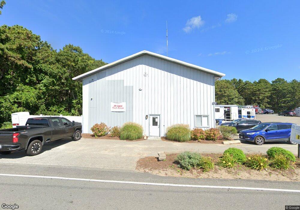
182 Queen Anne Rd Harwich, MA 2645
Northwest Harwich NeighborhoodEstimated Value: $961,149
--
Bed
1
Bath
5,040
Sq Ft
$191/Sq Ft
Est. Value
About This Home
This home is located at 182 Queen Anne Rd, Harwich, MA 2645 and is currently estimated at $961,149, approximately $190 per square foot. 182 Queen Anne Rd is a home located in Barnstable County with nearby schools including Harwich Elementary School, Chatham Elementary School, and Monomoy Regional Middle School.
Ownership History
Date
Name
Owned For
Owner Type
Purchase Details
Closed on
Aug 27, 2010
Sold by
Daluze John Z and Daluze Clifford A
Bought by
Water Island Llc
Current Estimated Value
Home Financials for this Owner
Home Financials are based on the most recent Mortgage that was taken out on this home.
Original Mortgage
$290,000
Outstanding Balance
$192,756
Interest Rate
4.57%
Mortgage Type
Commercial
Estimated Equity
$768,393
Create a Home Valuation Report for This Property
The Home Valuation Report is an in-depth analysis detailing your home's value as well as a comparison with similar homes in the area
Home Values in the Area
Average Home Value in this Area
Purchase History
| Date | Buyer | Sale Price | Title Company |
|---|---|---|---|
| Water Island Llc | $400,000 | -- |
Source: Public Records
Mortgage History
| Date | Status | Borrower | Loan Amount |
|---|---|---|---|
| Open | Water Island Llc | $290,000 |
Source: Public Records
Tax History Compared to Growth
Tax History
| Year | Tax Paid | Tax Assessment Tax Assessment Total Assessment is a certain percentage of the fair market value that is determined by local assessors to be the total taxable value of land and additions on the property. | Land | Improvement |
|---|---|---|---|---|
| 2025 | $3,074 | $520,100 | $274,200 | $245,900 |
| 2024 | $3,062 | $507,800 | $263,600 | $244,200 |
| 2023 | $2,957 | $445,300 | $209,200 | $236,100 |
| 2022 | $3,454 | $425,900 | $197,400 | $228,500 |
| 2021 | $3,666 | $426,300 | $195,600 | $230,700 |
| 2020 | $3,706 | $424,500 | $191,700 | $232,800 |
| 2019 | $3,601 | $415,300 | $184,200 | $231,100 |
| 2018 | $3,752 | $413,900 | $184,200 | $229,700 |
| 2017 | $3,627 | $404,400 | $175,400 | $229,000 |
| 2016 | $3,403 | $375,200 | $147,400 | $227,800 |
| 2015 | $3,330 | $371,200 | $144,500 | $226,700 |
| 2014 | $3,208 | $365,800 | $140,300 | $225,500 |
Source: Public Records
Map
Nearby Homes
- 3 Bittersweet Ln
- 3 Bentley Rd
- 2 Bassett Woods Rd
- 12 Old Campground Rd
- 18 Old Campground
- 159 Pleasant Lake Ave
- 16 Long Pond Dr
- 14 2nd St
- 11 Windjammer Rd
- 135 Sisson Rd
- 116 Parallel St
- 44 Beriah Brooks Rd
- 292 Route 28 Unit 7
- 91 Depot Rd W
- 64 Smith St
- 264 Massachusetts 28
- 4 Hope Ln
- 15 Shannon Rd
- 28 Dale Rd
- 231 Route 28 Unit 20
- 178 Queen Anne Rd
- 186 Queen Anne Rd
- 190 Queen Anne Rd
- 172 Queen Anne Rd
- 196 Queen Anne Rd
- 191 Queen Anne Rd
- 166 Queen Anne Rd
- 198 Queen Anne Rd
- 181 Queen Anne Rd
- 161 Queen Anne Rd
- 162 Queen Anne Rd Unit 1
- 162 Queen Anne Rd Unit 8
- 162 Queen Anne Rd
- 195 Queen Anne Rd
- 202 Queen Anne Rd
- 137 Factory Rd
- 205 Queen Anne Rd
- 156 Queen Anne Rd
- 155 Queen Anne Rd
- 210 Queen Anne Rd Unit 8