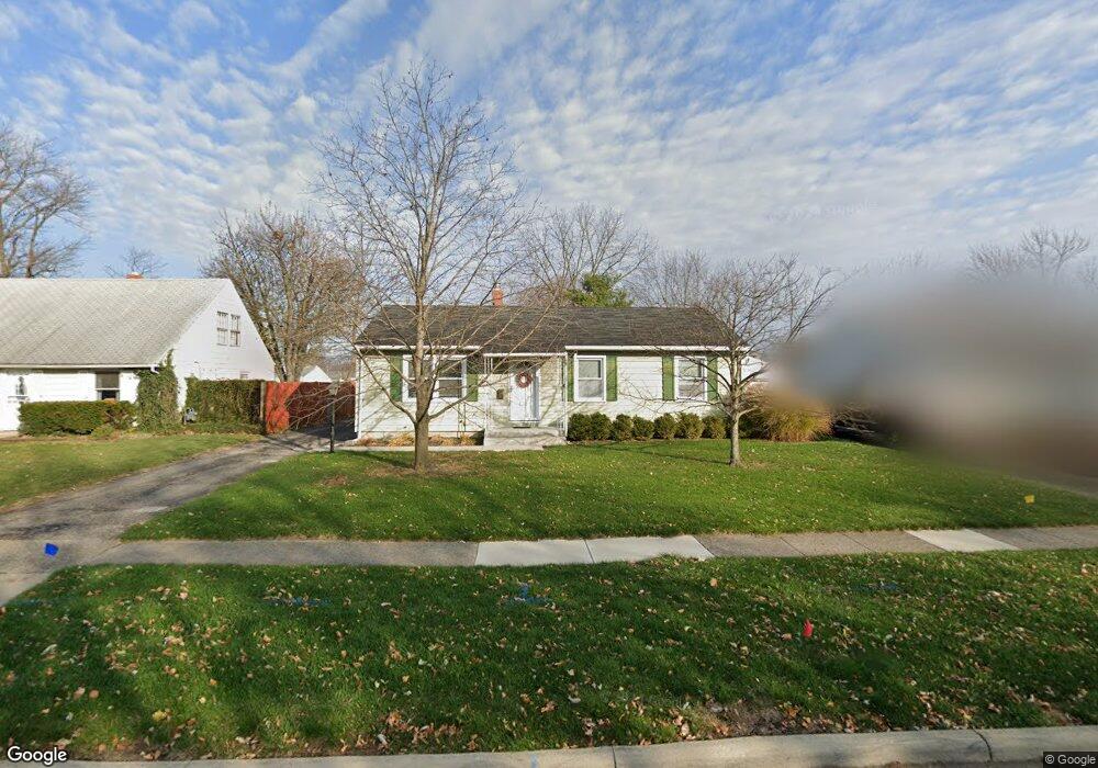
182 Sturbridge Rd Columbus, OH 43228
Estimated Value: $236,000 - $247,000
3
Beds
2
Baths
1,222
Sq Ft
$199/Sq Ft
Est. Value
About This Home
This home is located at 182 Sturbridge Rd, Columbus, OH 43228 and is currently estimated at $242,639, approximately $198 per square foot. 182 Sturbridge Rd is a home located in Franklin County with nearby schools including Prairie Lincoln Elementary School, Galloway Ridge Intermediate School, and Norton Middle School.
Ownership History
Date
Name
Owned For
Owner Type
Purchase Details
Closed on
Apr 15, 2004
Sold by
Cade John O and Cade Belinda E
Bought by
Tolliver Michael B and Tolliver Elissa B
Current Estimated Value
Home Financials for this Owner
Home Financials are based on the most recent Mortgage that was taken out on this home.
Original Mortgage
$125,000
Outstanding Balance
$57,031
Interest Rate
5.66%
Mortgage Type
Purchase Money Mortgage
Estimated Equity
$185,608
Purchase Details
Closed on
Apr 14, 1992
Bought by
Cade Ii John O
Purchase Details
Closed on
Mar 27, 1989
Purchase Details
Closed on
Oct 1, 1983
Create a Home Valuation Report for This Property
The Home Valuation Report is an in-depth analysis detailing your home's value as well as a comparison with similar homes in the area
Home Values in the Area
Average Home Value in this Area
Purchase History
| Date | Buyer | Sale Price | Title Company |
|---|---|---|---|
| Tolliver Michael B | $125,000 | Independent Title | |
| Cade Ii John O | $77,000 | -- | |
| -- | $58,900 | -- | |
| -- | $43,000 | -- |
Source: Public Records
Mortgage History
| Date | Status | Borrower | Loan Amount |
|---|---|---|---|
| Open | Tolliver Michael B | $125,000 |
Source: Public Records
Tax History
| Year | Tax Paid | Tax Assessment Tax Assessment Total Assessment is a certain percentage of the fair market value that is determined by local assessors to be the total taxable value of land and additions on the property. | Land | Improvement |
|---|---|---|---|---|
| 2025 | $3,185 | $68,960 | $17,890 | $51,070 |
| 2024 | $3,185 | $68,960 | $17,890 | $51,070 |
| 2023 | $3,050 | $68,950 | $17,885 | $51,065 |
| 2022 | $2,374 | $37,380 | $4,060 | $33,320 |
| 2021 | $2,411 | $37,380 | $4,060 | $33,320 |
| 2020 | $2,389 | $37,380 | $4,060 | $33,320 |
| 2019 | $2,332 | $31,850 | $3,360 | $28,490 |
| 2018 | $2,418 | $31,850 | $3,360 | $28,490 |
| 2017 | $2,161 | $31,850 | $3,360 | $28,490 |
| 2016 | $2,511 | $33,880 | $6,510 | $27,370 |
| 2015 | $2,511 | $33,880 | $6,510 | $27,370 |
| 2014 | $2,477 | $33,880 | $6,510 | $27,370 |
| 2013 | $1,455 | $39,865 | $7,665 | $32,200 |
Source: Public Records
Map
Nearby Homes
- 381 Pasadena Ave
- 89 Postle Blvd
- 110 Inah Ave
- 104 Oxley Rd
- 87 Tarryton Ct W Unit 18D
- 69 Lawrence Ave
- 129 Beacon Run W Unit 21C
- 4723 Tarryton Ct S Unit 14-E
- 5409 Longworth Dr
- 399 Carilla Ln
- 218 Darbyhurst Rd
- 329 Weymouth Ln
- 480 Yarmouth Ln
- 4682 Arnold Ave
- 4637 Hilton Ave
- 4647 Henley Ave
- 257 S Murray Hill Rd
- 404 Old Village Rd
- 400 Evergreen Terrace
- 429 Postle Blvd
- 190 Sturbridge Rd
- 174 Sturbridge Rd
- 200 Sturbridge Rd
- 183 Topsfield Rd
- 189 Topsfield Rd
- 173 Topsfield Rd
- 199 Topsfield Rd
- 208 Sturbridge Rd
- 185 Sturbridge Rd
- 156 Sturbridge Rd
- 177 Sturbridge Rd
- 195 Sturbridge Rd
- 169 Sturbridge Rd
- 165 Topsfield Rd
- 205 Topsfield Rd
- 216 Sturbridge Rd
- 203 Sturbridge Rd
- 161 Sturbridge Rd
- 148 Sturbridge Rd
- 161 Topsfield Rd
Your Personal Tour Guide
Ask me questions while you tour the home.