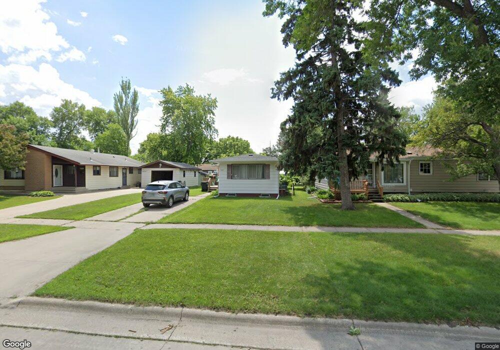
1820 6th Ave S Fargo, ND 58103
Jefferson-Carl NeighborhoodEstimated Value: $180,000 - $209,000
3
Beds
1
Bath
944
Sq Ft
$202/Sq Ft
Est. Value
About This Home
This home is located at 1820 6th Ave S, Fargo, ND 58103 and is currently estimated at $190,972, approximately $202 per square foot. 1820 6th Ave S is a home located in Cass County with nearby schools including Jefferson Elementary School, Carl Ben Eielson Middle School, and South High School.
Ownership History
Date
Name
Owned For
Owner Type
Purchase Details
Closed on
Aug 10, 2009
Sold by
Schlenker Paulette J
Bought by
Millinton Christian A and Millinton Lynnette L
Current Estimated Value
Home Financials for this Owner
Home Financials are based on the most recent Mortgage that was taken out on this home.
Original Mortgage
$95,900
Outstanding Balance
$62,814
Interest Rate
5.3%
Mortgage Type
VA
Estimated Equity
$128,158
Create a Home Valuation Report for This Property
The Home Valuation Report is an in-depth analysis detailing your home's value as well as a comparison with similar homes in the area
Home Values in the Area
Average Home Value in this Area
Purchase History
| Date | Buyer | Sale Price | Title Company |
|---|---|---|---|
| Millinton Christian A | -- | -- |
Source: Public Records
Mortgage History
| Date | Status | Borrower | Loan Amount |
|---|---|---|---|
| Open | Millinton Christian A | $95,900 |
Source: Public Records
Tax History Compared to Growth
Tax History
| Year | Tax Paid | Tax Assessment Tax Assessment Total Assessment is a certain percentage of the fair market value that is determined by local assessors to be the total taxable value of land and additions on the property. | Land | Improvement |
|---|---|---|---|---|
| 2024 | $2,227 | $76,750 | $15,400 | $61,350 |
| 2023 | $2,137 | $73,800 | $15,400 | $58,400 |
| 2022 | $2,096 | $70,950 | $15,400 | $55,550 |
| 2021 | $2,061 | $70,950 | $15,400 | $55,550 |
| 2020 | $1,937 | $70,950 | $15,400 | $55,550 |
| 2019 | $1,699 | $61,850 | $9,150 | $52,700 |
| 2018 | $1,678 | $61,850 | $9,150 | $52,700 |
| 2017 | $1,660 | $61,850 | $9,150 | $52,700 |
| 2016 | $1,467 | $60,050 | $9,150 | $50,900 |
| 2015 | $1,526 | $58,650 | $6,250 | $52,400 |
| 2014 | $1,451 | $54,300 | $6,250 | $48,050 |
| 2013 | $1,394 | $51,700 | $6,250 | $45,450 |
Source: Public Records
Map
Nearby Homes
- 814 19th St S
- 818 19th St S
- 813 17th St S
- 2126 5th Ave S
- 2209 6th Ave S
- 1524 5th Ave S
- 1637 10th Ave S
- 2213 5th Ave S
- 1529 4th Ave S
- 1610 2nd Ave S
- 1517 9th Ave S
- 402 23rd St S
- 1629 2nd Ave S
- 207 22nd St S
- 1419 5th Ave S
- 1425 4th Ave S
- 1129 22nd St S Unit B09
- 1129 22nd St S Unit B12
- 1524 1st Ave S
- 1709 13th Ave S
- 1818 6th Ave S
- 1822 6th Ave S
- 1810 6th Ave S
- 1826 6th Ave S
- 1821 7th Ave S
- 1825 7th Ave S
- 1817 7th Ave S
- 1806 6th Ave S
- 602 21st St S
- 1829 7th Ave S
- 1817 6th Ave S
- 1901 6th Ave S
- 1813 6th Ave S
- 606 21st St S
- 1726 6th Ave S
- 1815 7th Ave S
- 1905 6th Ave S
- 1805 6th Ave S
- 1801 6th Ave S
- 1801 6th Ave S Unit A