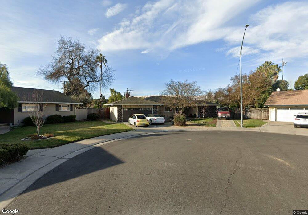
1820 Burnside Way Stockton, CA 95207
Parkwoods NeighborhoodEstimated Value: $504,000 - $562,000
About This Home
This home is located at 1820 Burnside Way, Stockton, CA 95207 and is currently estimated at $525,232, approximately $292 per square foot. 1820 Burnside Way is a home located in San Joaquin County with nearby schools including Lincoln Elementary School, Sierra Middle School, and Lincoln High School.
Ownership History
We collect this data history from publicly available records. To have your information removed, we recommend requesting removal directly through your county’s website.
Purchase Details
Home Financials for this Owner
Home Financials are based on the most recent Mortgage that was taken out on this home.Purchase Details
Purchase Details
Home Financials for this Owner
Home Financials are based on the most recent Mortgage that was taken out on this home.Home Values in the Area
Average Home Value in this Area
Purchase History
We collect this data history from publicly available records. To have your information removed, we recommend requesting removal directly through your county’s website.
| Date | Buyer | Sale Price | Title Company |
|---|---|---|---|
| -- | Orange Coast Title | ||
| -- | None Available | ||
| -- | Fidelity National Title Co |
Mortgage History
We collect this data history from publicly available records. To have your information removed, we recommend requesting removal directly through your county’s website.
| Date | Status | Borrower | Loan Amount |
|---|---|---|---|
| Closed | $146,477 | ||
| Closed | $104,000 |
Tax History
We collect this data history from publicly available records. To have your information removed, we recommend requesting removal directly through your county’s website.
| Year | Tax Paid | Tax Assessment Tax Assessment Total Assessment is a certain percentage of the fair market value that is determined by local assessors to be the total taxable value of land and additions on the property. | Land | Improvement |
|---|---|---|---|---|
| 2025 | $1,632 | $115,945 | $19,702 | $96,243 |
| 2024 | $1,488 | $113,672 | $19,316 | $94,356 |
| 2023 | $1,476 | $111,444 | $18,938 | $92,506 |
| 2022 | $1,367 | $109,260 | $18,567 | $90,693 |
| 2021 | $1,350 | $107,118 | $18,203 | $88,915 |
| 2020 | $1,349 | $106,021 | $18,017 | $88,004 |
| 2019 | $1,329 | $103,943 | $17,664 | $86,279 |
| 2018 | $1,305 | $101,906 | $17,318 | $84,588 |
| 2017 | $1,279 | $99,909 | $16,979 | $82,930 |
| 2016 | $1,266 | $97,950 | $16,646 | $81,304 |
| 2014 | $1,238 | $94,589 | $16,075 | $78,514 |
Map
- 6963 Leesburg Place
- 1720 Mcclellan Way
- 6821 Leesburg Place
- 2220 Fernvale Dr
- 1408 W Benjamin Holt Dr
- 2400 Bonniebrook Dr
- 1244 Mcclellan Way
- 7626 Brentwood Dr
- 2228 W Benjamin Holt Dr
- 7315 Parkwoods Dr
- 7706 Brentwood Dr
- 1921 Calhoun Way
- 6516 N Pershing Ave
- 1723 Polk Way
- 1149 W Benjamin Holt Dr
- 7722 Woodside Dr
- 1864 Polk Way
- 6505 Alexandria Place
- 1817 Douglas Rd
- 1040 Willora Rd
- 1812 Burnside Way
- 1819 Burnside Way
- 1759 Greeley Way
- 1751 Greeley Way
- 1804 Burnside Way
- 1811 Burnside Way
- 1743 Greeley Way
- 7013 Richmond Place
- 1764 Greeley Way
- 1818 Mcdowell Way
- 1735 Greeley Way
- 1826 Mcdowell Way
- 1750 Burnside Way
- 1756 Greeley Way
- 1748 Greeley Way
- 1727 Greeley Way
- 1736 Greeley Way
- 1740 Burnside Way
- 1728 Greeley Way
- 1719 Greeley Way Unit 35
Ask me questions while you tour the home.