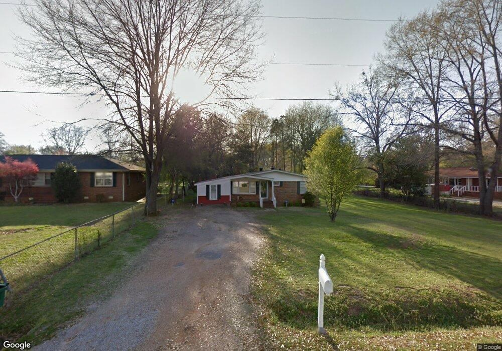
1820 Hurricane Rd Cottondale, AL 35453
Cottondale NeighborhoodEstimated Value: $132,000 - $174,000
--
Bed
--
Bath
875
Sq Ft
$177/Sq Ft
Est. Value
About This Home
This home is located at 1820 Hurricane Rd, Cottondale, AL 35453 and is currently estimated at $155,179, approximately $177 per square foot. 1820 Hurricane Rd is a home located in Tuscaloosa County with nearby schools including Cottondale Elementary School, Davis-Emerson Middle School, and Holt High School.
Ownership History
Date
Name
Owned For
Owner Type
Purchase Details
Closed on
Feb 19, 2010
Sold by
Housing
Bought by
Ryan Marie
Current Estimated Value
Home Financials for this Owner
Home Financials are based on the most recent Mortgage that was taken out on this home.
Original Mortgage
$75,666
Outstanding Balance
$49,676
Interest Rate
4.87%
Mortgage Type
FHA
Estimated Equity
$105,503
Purchase Details
Closed on
Oct 14, 2009
Sold by
Chase Home Finance Llc
Bought by
Hud
Purchase Details
Closed on
Jan 29, 2008
Sold by
Mcdonald Matthew J
Bought by
Meaney Melissa
Home Financials for this Owner
Home Financials are based on the most recent Mortgage that was taken out on this home.
Original Mortgage
$103,870
Interest Rate
6.06%
Purchase Details
Closed on
Mar 13, 2006
Sold by
Swihart Cletus C
Bought by
Mcdonald Matthew J and Mcdonald Pamela K
Home Financials for this Owner
Home Financials are based on the most recent Mortgage that was taken out on this home.
Original Mortgage
$50,000
Interest Rate
6.05%
Mortgage Type
Purchase Money Mortgage
Create a Home Valuation Report for This Property
The Home Valuation Report is an in-depth analysis detailing your home's value as well as a comparison with similar homes in the area
Home Values in the Area
Average Home Value in this Area
Purchase History
| Date | Buyer | Sale Price | Title Company |
|---|---|---|---|
| Ryan Marie | $71,000 | -- | |
| Hud | $93,200 | -- | |
| Meaney Melissa | $105,870 | -- | |
| Mcdonald Matthew J | $62,500 | -- |
Source: Public Records
Mortgage History
| Date | Status | Borrower | Loan Amount |
|---|---|---|---|
| Open | Meaney Melissa | $75,666 | |
| Previous Owner | Meaney Melissa | $103,870 | |
| Previous Owner | Mcdonald Matthew J | $50,000 |
Source: Public Records
Tax History Compared to Growth
Tax History
| Year | Tax Paid | Tax Assessment Tax Assessment Total Assessment is a certain percentage of the fair market value that is determined by local assessors to be the total taxable value of land and additions on the property. | Land | Improvement |
|---|---|---|---|---|
| 2024 | $169 | $16,000 | $1,480 | $14,520 |
| 2023 | $169 | $16,000 | $1,480 | $14,520 |
| 2022 | $175 | $16,420 | $1,480 | $14,940 |
| 2021 | $175 | $16,420 | $1,480 | $14,940 |
| 2020 | $144 | $7,080 | $740 | $6,340 |
| 2019 | $144 | $7,080 | $740 | $6,340 |
| 2018 | $144 | $7,080 | $740 | $6,340 |
| 2017 | $202 | $0 | $0 | $0 |
| 2016 | $201 | $0 | $0 | $0 |
| 2015 | $201 | $0 | $0 | $0 |
| 2014 | $201 | $9,180 | $740 | $8,440 |
Source: Public Records
Map
Nearby Homes
- 1615 Diane St
- 6835 Jenean St
- 1720 Hurricane Rd Unit LOT 95
- 6705 Spring Dr
- 7005 Keenes Mill Rd Unit F6
- 000 Route 11
- 4 University Blvd E
- 00 University Blvd E
- 7600 Keenes Mill Rd
- 6112 Cottonwood Ln
- 841 Olde Mill Trace
- 5628 Clearview Hills Dr
- 1031 54th Ave E Unit 11
- 1031 54th Ave E
- 1019 54th Ave E
- 00 55th Ave E Unit 143
- 00 55th Ave E
- 5506 8th St E
- 1469 51st Ave E
- 5421 Summerfield Dr E
- 1830 Hurricane Rd
- 1812 Hurricane Rd
- 1840 Hurricane Rd
- 1625 Diane St
- 1603 Diane St
- 1811 Hurricane Rd
- 1637 Diane St
- 1850 Hurricane Rd
- 1841 Hurricane Rd
- 1709 Diane St
- 1790 Hurricane Rd
- 1616 Diane St
- 1626 Diane St
- 1865 Hurricane Rd
- 1638 Diane St
- 1700 Diane St
- 1771 Hurricane Rd
- 1727 Diane St
- 1712 Diane St
- 1531 Diane St