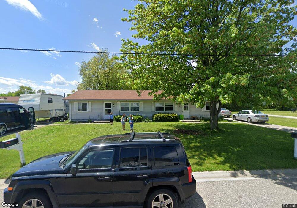
1820 Kern St Unit Bldg-Unit Port Huron, MI 48060
Estimated Value: $147,000 - $173,000
--
Bed
2
Baths
1,488
Sq Ft
$111/Sq Ft
Est. Value
About This Home
This home is located at 1820 Kern St Unit Bldg-Unit, Port Huron, MI 48060 and is currently estimated at $165,246, approximately $111 per square foot. 1820 Kern St Unit Bldg-Unit is a home located in St. Clair County with nearby schools including H.D. Crull Elementary School, Holland Woods Middle School, and Port Huron High School.
Ownership History
Date
Name
Owned For
Owner Type
Purchase Details
Closed on
Mar 9, 2018
Sold by
Loureiro Robert J
Bought by
Union Properties Ii Llc
Current Estimated Value
Purchase Details
Closed on
Jun 20, 2016
Sold by
Kennedy David W and Kennedy Diane L
Bought by
Loureiro Robert J
Purchase Details
Closed on
Apr 30, 2014
Sold by
Kennedy Diane L and Kennedy David W
Bought by
Kennedy Family Trust
Purchase Details
Closed on
Aug 26, 2013
Sold by
Senn Michele M
Bought by
Dianne Kennedy Living Trust
Purchase Details
Closed on
May 23, 2008
Sold by
Diane L Kennedy Living Trust
Bought by
Loureiro Robert J
Purchase Details
Closed on
Oct 25, 2007
Sold by
Senn Kevin J
Bought by
Senn Michelle M
Purchase Details
Closed on
Oct 1, 2007
Sold by
Senn Joseph and Senn Michelle M
Bought by
Kennedy David W and Kennedy Diane L
Create a Home Valuation Report for This Property
The Home Valuation Report is an in-depth analysis detailing your home's value as well as a comparison with similar homes in the area
Home Values in the Area
Average Home Value in this Area
Purchase History
| Date | Buyer | Sale Price | Title Company |
|---|---|---|---|
| Union Properties Ii Llc | $74,500 | -- | |
| Loureiro Robert J | $87,500 | None Available | |
| Kennedy Family Trust | -- | None Available | |
| The Kennedy Family Trust | -- | None Available | |
| Dianne Kennedy Living Trust | $90,000 | None Available | |
| Loureiro Robert J | -- | None Available | |
| Senn Michelle M | -- | None Available | |
| Kennedy David W | $56,996 | None Available |
Source: Public Records
Tax History Compared to Growth
Tax History
| Year | Tax Paid | Tax Assessment Tax Assessment Total Assessment is a certain percentage of the fair market value that is determined by local assessors to be the total taxable value of land and additions on the property. | Land | Improvement |
|---|---|---|---|---|
| 2025 | $3,192 | $78,300 | $0 | $0 |
| 2024 | $2,851 | $71,800 | $0 | $0 |
| 2023 | $2,700 | $65,000 | $0 | $0 |
| 2022 | $2,760 | $57,500 | $0 | $0 |
| 2021 | $2,635 | $52,700 | $0 | $0 |
| 2020 | $2,645 | $45,300 | $45,300 | $0 |
| 2019 | $2,598 | $34,200 | $0 | $0 |
| 2018 | $2,023 | $34,200 | $0 | $0 |
| 2017 | $1,734 | $29,500 | $0 | $0 |
| 2016 | $1,545 | $29,500 | $0 | $0 |
| 2015 | $1,546 | $28,600 | $28,600 | $0 |
| 2014 | $1,546 | $28,700 | $28,700 | $0 |
| 2013 | -- | $28,700 | $0 | $0 |
Source: Public Records
Map
Nearby Homes
- 1820 Kern St
- 213 Rural St
- 1824 Kern St Unit 1826
- 163 Rural St Unit 165
- 157 Rural St
- 157 Rural St Unit 157 Rural
- 210 Rural St
- 202 Rural St
- 223 Rural St Unit 223 Rural St
- 154 Rural St
- 1832 Kern St
- 149 Rural St Unit 151
- 229 Rural St
- 218 Rural St
- 234 Rural St
- 226 Rural St
- 143 Rural St Unit 145
- 146 Rural St
- 138 Rural St
- 242 Rural St