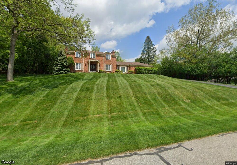
1820 Long Pointe Dr Bloomfield Hills, MI 48302
Estimated Value: $556,656 - $776,000
3
Beds
3
Baths
2,525
Sq Ft
$270/Sq Ft
Est. Value
About This Home
This home is located at 1820 Long Pointe Dr, Bloomfield Hills, MI 48302 and is currently estimated at $681,164, approximately $269 per square foot. 1820 Long Pointe Dr is a home located in Oakland County with nearby schools including Walt Whitman Elementary School, Pontiac Middle School, and Pontiac High School.
Ownership History
Date
Name
Owned For
Owner Type
Purchase Details
Closed on
Dec 1, 2021
Sold by
Vladimir Kovner
Bought by
Kovner Vladimir and Kovner Elaine
Current Estimated Value
Purchase Details
Closed on
Nov 4, 2021
Sold by
Kovner Vladimir J and Kovner Elaine
Bought by
Vladimir J Kovner Revocable Living Trust
Purchase Details
Closed on
Mar 30, 2004
Sold by
Kovner Vladimir and Kovner Elaine
Bought by
Kovner Vladimir and Kovner Elaine
Home Financials for this Owner
Home Financials are based on the most recent Mortgage that was taken out on this home.
Original Mortgage
$279,000
Interest Rate
5.66%
Mortgage Type
Purchase Money Mortgage
Create a Home Valuation Report for This Property
The Home Valuation Report is an in-depth analysis detailing your home's value as well as a comparison with similar homes in the area
Home Values in the Area
Average Home Value in this Area
Purchase History
| Date | Buyer | Sale Price | Title Company |
|---|---|---|---|
| Kovner Vladimir | -- | None Listed On Document | |
| Vladimir J Kovner Revocable Living Trust | -- | None Listed On Document | |
| Kovner Vladimir | -- | Land Owners Title Agency |
Source: Public Records
Mortgage History
| Date | Status | Borrower | Loan Amount |
|---|---|---|---|
| Previous Owner | Kovner Vladimir | $279,000 |
Source: Public Records
Tax History Compared to Growth
Tax History
| Year | Tax Paid | Tax Assessment Tax Assessment Total Assessment is a certain percentage of the fair market value that is determined by local assessors to be the total taxable value of land and additions on the property. | Land | Improvement |
|---|---|---|---|---|
| 2024 | $2,672 | $234,460 | $0 | $0 |
| 2023 | $2,550 | $224,560 | $0 | $0 |
| 2022 | $4,352 | $231,720 | $0 | $0 |
| 2021 | $4,252 | $223,330 | $0 | $0 |
| 2020 | $2,347 | $216,630 | $0 | $0 |
| 2019 | $4,167 | $212,970 | $0 | $0 |
| 2018 | $4,093 | $207,060 | $0 | $0 |
| 2017 | $4,034 | $194,330 | $0 | $0 |
| 2016 | $4,032 | $184,800 | $0 | $0 |
| 2015 | -- | $153,040 | $0 | $0 |
| 2014 | -- | $143,010 | $0 | $0 |
| 2011 | -- | $118,610 | $0 | $0 |
Source: Public Records
Map
Nearby Homes
- 1831 Long Pointe Dr
- 2779 Turtle Lake Dr
- 2759 Turtle Ridge Dr
- 2785 Turtle Lake Dr
- 1772 Heron Ridge Dr
- 2707 Turtle Lake Dr
- 2121 Uplong St
- 1744 Heron Ridge Dr
- 2756 Turtle Bluff Dr
- 1735 Heron Ridge Dr
- 1723 Heron Ridge Dr
- 2717 Turtle Shores Dr
- 2717 Turtle Shores Ranch Dr
- 2670 Turtle Lake Dr
- 2630 Turtle Lake Dr
- 2623 Turtle Shores
- 2657 Turtle Shores Dr
- 1853 W Bend Dr
- 2954 Long Ridge Ct
- 1947 Maplewood Ave
- 1830 Long Pointe Dr
- 1810 Long Pointe Dr
- 1825 Long Pointe Dr Unit Bldg-Unit
- 1825 Long Pointe Dr
- 1847 Packer Rd
- 1819 Long Pointe Dr
- 1813 Long Pointe Dr Unit Bldg-Unit
- 1813 Long Pointe Dr
- 2681 Mcclintock Rd Unit Bldg-Unit
- 2681 Mcclintock Rd
- 1802 Long Pointe Dr
- 1807 Long Pointe Dr
- 1837 Long Pointe Dr
- 1863 Packer Rd
- 2669 Mcclintock Rd
- 1840 Long Pointe Dr
- 1848 Packer Rd
- 1810 Marie Cir
- 2680 Mcclintock Rd
- 2773 Turtle Lake Dr