D
Seller's Agent in 2021
DEBBIE G FOREMAN
Coldwell Banker Walden & Kirkland
(229) 869-4130
3 in this area
60 Total Sales


Estimated Value: $198,000 - $205,000
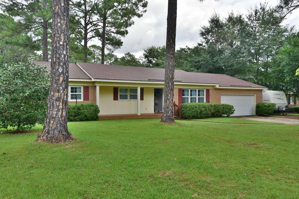
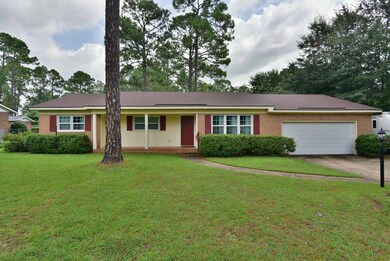
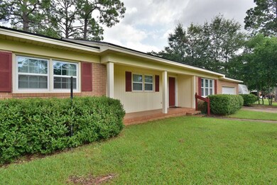
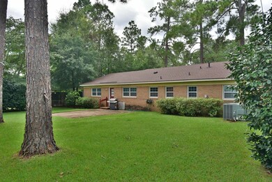
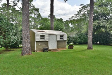
Great home in terrific Lake Park location! New Roof, New Paint, New high end vinyl plank flooring throughout. Foyer opens to LR & DR. Openness with den and kitchen..Nice breakfast area. 3 Spacious Bedrooms with good closet space. .Lovely, private fenced yard with storage building..Low maintenance home with brick exterior and vinyl trim. Great Price. Call your Realor today.
Last Agent to Sell the Property
Coldwell Banker Walden & Kirkland Brokerage Phone: 2294368811 License #280173 Listed on: 09/07/2021
| Date | Buyer | Sale Price | Title Company |
|---|---|---|---|
| Cooper Ray V | $155,000 | -- | |
| Mitcheall L Stover | -- | -- | |
| Mitchell L Stover | -- | -- | |
| Sellers Thomas K | -- | -- | |
| Sellers Thomas K | -- | -- |
| Date | Status | Borrower | Loan Amount |
|---|---|---|---|
| Open | Cooper Ray V | $152,192 | |
| Previous Owner | Mitchell L Stover | $116,872 |
| Date | Event | Price | List to Sale | Price per Sq Ft |
|---|---|---|---|---|
| 10/08/2021 10/08/21 | Sold | $155,000 | -- | $92 / Sq Ft |
| 09/07/2021 09/07/21 | Pending | -- | -- | -- |
| Year | Tax Paid | Tax Assessment Tax Assessment Total Assessment is a certain percentage of the fair market value that is determined by local assessors to be the total taxable value of land and additions on the property. | Land | Improvement |
|---|---|---|---|---|
| 2024 | $2,074 | $45,480 | $9,000 | $36,480 |
| 2023 | $1,187 | $45,480 | $9,000 | $36,480 |
| 2022 | $2,033 | $45,480 | $9,000 | $36,480 |
| 2021 | $1,866 | $43,040 | $9,000 | $34,040 |
| 2020 | $1,870 | $43,040 | $9,000 | $34,040 |
| 2019 | $1,877 | $43,040 | $9,000 | $34,040 |
| 2018 | $1,885 | $43,040 | $9,000 | $34,040 |
| 2017 | $1,756 | $43,040 | $9,000 | $34,040 |
| 2016 | $1,757 | $43,040 | $9,000 | $34,040 |
| 2015 | $1,762 | $43,040 | $9,000 | $34,040 |
| 2014 | $1,740 | $43,040 | $9,000 | $34,040 |
D
Seller's Agent in 2021
DEBBIE G FOREMAN
Coldwell Banker Walden & Kirkland
(229) 869-4130
3 in this area
60 Total Sales
M
Buyer's Agent in 2021
Marisha R. Wooten
Prestige Realty Of S.W. Ga
(229) 376-1453
2 in this area
54 Total Sales
Source: Albany Board of REALTORS®
MLS Number: 148431
APN: 000PP-00010-028
