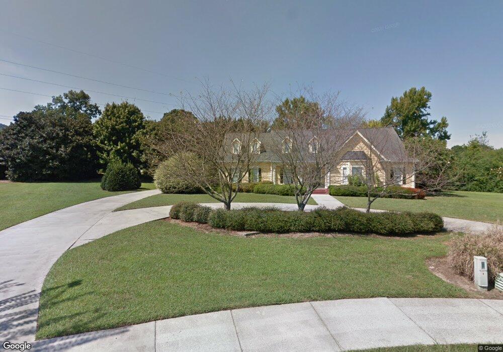
1820 Martha's Bridge Rd Dalton, GA 30720
Estimated Value: $625,459 - $762,000
4
Beds
4
Baths
4,900
Sq Ft
$144/Sq Ft
Est. Value
About This Home
This home is located at 1820 Martha's Bridge Rd, Dalton, GA 30720 and is currently estimated at $706,153, approximately $144 per square foot. 1820 Martha's Bridge Rd is a home located in Whitfield County with nearby schools including Brookwood Elementary School, Dalton Middle School, and Dalton High School.
Ownership History
Date
Name
Owned For
Owner Type
Purchase Details
Closed on
May 28, 2015
Sold by
Gillani Khairun
Bought by
Chhagan Alnoor Gillani and Gillani Khairun
Current Estimated Value
Home Financials for this Owner
Home Financials are based on the most recent Mortgage that was taken out on this home.
Original Mortgage
$397,500
Outstanding Balance
$307,437
Interest Rate
3.79%
Mortgage Type
New Conventional
Estimated Equity
$398,716
Purchase Details
Closed on
Aug 21, 2001
Sold by
Mason Martin D and Mason Caruso
Bought by
Gillani Khairun
Purchase Details
Closed on
Jan 1, 1999
Bought by
Mason Martin D and Mason Caruso
Create a Home Valuation Report for This Property
The Home Valuation Report is an in-depth analysis detailing your home's value as well as a comparison with similar homes in the area
Home Values in the Area
Average Home Value in this Area
Purchase History
| Date | Buyer | Sale Price | Title Company |
|---|---|---|---|
| Chhagan Alnoor Gillani | -- | -- | |
| Gillani Khairun | $405,000 | -- | |
| Mason Martin D | $360,000 | -- |
Source: Public Records
Mortgage History
| Date | Status | Borrower | Loan Amount |
|---|---|---|---|
| Open | Chhagan Alnoor Gillani | $397,500 |
Source: Public Records
Tax History Compared to Growth
Tax History
| Year | Tax Paid | Tax Assessment Tax Assessment Total Assessment is a certain percentage of the fair market value that is determined by local assessors to be the total taxable value of land and additions on the property. | Land | Improvement |
|---|---|---|---|---|
| 2024 | $6,895 | $244,338 | $31,200 | $213,138 |
| 2023 | $6,895 | $192,747 | $21,600 | $171,147 |
| 2022 | $5,968 | $180,656 | $34,400 | $146,256 |
| 2021 | $5,977 | $180,656 | $34,400 | $146,256 |
| 2020 | $6,197 | $180,656 | $34,400 | $146,256 |
| 2019 | $6,385 | $180,656 | $34,400 | $146,256 |
| 2018 | $6,476 | $180,656 | $34,400 | $146,256 |
| 2017 | $6,227 | $180,656 | $34,400 | $146,256 |
| 2016 | $5,602 | $162,422 | $29,400 | $133,022 |
| 2014 | $4,661 | $148,169 | $29,400 | $118,769 |
| 2013 | -- | $148,169 | $29,400 | $118,769 |
Source: Public Records
Map
Nearby Homes
- 1709 Dug Gap Rd
- 1913 Tara Place
- 0 Horizon Ct Unit 130497
- 0 Horizon Ct Unit 130499
- 0 Horizon Ct Unit 130479
- 0 Horizon Ct Unit 130477
- 0 Horizon Ct Unit 130478
- 0 Horizon Ct Unit 130496
- 0 Horizon Ct Unit 130498
- 1704 Southmont Dr
- 1608 Ryman Ridge Rd
- 1506 Summer Gate Way
- 1506 Summer Gate Way Unit 8
- 1922 Fairfield Dr
- 1482 Mineral Springs Rd
- 1498 Mineral Springs Rd
- 1908 Valley Brook Dr
- 1902 W Brookhaven Cir
- 0 Courtland Ln Unit 131551
- 1934 Spring Chase Way
- 1820 Marthas Bridge Rd
- 1818 Marthas Bridge Rd
- 1722 Dug Gap Rd
- 1817 Marthas Bridge Rd
- 1811 Oakmont Dr
- 1716 Dug Gap Rd
- 1715 Westchester Dr
- 1809 Oakmont Dr
- 1816 Marthas Bridge Rd
- 1713 Westchester Dr
- 1815 Marthas Bridge Rd
- 1714 Dug Gap Rd
- 1724 Dug Gap Rd
- 00 Richland Ln
- 1711 Westchester Dr
- 1714 Westchester Dr
- 1814 Marthas Bridge Rd
- 1712 Westchester Dr
- 1807 Oakmont Dr
- 1710 Dug Gap Rd