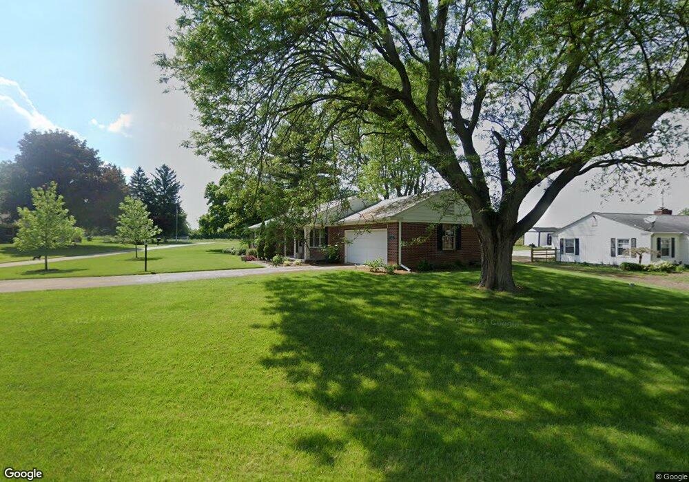
1820 Melody Dr Fremont, OH 43420
Estimated Value: $186,000 - $236,000
3
Beds
2
Baths
1,320
Sq Ft
$158/Sq Ft
Est. Value
About This Home
This home is located at 1820 Melody Dr, Fremont, OH 43420 and is currently estimated at $208,775, approximately $158 per square foot. 1820 Melody Dr is a home located in Sandusky County with nearby schools including Fremont Ross High School, St. Ann Catholic School, and St. Joseph School.
Ownership History
Date
Name
Owned For
Owner Type
Purchase Details
Closed on
Jul 7, 1998
Sold by
Tuck Colleen R
Bought by
Hohman Eric J and Hohman Jolianne E
Current Estimated Value
Home Financials for this Owner
Home Financials are based on the most recent Mortgage that was taken out on this home.
Original Mortgage
$116,250
Outstanding Balance
$24,163
Interest Rate
7.18%
Mortgage Type
VA
Estimated Equity
$184,612
Purchase Details
Closed on
Jun 1, 1985
Bought by
Hohman Eric J and Hohman Jolianne E
Create a Home Valuation Report for This Property
The Home Valuation Report is an in-depth analysis detailing your home's value as well as a comparison with similar homes in the area
Home Values in the Area
Average Home Value in this Area
Purchase History
| Date | Buyer | Sale Price | Title Company |
|---|---|---|---|
| Hohman Eric J | $114,000 | -- | |
| Hohman Eric J | -- | -- |
Source: Public Records
Mortgage History
| Date | Status | Borrower | Loan Amount |
|---|---|---|---|
| Open | Hohman Eric J | $116,250 |
Source: Public Records
Tax History Compared to Growth
Tax History
| Year | Tax Paid | Tax Assessment Tax Assessment Total Assessment is a certain percentage of the fair market value that is determined by local assessors to be the total taxable value of land and additions on the property. | Land | Improvement |
|---|---|---|---|---|
| 2024 | $2,525 | $67,030 | $14,000 | $53,030 |
| 2023 | $2,525 | $52,790 | $11,030 | $41,760 |
| 2022 | $2,114 | $52,790 | $11,030 | $41,760 |
| 2021 | $2,587 | $52,790 | $11,030 | $41,760 |
| 2020 | $2,335 | $45,890 | $11,030 | $34,860 |
| 2019 | $2,361 | $45,890 | $11,030 | $34,860 |
| 2018 | $2,333 | $45,890 | $11,030 | $34,860 |
| 2017 | $2,302 | $44,250 | $11,030 | $33,220 |
| 2016 | $2,080 | $44,250 | $11,030 | $33,220 |
| 2015 | $2,054 | $44,250 | $11,030 | $33,220 |
| 2014 | $2,111 | $43,650 | $10,990 | $32,660 |
| 2013 | $2,076 | $43,650 | $10,990 | $32,660 |
Source: Public Records
Map
Nearby Homes
- 1730 Port Clinton Rd Unit 41
- 1730 Port Clinton Rd
- 1730 Port Clinton Rd Unit 33
- 0 Sean Dr
- Outlot A Sean Dr
- 711 Bloom Rd
- 2100 Ohio 53
- 900 Spring St
- 1441 White Ave
- 612 2nd St
- 711 Rawson Ave
- 533 Sandusky Ave Unit 535
- 1227 White Ave
- 433 Sandusky Ave
- 2219 Oak Harbor Rd
- 516 N Front St
- 340 340 Sandusky Ave
- 818 Franklin Ave
- 1707 North St
- 1720 North St
- 1918 Valley View Terrace
- 1910 Melody Dr
- 1924 Valley View Terrace
- 1815 Melody Dr
- 1905 Melody Dr
- 1913 Valley View Terrace
- 1921 Valley View Terrace
- 1911 Melody Dr
- 1930 Valley View Terrace
- 1927 Valley View Terrace
- 1917 Melody Dr
- 1930 Melody Dr
- 451 Kingsgate Dr
- 1925 Melody Dr
- 1809 Melody Dr
- 1809 Melody Dr
- 1956 Melody Dr
- 1940 Melody Dr
- 460 Kingsgate Dr
- 1960 Melody Dr