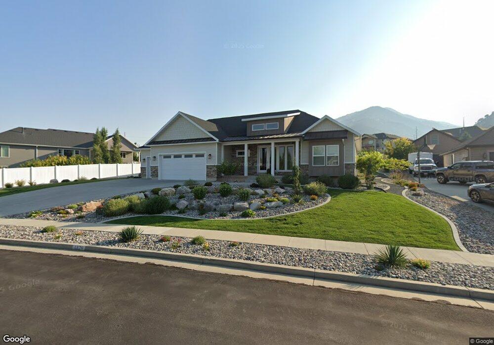
1820 N 1900 E Unit 26 North Logan, UT 84341
Estimated Value: $798,000 - $875,000
--
Bed
--
Bath
2,034
Sq Ft
$413/Sq Ft
Est. Value
About This Home
This home is located at 1820 N 1900 E Unit 26, North Logan, UT 84341 and is currently estimated at $839,162, approximately $412 per square foot. 1820 N 1900 E Unit 26 is a home located in Cache County with nearby schools including Greenville School, Cedar Ridge School, and Cedar Ridge Middle School.
Ownership History
Date
Name
Owned For
Owner Type
Purchase Details
Closed on
Jun 4, 2025
Sold by
Kathy Cabe Trundle Revocable Trust and Trundle Kathy Cabe
Bought by
Lee Byongho and Lee Soon A
Current Estimated Value
Home Financials for this Owner
Home Financials are based on the most recent Mortgage that was taken out on this home.
Original Mortgage
$637,500
Outstanding Balance
$624,115
Interest Rate
5.94%
Mortgage Type
New Conventional
Estimated Equity
$215,047
Purchase Details
Closed on
Sep 1, 2020
Sold by
Trundle Kathy Cabe
Bought by
Trundle Kathy
Home Financials for this Owner
Home Financials are based on the most recent Mortgage that was taken out on this home.
Original Mortgage
$394,000
Interest Rate
2.9%
Mortgage Type
New Conventional
Purchase Details
Closed on
Aug 26, 2020
Sold by
Trundle Kathy
Bought by
Trundle Kathy Cabe and The Kathy Cabe Trundle Revocab
Home Financials for this Owner
Home Financials are based on the most recent Mortgage that was taken out on this home.
Original Mortgage
$394,000
Interest Rate
2.9%
Mortgage Type
New Conventional
Purchase Details
Closed on
Aug 18, 2020
Sold by
Trundle Kathy Cabe and Trundle Revocable Trust
Bought by
Trundle Kathy Cabe
Home Financials for this Owner
Home Financials are based on the most recent Mortgage that was taken out on this home.
Original Mortgage
$394,000
Interest Rate
2.9%
Mortgage Type
New Conventional
Purchase Details
Closed on
Jul 25, 2019
Sold by
Trundle Kathy Cabe
Bought by
Trundle Kathy Cabe and Trundle Kathy Cabe
Purchase Details
Closed on
May 7, 2018
Sold by
Trundle Kathy
Bought by
Trundle Kathy Cabe
Home Financials for this Owner
Home Financials are based on the most recent Mortgage that was taken out on this home.
Original Mortgage
$340,000
Interest Rate
4.4%
Mortgage Type
New Conventional
Purchase Details
Closed on
May 4, 2018
Sold by
Astle Jared Larry and Astle Kate Peterson
Bought by
Trundle Kathy
Home Financials for this Owner
Home Financials are based on the most recent Mortgage that was taken out on this home.
Original Mortgage
$340,000
Interest Rate
4.4%
Mortgage Type
New Conventional
Purchase Details
Closed on
Aug 18, 2016
Sold by
Li Mathias James Dean and Li Mathias Mai
Bought by
Astle Jared Larry and Astle Kate Peterson
Purchase Details
Closed on
Nov 26, 2013
Sold by
Mathias James Dean
Bought by
Mathias James Dean and Li Mai
Create a Home Valuation Report for This Property
The Home Valuation Report is an in-depth analysis detailing your home's value as well as a comparison with similar homes in the area
Home Values in the Area
Average Home Value in this Area
Purchase History
| Date | Buyer | Sale Price | Title Company |
|---|---|---|---|
| Lee Byongho | -- | Pinnacle Title | |
| Lee Byongho | -- | Pinnacle Title | |
| Trundle Kathy | -- | Cache Title Logan | |
| Trundle Kathy Cabe | -- | Cache Title Logan | |
| Trundle Kathy Cabe | -- | Cache Title Logan | |
| Trundle Kathy Cabe | -- | None Available | |
| Trundle Kathy Cabe | -- | Heritage Title | |
| Trundle Kathy | -- | Cache Title | |
| Astle Jared Larry | -- | Hickman Land Title Company | |
| Mathias James Dean | -- | Hickman Land Title Company | |
| Mathias James Dean | -- | Hickman Land Title Company |
Source: Public Records
Mortgage History
| Date | Status | Borrower | Loan Amount |
|---|---|---|---|
| Open | Lee Byongho | $637,500 | |
| Closed | Lee Byongho | $637,500 | |
| Previous Owner | Trundle Kathy | $394,000 | |
| Previous Owner | Trundle Kathy Cabe | $390,000 | |
| Previous Owner | Trundle Kathy | $340,000 |
Source: Public Records
Tax History Compared to Growth
Tax History
| Year | Tax Paid | Tax Assessment Tax Assessment Total Assessment is a certain percentage of the fair market value that is determined by local assessors to be the total taxable value of land and additions on the property. | Land | Improvement |
|---|---|---|---|---|
| 2025 | $3,093 | $433,020 | $0 | $0 |
| 2024 | $3,297 | $429,480 | $0 | $0 |
| 2023 | $3,490 | $425,425 | $0 | $0 |
| 2022 | $365 | $425,425 | $0 | $0 |
| 2021 | $2,867 | $517,654 | $68,400 | $449,254 |
| 2020 | $2,711 | $459,056 | $68,400 | $390,656 |
| 2019 | $2,839 | $459,056 | $68,400 | $390,656 |
| 2018 | $2,661 | $417,200 | $68,400 | $348,800 |
| 2017 | $829 | $68,400 | $0 | $0 |
| 2016 | $842 | $68,400 | $0 | $0 |
| 2015 | $845 | $68,400 | $0 | $0 |
| 2014 | $825 | $68,400 | $0 | $0 |
Source: Public Records
Map
Nearby Homes
- 1872 N 1850 E
- 1901 Southpointe Ct
- 1949 Deer Crest Cir Unit 49
- 1810 N 2070 E Unit 10
- 1586 N Sharptail Cir
- 1891 E 1500 N
- 1902 E 1500 N
- 1465 N Stonecrest Ln Unit 14
- 1451 N Aspen Dr
- 1405 N Aspen Dr
- 2025 N 1550 E
- 1901 N 1380 E
- 945 N 1600 E
- 1454 N 1400 E
- 1285 E 1600 N
- 1395 E Talmage Ln Unit 31
- 1491 E 2300 N
- 1495 E 2300 N
- 1374 N 1250 E
- Sydney Plan at Mountainside Estates
- 1930 E 1850 N
- 1930 E 1850 N Unit 28
- 1800 N 1900 E Unit 25
- 1830 N 1900 E Unit 27
- 1950 E 1850 N Unit 29
- 1950 E 1850 N
- 1805 N 1900 E Unit 7
- 1805 N 1900 E
- 1895 E 1780 N Unit 8
- 1895 E 1780 N
- 1790 N 1900 E Unit 24
- 1811 N 2000 E Unit 42
- 1811 N 2000 E
- 1825 N 1900 E Unit 6
- 1825 N 2000 E
- 1925 E 1850 N
- 1835 N 1900 E
- 1841 N 2000 E
- 1795 N 2000 E
- 1885 E 1780 N Unit 9