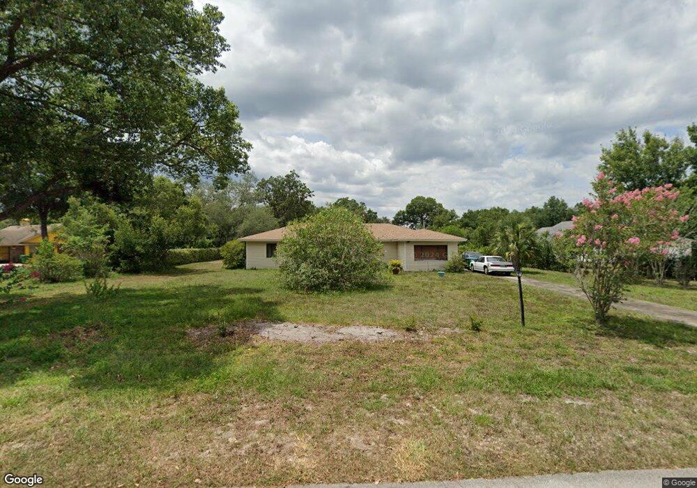
1820 Odham Dr Deltona, FL 32738
Estimated Value: $274,000 - $332,000
3
Beds
2
Baths
1,733
Sq Ft
$174/Sq Ft
Est. Value
About This Home
This home is located at 1820 Odham Dr, Deltona, FL 32738 and is currently estimated at $301,153, approximately $173 per square foot. 1820 Odham Dr is a home located in Volusia County with nearby schools including Forest Lake Elementary School, Heritage Middle School, and Pine Ridge High School.
Ownership History
Date
Name
Owned For
Owner Type
Purchase Details
Closed on
Apr 22, 2002
Sold by
Evans Charles and Evans Imogene F
Bought by
Jones David A and Jones Mary M
Current Estimated Value
Purchase Details
Closed on
Dec 15, 1987
Bought by
Jones David A and Jones Mary M
Purchase Details
Closed on
Jul 15, 1984
Bought by
Jones David A and Jones Mary M
Purchase Details
Closed on
Jun 15, 1983
Bought by
Jones David A and Jones Mary M
Purchase Details
Closed on
Aug 15, 1969
Bought by
Jones David A and Jones Mary M
Create a Home Valuation Report for This Property
The Home Valuation Report is an in-depth analysis detailing your home's value as well as a comparison with similar homes in the area
Home Values in the Area
Average Home Value in this Area
Purchase History
| Date | Buyer | Sale Price | Title Company |
|---|---|---|---|
| Jones David A | $105,000 | -- | |
| Jones David A | $64,500 | -- | |
| Jones David A | $100 | -- | |
| Jones David A | $59,500 | -- | |
| Jones David A | $100 | -- | |
| Jones David A | $2,300 | -- |
Source: Public Records
Tax History
| Year | Tax Paid | Tax Assessment Tax Assessment Total Assessment is a certain percentage of the fair market value that is determined by local assessors to be the total taxable value of land and additions on the property. | Land | Improvement |
|---|---|---|---|---|
| 2026 | $864 | $93,752 | -- | -- |
| 2025 | $864 | $93,752 | -- | -- |
| 2024 | $720 | $91,110 | -- | -- |
| 2023 | $720 | $88,457 | $0 | $0 |
| 2022 | $1,191 | $85,881 | $0 | $0 |
| 2021 | $725 | $83,380 | $0 | $0 |
| 2020 | $726 | $82,229 | $0 | $0 |
| 2019 | $3,359 | $80,380 | $0 | $0 |
| 2018 | $720 | $78,881 | $0 | $0 |
| 2017 | $695 | $77,259 | $0 | $0 |
| 2016 | $678 | $75,670 | $0 | $0 |
| 2015 | $693 | $75,144 | $0 | $0 |
| 2014 | $670 | $74,548 | $0 | $0 |
Source: Public Records
Map
Nearby Homes
- 1788 E Normandy Blvd
- 1778 E Normandy Blvd
- 1792 Paco Ct
- 1768 E Normandy Blvd
- 731 Brechner Terrace
- 1901 Odham Dr
- 1906 Kingway Dr
- 868 Saxon Blvd
- 1680 E Normandy Blvd
- 1891 Marysville Dr
- 1876 Coble Dr
- 560 Saxon Blvd
- 1009 Fort Smith Blvd
- 1057 Fort Smith Blvd
- 520 W Kingway Dr
- 2046 Galahad Dr
- 1668 W Waycross Cir
- 542 Cleo Ln
- 968 Fort Smith Blvd
- 937 Potomac Ave
- 1830 Odham Dr
- 1810 Odham Dr
- 1840 Odham Dr
- 1819 Odham Dr
- 1839 Odham Dr
- 1809 E Normandy Blvd
- 1801 E Normandy Blvd
- 750 Brechner Terrace
- 1850 Odham Dr
- 771 Saxon Blvd
- 731 Saxon Blvd
- 1781 E Normandy Blvd
- 740 Brechner Terrace
- 740 Saxon Blvd
- 1860 Odham Dr
- 720 Saxon Blvd
- 1859 Odham Dr
- 721 Saxon Blvd
- 1827 E Normandy Blvd
- 730 Brechner Terrace Unit 11
Your Personal Tour Guide
Ask me questions while you tour the home.