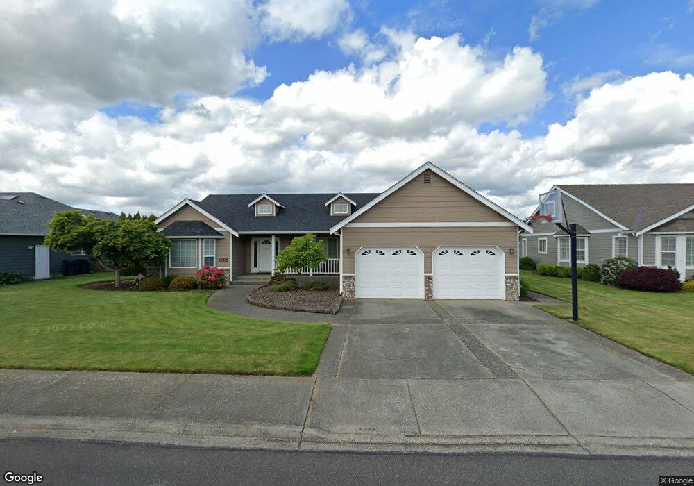
1820 Pine Cir Lynden, WA 98264
Estimated Value: $655,164 - $745,000
4
Beds
2
Baths
2,147
Sq Ft
$320/Sq Ft
Est. Value
About This Home
This home is located at 1820 Pine Cir, Lynden, WA 98264 and is currently estimated at $687,791, approximately $320 per square foot. 1820 Pine Cir is a home located in Whatcom County with nearby schools including Lynden High School, Lynden Christian School, and Lynden Christian Schools: Administration.
Ownership History
Date
Name
Owned For
Owner Type
Purchase Details
Closed on
Aug 5, 2005
Sold by
Little Thomas L and Little Diana L
Bought by
Roper Brian and Roper Jill
Current Estimated Value
Purchase Details
Closed on
Dec 11, 2003
Sold by
Little Thomas L
Bought by
Little Thomas L and Little Diana L
Home Financials for this Owner
Home Financials are based on the most recent Mortgage that was taken out on this home.
Original Mortgage
$145,700
Interest Rate
5.26%
Mortgage Type
Purchase Money Mortgage
Create a Home Valuation Report for This Property
The Home Valuation Report is an in-depth analysis detailing your home's value as well as a comparison with similar homes in the area
Home Values in the Area
Average Home Value in this Area
Purchase History
| Date | Buyer | Sale Price | Title Company |
|---|---|---|---|
| Roper Brian | $329,280 | Stewart Title Company | |
| Little Thomas L | -- | Chicago Title Insurance |
Source: Public Records
Mortgage History
| Date | Status | Borrower | Loan Amount |
|---|---|---|---|
| Previous Owner | Little Thomas L | $145,700 |
Source: Public Records
Tax History
| Year | Tax Paid | Tax Assessment Tax Assessment Total Assessment is a certain percentage of the fair market value that is determined by local assessors to be the total taxable value of land and additions on the property. | Land | Improvement |
|---|---|---|---|---|
| 2025 | $4,528 | $617,437 | $272,825 | $344,612 |
| 2024 | $4,249 | $597,770 | $242,500 | $355,270 |
| 2023 | $4,249 | $591,606 | $250,000 | $341,606 |
| 2022 | $3,930 | $516,239 | $127,711 | $388,528 |
| 2021 | $3,855 | $426,639 | $105,545 | $321,094 |
| 2020 | $3,376 | $380,937 | $94,239 | $286,698 |
| 2019 | $3,004 | $349,334 | $86,527 | $262,807 |
| 2018 | $3,283 | $318,621 | $78,823 | $239,798 |
| 2017 | $2,984 | $285,989 | $70,750 | $215,239 |
| 2016 | $2,810 | $276,492 | $66,000 | $210,492 |
| 2015 | $2,490 | $258,957 | $63,480 | $195,477 |
| 2014 | -- | $250,187 | $61,320 | $188,867 |
| 2013 | -- | $248,867 | $60,000 | $188,867 |
Source: Public Records
Map
Nearby Homes
- 8424 Double Ditch Rd
- 605 N Forest Ct
- 508 Forest Cir Unit 4A
- 801 19th St
- 2108 Main St
- 1656 Liberty St Unit 101
- 1882 Front St Unit B404
- 1882 Front St Unit B302
- 816 Cedar Dr
- 805 Cedar Dr
- 885 Sunrise Dr
- 735 Ivy St
- 410 10th St
- 210 Stremler Dr
- 1717 E St
- 1739 Emerald Way
- 1510 E St
- 2263 W Main St
- 761 Sunrise Dr
- 2208 Main St