Estimated Value: $649,000 - $866,000
3
Beds
3
Baths
4,964
Sq Ft
$153/Sq Ft
Est. Value
About This Home
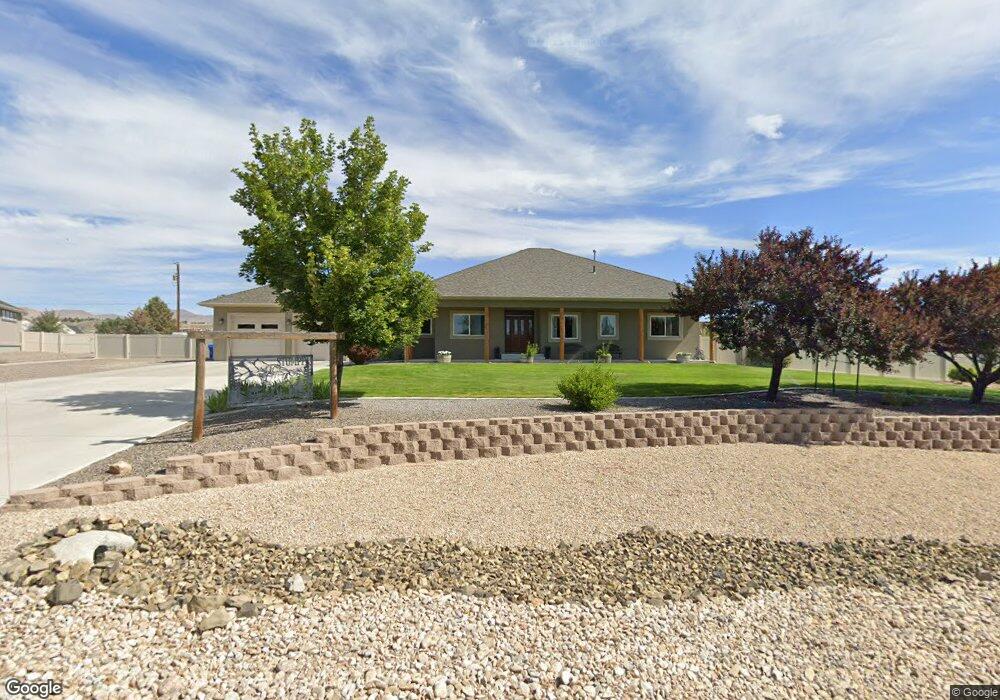
This home is located at 1820 Royal Crest Dr, Elko, NV 89801 and is currently estimated at $761,155, approximately $153 per square foot. 1820 Royal Crest Dr is a home located in Elko County with nearby schools including Mountain View Elementary School, Adobe Middle School, and Flagview Intermediate School.
Ownership History
Date
Name
Owned For
Owner Type
Purchase Details
Closed on
Aug 19, 2020
Sold by
Weichert Workforce Mobility Inc
Bought by
Stumpf Larry Justin and Stumpf Christine
Current Estimated Value
Home Financials for this Owner
Home Financials are based on the most recent Mortgage that was taken out on this home.
Original Mortgage
$340,000
Outstanding Balance
$301,042
Interest Rate
2.9%
Mortgage Type
New Conventional
Estimated Equity
$460,114
Purchase Details
Closed on
Jun 5, 2020
Sold by
Timothy And Laura Pike Family Trust
Bought by
In Weichert Workforce Mobility
Purchase Details
Closed on
Jan 15, 2016
Sold by
Pike Timothy R and Pike Laura B
Bought by
Timothy & Laura Pike Family Trust and Pike Laura B
Purchase Details
Closed on
Feb 13, 2012
Sold by
Walther Joseph C and Walther Mary H
Bought by
Pike Timothy R and Pike Laura B
Create a Home Valuation Report for This Property
The Home Valuation Report is an in-depth analysis detailing your home's value as well as a comparison with similar homes in the area
Home Values in the Area
Average Home Value in this Area
Purchase History
| Date | Buyer | Sale Price | Title Company |
|---|---|---|---|
| Stumpf Larry Justin | -- | Stewart Title | |
| In Weichert Workforce Mobility | -- | Stewart Title | |
| Timothy & Laura Pike Family Trust | -- | None Available | |
| Pike Timothy R | $115,000 | Stewart Title Elko |
Source: Public Records
Mortgage History
| Date | Status | Borrower | Loan Amount |
|---|---|---|---|
| Open | Stumpf Larry Justin | $340,000 |
Source: Public Records
Tax History Compared to Growth
Tax History
| Year | Tax Paid | Tax Assessment Tax Assessment Total Assessment is a certain percentage of the fair market value that is determined by local assessors to be the total taxable value of land and additions on the property. | Land | Improvement |
|---|---|---|---|---|
| 2025 | $8,626 | $262,394 | $41,300 | $221,094 |
| 2024 | $8,626 | $256,630 | $29,750 | $226,880 |
| 2023 | $7,877 | $204,712 | $29,750 | $174,962 |
| 2022 | $6,380 | $176,903 | $29,750 | $147,153 |
| 2021 | $6,194 | $172,624 | $29,750 | $142,874 |
| 2020 | $6,058 | $173,929 | $29,750 | $144,179 |
| 2019 | $6,038 | $173,374 | $29,750 | $143,624 |
| 2018 | $6,018 | $172,780 | $29,750 | $143,030 |
| 2017 | $5,945 | $170,683 | $29,750 | $140,933 |
| 2016 | $5,763 | $160,692 | $29,750 | $130,942 |
| 2015 | $5,596 | $152,928 | $29,750 | $123,178 |
| 2014 | $5,326 | $145,314 | $29,750 | $115,564 |
Source: Public Records
Map
Nearby Homes
- 3733 Autumn Colors Dr
- TBD Mountain City Hwy
- 3050 Mountain City Hwy
- 3320 Mountain City Hwy
- 3634 Boulder Creek
- 3221 Jennings Way
- 2908 Aria Way
- 2939 Aria Way
- 2943 Aria Way
- 2910 Aria Way
- 2953 Aria Way
- 2912 Aria Way
- 2911 Aria Way
- 2963 Aria Way
- 2914 Aria Way
- 2918 Aria Way
- 2966 Aria Way
- 2970 Aria Way
- 2057 Eagle Ridge Loop
- 2045 Eagle Ridge Loop Unit 12
- 1850 Royal Crest Dr
- 1628 Royal Crest Dr
- 1815 Royal Crest Dr
- 3711 Sundance Dr
- 1831 Royal Crest Dr
- 3713 Sundance Dr
- 1588 Royal Crest Dr
- 1880 Royal Crest Dr
- 1845 Royal Crest Dr
- 3721 Sundance Dr
- 1628 Tamarack Rd
- 1585 Royal Crest Dr
- 1875 Royal Crest Dr
- 1515 Tamarack Rd
- 3700 Sundance Dr
- 1536 Royal Crest Dr
- 1910 Royal Crest Dr
- 1910 Royal Crest Dr
- 3483 Sundance Dr
- 1905 Royal Crest Dr