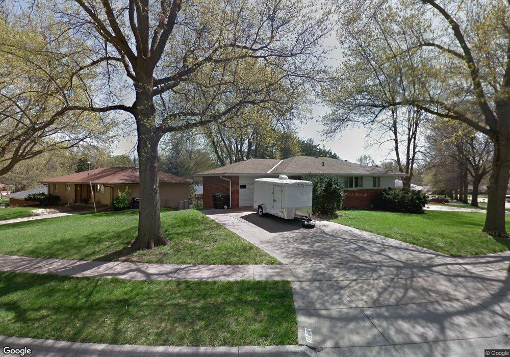
1820 Rusty Ln Lincoln, NE 68506
Central Lincoln NeighborhoodEstimated Value: $255,000 - $281,000
3
Beds
2
Baths
1,232
Sq Ft
$218/Sq Ft
Est. Value
About This Home
This home is located at 1820 Rusty Ln, Lincoln, NE 68506 and is currently estimated at $268,959, approximately $218 per square foot. 1820 Rusty Ln is a home located in Lancaster County with nearby schools including Morley Elementary School, Lux Middle School, and Lincoln East High School.
Ownership History
Date
Name
Owned For
Owner Type
Purchase Details
Closed on
Dec 12, 2019
Sold by
Oenbring Mary Ann
Bought by
Bloyd Doug and Bloyd Greta
Current Estimated Value
Home Financials for this Owner
Home Financials are based on the most recent Mortgage that was taken out on this home.
Original Mortgage
$128,000
Outstanding Balance
$112,607
Interest Rate
3.6%
Mortgage Type
Future Advance Clause Open End Mortgage
Estimated Equity
$156,352
Create a Home Valuation Report for This Property
The Home Valuation Report is an in-depth analysis detailing your home's value as well as a comparison with similar homes in the area
Home Values in the Area
Average Home Value in this Area
Purchase History
| Date | Buyer | Sale Price | Title Company |
|---|---|---|---|
| Bloyd Doug | $160,000 | None Available |
Source: Public Records
Mortgage History
| Date | Status | Borrower | Loan Amount |
|---|---|---|---|
| Open | Bloyd Doug | $128,000 |
Source: Public Records
Tax History Compared to Growth
Tax History
| Year | Tax Paid | Tax Assessment Tax Assessment Total Assessment is a certain percentage of the fair market value that is determined by local assessors to be the total taxable value of land and additions on the property. | Land | Improvement |
|---|---|---|---|---|
| 2025 | $3,546 | $277,900 | $69,000 | $208,900 |
| 2024 | $3,546 | $253,600 | $57,500 | $196,100 |
| 2023 | $3,987 | $237,900 | $57,500 | $180,400 |
| 2022 | $3,685 | $184,900 | $40,000 | $144,900 |
| 2021 | $3,486 | $184,900 | $40,000 | $144,900 |
| 2020 | $3,214 | $168,200 | $40,000 | $128,200 |
| 2019 | $3,214 | $168,200 | $40,000 | $128,200 |
| 2018 | $2,919 | $152,100 | $40,000 | $112,100 |
| 2017 | $2,946 | $152,100 | $40,000 | $112,100 |
| 2016 | $2,783 | $142,900 | $35,000 | $107,900 |
| 2015 | $2,763 | $142,900 | $35,000 | $107,900 |
| 2014 | $2,589 | $133,100 | $40,000 | $93,100 |
| 2013 | -- | $133,100 | $40,000 | $93,100 |
Source: Public Records
Map
Nearby Homes
- 1830 E Bermuda Dr
- 1850 E Bermuda Dr
- 2001 Morningside Dr
- 1920 Riviera Dr
- 1731 E Manor Dr
- 1521 Kingston Rd
- 6220 Sumner St
- 6545 Flint Ridge Place
- 6341 Rainier Dr
- 6301 Newton St
- 6123 A St
- 1900 Lori Ln
- 7101 South St Unit 1
- 2036 Greenbriar Ln
- 7100 Lincolnshire Rd
- 1401 S 58th St
- 7010 Shamrock Rd
- 2505 S 70th St
- 1610 Circle Dr
- 7300 South St Unit 13
- 1810 Rusty Ln
- 1830 Rusty Ln
- 1821 Broadmoore Dr
- 1831 Broadmoore Dr
- 1840 Rusty Ln
- 1841 Rusty Ln
- 1817 Rusty Ln
- 1833 Rusty Ln
- 1849 Rusty Ln
- 1809 Rusty Ln
- 1825 Rusty Ln
- 1841 Broadmoore Dr
- 1801 Rusty Ln
- 1857 Rusty Ln
- 1850 Rusty Ln
- 1851 Broadmoore Dr
- 1820 Broadmoore Dr
- 1865 Rusty Ln
- 1830 Broadmoore Dr
- 1840 Twin Ridge Rd