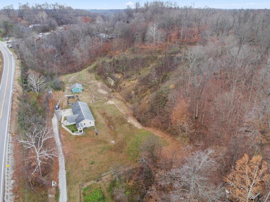
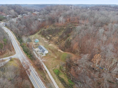
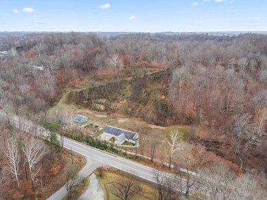
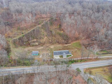
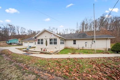
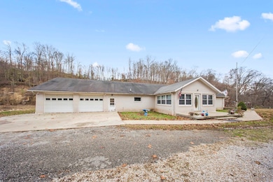
1820 State Route 141 Ironton, OH 45638
Estimated payment $2,146/month
Highlights
- Hilly Lot
- Ranch Style House
- 2 Car Attached Garage
- Wooded Lot
- Porch
- Brick or Stone Mason
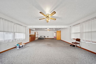
About This Home
RARE find! This Sprawling Ranch is situated on 8.95 Acres! Just a minute to 141 Ironton Exit and minutes to Ashland Ky. House is Very large with HUGE unfinished Walk out basement. Open floorplan with 4 bedrooms and 2 full baths. Large Utility room. Detached 2 Car garage. With just a little TLC this could be your dream home and cheaper than building. Acreage is private with flat, rolling and hills for small pasture, hunting or more home sites.
Home Details
Home Type
- Single Family
Est. Annual Taxes
- $2,069
Year Built
- Built in 1998
Lot Details
- 8.95 Acre Lot
- Level Lot
- Hilly Lot
- Wooded Lot
Home Design
- Ranch Style House
- Brick or Stone Mason
- Shingle Roof
Interior Spaces
- 2,480 Sq Ft Home
- Pull Down Stairs to Attic
Flooring
- Wall to Wall Carpet
- Tile
- Vinyl
Bedrooms and Bathrooms
- 4 Bedrooms
- 2 Full Bathrooms
Unfinished Basement
- Walk-Out Basement
- Basement Fills Entire Space Under The House
Parking
- 2 Car Attached Garage
- Off-Street Parking
Outdoor Features
- Porch
Schools
- Rock Hill Elementary And Middle School
- Rock Hill High School
Utilities
- Central Heating and Cooling System
- Septic System
Listing and Financial Details
- Assessor Parcel Number 27-092-0900.000 27-092-10
Map
Home Values in the Area
Average Home Value in this Area
Tax History
| Year | Tax Paid | Tax Assessment Tax Assessment Total Assessment is a certain percentage of the fair market value that is determined by local assessors to be the total taxable value of land and additions on the property. | Land | Improvement |
|---|---|---|---|---|
| 2024 | -- | $85,070 | $6,810 | $78,260 |
| 2023 | $2,108 | $85,070 | $6,810 | $78,260 |
| 2022 | $2,113 | $85,070 | $6,810 | $78,260 |
| 2021 | $1,821 | $73,210 | $5,130 | $68,080 |
| 2020 | $1,854 | $73,210 | $5,130 | $68,080 |
| 2019 | $1,830 | $73,210 | $5,130 | $68,080 |
| 2018 | $1,123 | $47,310 | $5,130 | $42,180 |
| 2017 | $1,123 | $47,310 | $5,130 | $42,180 |
| 2016 | $1,038 | $47,310 | $5,130 | $42,180 |
| 2015 | $929 | $42,610 | $5,130 | $37,480 |
| 2014 | $927 | $42,610 | $5,130 | $37,480 |
| 2013 | $923 | $42,610 | $5,130 | $37,480 |
Property History
| Date | Event | Price | List to Sale | Price per Sq Ft |
|---|---|---|---|---|
| 11/28/2025 11/28/25 | For Sale | $375,000 | -- | $151 / Sq Ft |
Purchase History
| Date | Type | Sale Price | Title Company |
|---|---|---|---|
| Quit Claim Deed | -- | Attorney | |
| Deed | -- | -- | |
| Deed | -- | -- | |
| Deed | $20,000 | -- |
Source: Huntington Board of REALTORS®
MLS Number: 182757
APN: 27-092-0900-000
Disclaimer: Certain information contained herein is derived from information provided by parties other than Homes.com. All information provided is deemed reliable, but is not guaranteed to be accurate and should be independently verified.
![]() IDX information is provided exclusively for personal, non-commercial use, and may not be used for any purpose other than to identify prospective properties consumers may be interested in purchasing.
IDX information is provided exclusively for personal, non-commercial use, and may not be used for any purpose other than to identify prospective properties consumers may be interested in purchasing.
Information is deemed reliable but not guaranteed.
- 1917 Woodland Dr
- 1219 Penobscot Trail
- 228 Township Road 612
- 0 County Road 181 Unit 182508
- 0 County Road 181 Unit 11540303
- 0 County Road 181 Unit 24215136
- 2480 County Road 181
- 2001 Liberty Ave
- 1324 S 10th St
- 914 Pine St
- 0 Ora Richey Rd
- 2008 S 9th St
- 2008 S 9th St Unit KO-2
- 2616 S 13th St
- 2620 S 13th St
- 605 S 10th St
- 1116 S 8th St
- 707 Mastin Ave
- 2503 S 9th St
- 1902 S 7th St
- 200 Providence Hill Dr
- 601 Cliff St
- 1323 Winchester Ave Unit 1323
- 160 Township Road 1316 Unit 1
- 1916 Beech St
- 1916 Beech St
- 855 C St Unit 3
- 2305 Adams Ave Unit 25
- 2305 Adams Ave
- 2205 Adams Ave
- 1616 Spring Valley Dr
- 1616 Spring Valley Dr Unit Park Place 8
- 1616 Spring Valley Dr Unit Park Place 40
- 1154 Jefferson Ave Unit 1
- 525 10th St W Unit 525 10TH STREET WEST
- 652 Adams Ave Unit Apartment 2
- 337 5th Ave W
- 511 2nd St Unit 3
- 511 2nd St Unit 4
- 511 2nd St Unit 1
