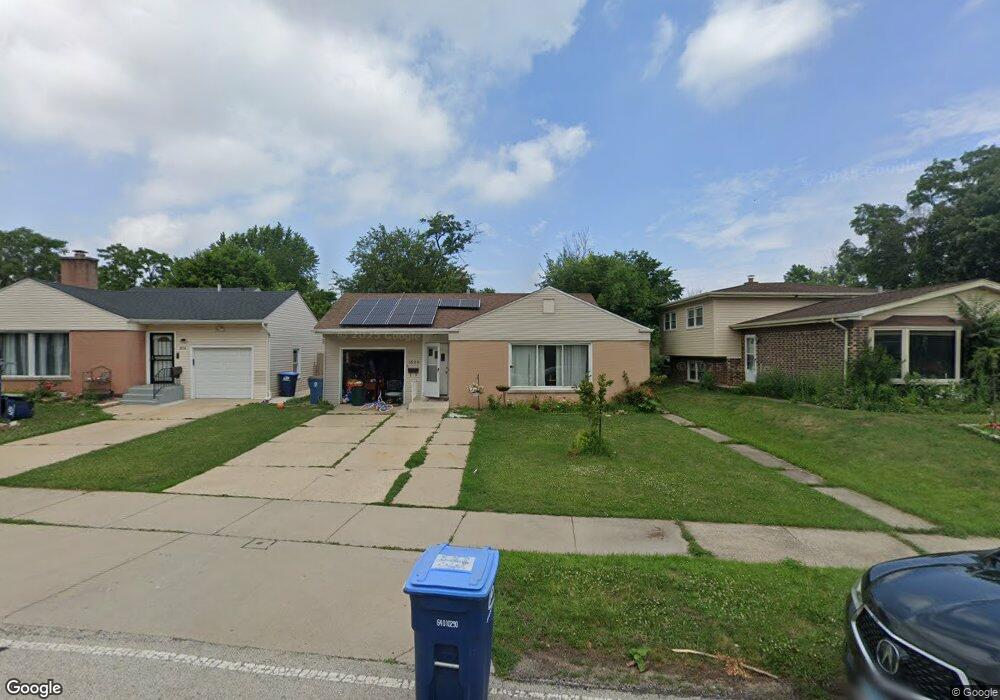
1820 Stewart Ave Des Plaines, IL 60018
Estimated Value: $330,000 - $393,000
3
Beds
2
Baths
1,204
Sq Ft
$298/Sq Ft
Est. Value
About This Home
This home is located at 1820 Stewart Ave, Des Plaines, IL 60018 and is currently estimated at $359,392, approximately $298 per square foot. 1820 Stewart Ave is a home located in Cook County with nearby schools including Central Elementary School, Chippewa Middle School, and Maine West High School.
Ownership History
Date
Name
Owned For
Owner Type
Purchase Details
Closed on
Aug 25, 2017
Sold by
Mtglq Investors Lp
Bought by
Flores Noel Moreno and Moreno Emely M
Current Estimated Value
Home Financials for this Owner
Home Financials are based on the most recent Mortgage that was taken out on this home.
Original Mortgage
$179,450
Outstanding Balance
$152,204
Interest Rate
4.5%
Mortgage Type
New Conventional
Estimated Equity
$207,188
Purchase Details
Closed on
Mar 29, 1994
Sold by
Caputo Anthony M and Caputo Sharon R
Bought by
Orozco Jose A and Orozco Maricela
Home Financials for this Owner
Home Financials are based on the most recent Mortgage that was taken out on this home.
Original Mortgage
$118,000
Interest Rate
7.84%
Create a Home Valuation Report for This Property
The Home Valuation Report is an in-depth analysis detailing your home's value as well as a comparison with similar homes in the area
Home Values in the Area
Average Home Value in this Area
Purchase History
| Date | Buyer | Sale Price | Title Company |
|---|---|---|---|
| Flores Noel Moreno | $185,000 | Chicago Title | |
| Orozco Jose A | $88,000 | -- |
Source: Public Records
Mortgage History
| Date | Status | Borrower | Loan Amount |
|---|---|---|---|
| Open | Flores Noel Moreno | $179,450 | |
| Previous Owner | Orozco Jose A | $118,000 |
Source: Public Records
Tax History Compared to Growth
Tax History
| Year | Tax Paid | Tax Assessment Tax Assessment Total Assessment is a certain percentage of the fair market value that is determined by local assessors to be the total taxable value of land and additions on the property. | Land | Improvement |
|---|---|---|---|---|
| 2024 | $7,036 | $30,000 | $5,775 | $24,225 |
| 2023 | $6,839 | $30,000 | $5,775 | $24,225 |
| 2022 | $6,839 | $30,000 | $5,775 | $24,225 |
| 2021 | $4,992 | $19,572 | $5,005 | $14,567 |
| 2020 | $4,977 | $19,572 | $5,005 | $14,567 |
| 2019 | $5,918 | $21,992 | $5,005 | $16,987 |
| 2018 | $6,806 | $22,759 | $4,427 | $18,332 |
| 2017 | $5,695 | $22,759 | $4,427 | $18,332 |
| 2016 | $5,630 | $22,759 | $4,427 | $18,332 |
| 2015 | $4,613 | $17,881 | $3,850 | $14,031 |
| 2014 | $4,532 | $17,881 | $3,850 | $14,031 |
| 2013 | $4,401 | $17,881 | $3,850 | $14,031 |
Source: Public Records
Map
Nearby Homes
- 1278 E River Dr
- 1700 E Forest Ave
- 2015 Busse Hwy
- 960 S River Rd Unit 410
- 960 S River Rd Unit 208
- 1489 E Algonquin Rd
- 1524 Oakwood Ave
- 1010 Crabtree Ln
- 1640 S River Rd
- 1509 Center St
- 905 Center St Unit B507
- 905 Center St Unit B208
- 711 S River Rd Unit 401
- 1928 Kennicott Ct
- 1721 Linden St
- 1365 Ashland Ave Unit 302
- 1685 Mill St Unit 605
- 750 Pearson St Unit 904
- 1632 S Elm St
- 843 Lexington Cir E
- 1816 Stewart Ave
- 1832 Stewart Ave
- 1800 Stewart Ave
- 1842 Stewart Ave
- 1825 E Algonquin Rd
- 1801 E Algonquin Rd
- 1227 S River Rd
- 1819 Stewart Ave
- 1260 E River Dr
- 1796 Stewart Ave
- 1255 S River Rd
- 1847 E Algonquin Rd
- 1847 E Algonquin Rd
- 1265 S River Rd
- 1211 S River Rd
- 1211 S River Rd
- 1265 E River Dr
- 1275 S River Rd
- 1820 E Algonquin Rd
- 1282 E River Dr