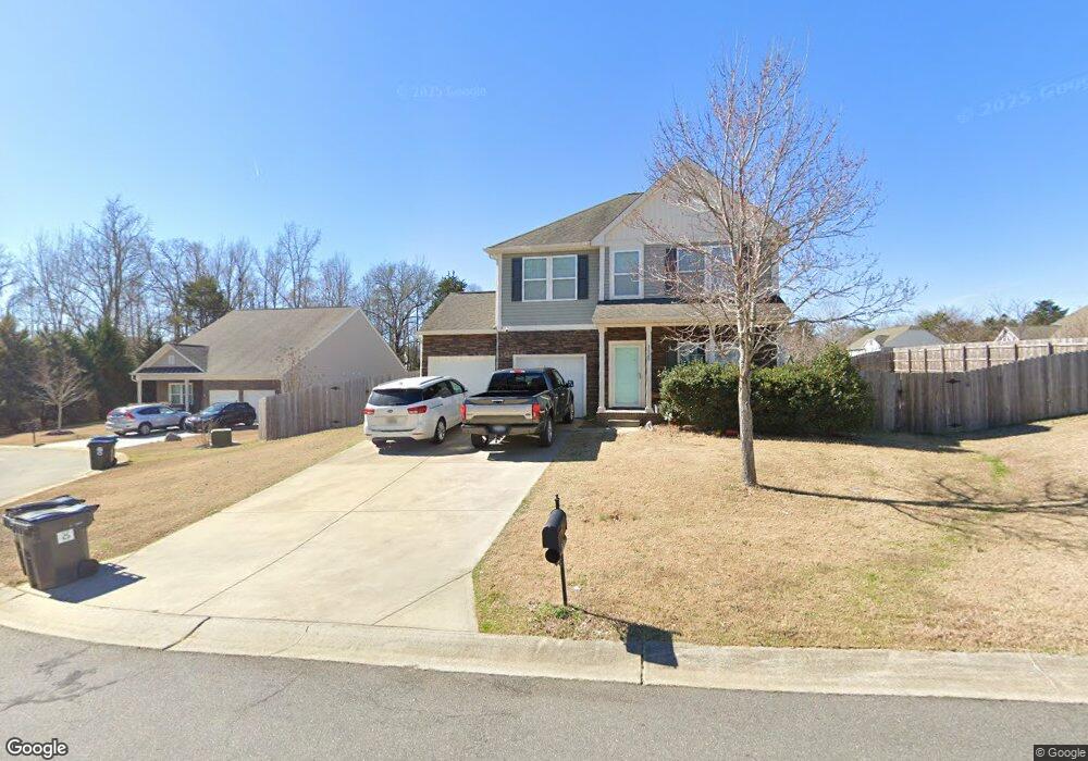
1820 Stuart Carter Ave Rock Hill, SC 29730
Estimated Value: $363,000 - $423,000
--
Bed
1
Bath
2,196
Sq Ft
$179/Sq Ft
Est. Value
About This Home
This home is located at 1820 Stuart Carter Ave, Rock Hill, SC 29730 and is currently estimated at $393,225, approximately $179 per square foot. 1820 Stuart Carter Ave is a home with nearby schools including Independence Elementary School, Castle Heights Middle School, and Rock Hill High School.
Ownership History
Date
Name
Owned For
Owner Type
Purchase Details
Closed on
Feb 26, 2013
Sold by
True Homes Llc
Bought by
Noviello Jacqueline Brie
Current Estimated Value
Home Financials for this Owner
Home Financials are based on the most recent Mortgage that was taken out on this home.
Original Mortgage
$170,352
Outstanding Balance
$120,322
Interest Rate
3.56%
Mortgage Type
New Conventional
Estimated Equity
$272,903
Purchase Details
Closed on
Aug 12, 2010
Sold by
Ellis Pond Inc
Bought by
Provident Community Bank Na
Create a Home Valuation Report for This Property
The Home Valuation Report is an in-depth analysis detailing your home's value as well as a comparison with similar homes in the area
Home Values in the Area
Average Home Value in this Area
Purchase History
| Date | Buyer | Sale Price | Title Company |
|---|---|---|---|
| Noviello Jacqueline Brie | $166,945 | -- | |
| Provident Community Bank Na | -- | -- |
Source: Public Records
Mortgage History
| Date | Status | Borrower | Loan Amount |
|---|---|---|---|
| Open | Noviello Jacqueline Brie | $170,352 |
Source: Public Records
Tax History Compared to Growth
Tax History
| Year | Tax Paid | Tax Assessment Tax Assessment Total Assessment is a certain percentage of the fair market value that is determined by local assessors to be the total taxable value of land and additions on the property. | Land | Improvement |
|---|---|---|---|---|
| 2024 | $1,130 | $8,050 | $957 | $7,093 |
| 2023 | $1,159 | $8,050 | $957 | $7,093 |
| 2022 | $1,163 | $8,050 | $957 | $7,093 |
| 2021 | -- | $8,050 | $957 | $7,093 |
| 2020 | $1,159 | $8,050 | $0 | $0 |
| 2019 | $1,057 | $7,000 | $0 | $0 |
| 2018 | $1,049 | $7,000 | $0 | $0 |
| 2017 | $988 | $7,000 | $0 | $0 |
| 2016 | $958 | $7,000 | $0 | $0 |
| 2014 | $534 | $7,000 | $1,200 | $5,800 |
| 2013 | $534 | $6,240 | $1,200 | $5,040 |
Source: Public Records
Map
Nearby Homes
- 1177 Ellis Pond Dr
- 1780 Stuart Carter Ave
- 2021 Eddie Massey Ln
- 1354 Springwood Ln
- 1255 Church Rd
- 953 Church Rd
- 1715 Hopewell Rd
- 1014 Holly Rd
- Drexel Plan at Waterford Commons
- Oxford Plan at Waterford Commons
- Avery Plan at Waterford Commons
- Newberry Plan at Waterford Commons
- Fenwick Plan at Waterford Commons
- Wescott Plan at Waterford Commons
- Mayfair Plan at Waterford Commons
- Davidson Plan at Waterford Commons
- Wilmington Plan at Waterford Commons
- Cypress Plan at Waterford Commons
- 529 Cheryl Lynn Dr
- 535 Cheryl Lynn Dr
- 1972 Vickie Ln
- 2063 Vickie Ln
- 2101 Vickie Ln
- 1828 Stuart Carter Ave Unit 43
- 1973 Vickie Ln
- 1821 Stuart Carter Ave
- 1829 Stuart Carter Ave
- 1964 Vickie Ln
- 1964 Vickie Ln Unit 40
- 1813 Stuart Carter Ave
- 1965 Vickie Ln
- 1805 Stuart Carter Ave
- 1796 Stuart Carter Ave Unit 106
- 1796 Stuart Carter Ave
- 1639 Natalie Ln
- 1639 Natalie Ln Unit 110
- 1957 Vickie Ln
- 1797 Stuart Carter Ave
- 1639R Natalie Ln
- 1784 Stuart Carter Ave