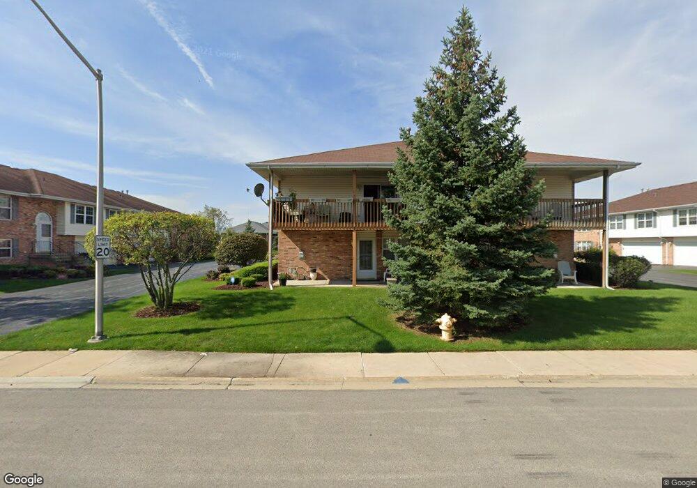
18202 Kirby Dr Unit 18202 Tinley Park, IL 60487
Central Tinley Park NeighborhoodEstimated Value: $256,199 - $312,000
2
Beds
1
Bath
1,800
Sq Ft
$159/Sq Ft
Est. Value
About This Home
This home is located at 18202 Kirby Dr Unit 18202, Tinley Park, IL 60487 and is currently estimated at $286,800, approximately $159 per square foot. 18202 Kirby Dr Unit 18202 is a home located in Cook County with nearby schools including Millennium Elementary School, Prairie View Middle School, and Victor J Andrew High School.
Ownership History
Date
Name
Owned For
Owner Type
Purchase Details
Closed on
Sep 11, 2024
Sold by
Daoud Sonia B
Bought by
Sonia Daoud Living Trust and Daoud
Current Estimated Value
Purchase Details
Closed on
Apr 8, 2013
Sold by
Daoud David
Bought by
Daoud Lutfi and Daoud Sonia B
Purchase Details
Closed on
May 20, 2008
Sold by
Daoud Lutfi and Daoud David
Bought by
Daoud Lutfi and Doaud Sonia
Purchase Details
Closed on
Oct 1, 2006
Sold by
Daoud David
Bought by
Daoud Lutfi and Daoud David
Home Financials for this Owner
Home Financials are based on the most recent Mortgage that was taken out on this home.
Original Mortgage
$175,000
Interest Rate
6.59%
Mortgage Type
Unknown
Purchase Details
Closed on
Aug 13, 2006
Sold by
Flood Forrest and Valeriote Annamarie Frances
Bought by
Daoud David
Home Financials for this Owner
Home Financials are based on the most recent Mortgage that was taken out on this home.
Original Mortgage
$175,000
Interest Rate
6.59%
Mortgage Type
Unknown
Purchase Details
Closed on
Jun 7, 2003
Sold by
Flood Forrest A
Bought by
Flood Forrest A and Valeriote Annamarie Frances
Purchase Details
Closed on
Mar 20, 2003
Sold by
Flood Forrest A and Stanfa Annamarie F
Bought by
Flood Forrest A
Home Financials for this Owner
Home Financials are based on the most recent Mortgage that was taken out on this home.
Original Mortgage
$122,000
Interest Rate
5.9%
Mortgage Type
Stand Alone First
Purchase Details
Closed on
Mar 29, 2002
Sold by
Flood Forrest A
Bought by
Flood Forrest A and Stanfa Annamarie F
Purchase Details
Closed on
Mar 14, 2000
Sold by
Old Kent Bank
Bought by
Flood Forrest A
Home Financials for this Owner
Home Financials are based on the most recent Mortgage that was taken out on this home.
Original Mortgage
$110,000
Interest Rate
8.39%
Create a Home Valuation Report for This Property
The Home Valuation Report is an in-depth analysis detailing your home's value as well as a comparison with similar homes in the area
Home Values in the Area
Average Home Value in this Area
Purchase History
| Date | Buyer | Sale Price | Title Company |
|---|---|---|---|
| Sonia Daoud Living Trust | -- | None Listed On Document | |
| Sonia Daoud Living Trust | -- | None Listed On Document | |
| Daoud Lutfi | -- | None Available | |
| Daoud Lutfi | -- | None Available | |
| Daoud Lutfi | -- | None Available | |
| Daoud David | $225,000 | Multiple | |
| Flood Forrest A | -- | -- | |
| Flood Forrest A | -- | -- | |
| Flood Forrest A | -- | Cti | |
| Flood Forrest A | -- | Cti | |
| Flood Forrest A | -- | -- | |
| Flood Forrest A | $168,500 | Ticor Title |
Source: Public Records
Mortgage History
| Date | Status | Borrower | Loan Amount |
|---|---|---|---|
| Previous Owner | Daoud David | $175,000 | |
| Previous Owner | Flood Forrest A | $122,000 | |
| Previous Owner | Flood Forrest A | $110,000 |
Source: Public Records
Tax History Compared to Growth
Tax History
| Year | Tax Paid | Tax Assessment Tax Assessment Total Assessment is a certain percentage of the fair market value that is determined by local assessors to be the total taxable value of land and additions on the property. | Land | Improvement |
|---|---|---|---|---|
| 2024 | $4,223 | $21,181 | $2,677 | $18,504 |
| 2023 | $4,406 | $21,181 | $2,677 | $18,504 |
| 2022 | $4,406 | $18,518 | $2,328 | $16,190 |
| 2021 | $2,446 | $18,516 | $2,327 | $16,189 |
| 2020 | $2,219 | $18,516 | $2,327 | $16,189 |
| 2019 | $2,367 | $16,068 | $2,094 | $13,974 |
| 2018 | $2,320 | $16,068 | $2,094 | $13,974 |
| 2017 | $2,219 | $16,068 | $2,094 | $13,974 |
| 2016 | $3,232 | $15,385 | $1,862 | $13,523 |
| 2015 | $3,359 | $15,385 | $1,862 | $13,523 |
| 2014 | $2,980 | $15,385 | $1,862 | $13,523 |
| 2013 | $3,095 | $14,756 | $1,862 | $12,894 |
Source: Public Records
Map
Nearby Homes
- 8423 Stratford Dr Unit 8423
- 18261 Kirby Dr Unit 2918261
- 8416 Stratford Dr Unit 8416
- 17908 Iroquois Trace
- 8036 Blarney Rd
- 17631 Dover Ct
- 9038 Mansfield Dr Unit 8
- 9051 Mansfield Dr Unit 1
- 9058 Newcastle Ct
- Fremont Plan at Radcliffe Place
- Calysta Plan at Radcliffe Place
- Danbury Plan at Radcliffe Place
- Briarcliffe Plan at Radcliffe Place
- Eden Plan at Radcliffe Place
- Amberwood Plan at Radcliffe Place
- 8313 Aster Ln
- 18055 Upland Dr
- 18248 Murphy Cir Unit 182
- 17964 Upland Dr
- 7783 Bristol Park Dr Unit 1-SW
- 18196 Kirby Dr Unit 18196
- 18200 Kirby Dr Unit 18200
- 18198 Kirby Dr Unit 18198
- 18212 Kirby Dr Unit 18212
- 18212 Kirby Dr Unit 1821
- 18210 Kirby Dr Unit 18210
- 18216 Kirby Dr Unit 18216
- 18211 Nielsen Dr
- 18214 Kirby Dr Unit 18214
- 18130 Kirby Dr Unit 18130
- 18132 Kirby Dr Unit 18132
- 18225 Nielsen Dr
- 18128 Kirby Dr Unit 18128
- 18195 Nielsen Dr
- 18239 Nielsen Dr
- 18137 Kirby Dr Unit 3018137
- 18139 Kirby Dr Unit 3018139
- 18254 Kirby Dr Unit 18254
- 18141 Kirby Dr Unit 3018141
- 18256 Kirby Dr Unit 18256