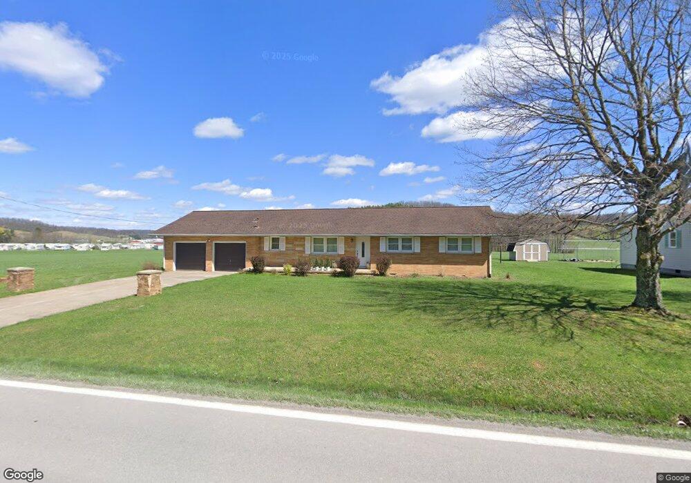
1821 Brushy Fork Rd Buckhannon, WV 26201
Estimated Value: $117,000 - $222,000
3
Beds
2
Baths
1,425
Sq Ft
$132/Sq Ft
Est. Value
About This Home
This home is located at 1821 Brushy Fork Rd, Buckhannon, WV 26201 and is currently estimated at $188,303, approximately $132 per square foot. 1821 Brushy Fork Rd is a home with nearby schools including Buckhannon Upshur High School, Seventh Day Adventist School, and Brushy Fork Christian School.
Ownership History
Date
Name
Owned For
Owner Type
Purchase Details
Closed on
Sep 23, 2024
Sold by
Mcdaniels Jacqueline A
Bought by
Montalvo Dawn Michele
Current Estimated Value
Home Financials for this Owner
Home Financials are based on the most recent Mortgage that was taken out on this home.
Original Mortgage
$200,000
Interest Rate
6.12%
Mortgage Type
Credit Line Revolving
Purchase Details
Closed on
Oct 18, 2019
Sold by
Mcdaniels Jeffrey A
Bought by
Mcdaniels Jacqueline A
Purchase Details
Closed on
Jun 22, 2018
Sold by
Mcdaniels Patricia M
Bought by
Mcdaniels Jeffrey A and Mcdaniels Jacqueline A
Create a Home Valuation Report for This Property
The Home Valuation Report is an in-depth analysis detailing your home's value as well as a comparison with similar homes in the area
Home Values in the Area
Average Home Value in this Area
Purchase History
| Date | Buyer | Sale Price | Title Company |
|---|---|---|---|
| Montalvo Dawn Michele | $200,000 | None Listed On Document | |
| Montalvo Dawn Michele | $200,000 | None Listed On Document | |
| Mcdaniels Jacqueline A | -- | None Available | |
| Mcdaniels Jeffrey A | -- | None Available |
Source: Public Records
Mortgage History
| Date | Status | Borrower | Loan Amount |
|---|---|---|---|
| Previous Owner | Montalvo Dawn Michele | $200,000 |
Source: Public Records
Tax History Compared to Growth
Tax History
| Year | Tax Paid | Tax Assessment Tax Assessment Total Assessment is a certain percentage of the fair market value that is determined by local assessors to be the total taxable value of land and additions on the property. | Land | Improvement |
|---|---|---|---|---|
| 2024 | $610 | $90,000 | $10,500 | $79,500 |
| 2023 | $770 | $87,960 | $10,500 | $77,460 |
| 2022 | $751 | $85,800 | $10,500 | $75,300 |
| 2021 | $567 | $84,720 | $10,500 | $74,220 |
| 2020 | $556 | $83,460 | $10,500 | $72,960 |
| 2019 | $29 | $83,580 | $10,500 | $73,080 |
| 2018 | $557 | $83,580 | $10,500 | $73,080 |
| 2017 | $558 | $83,700 | $10,500 | $73,200 |
| 2016 | $543 | $82,020 | $10,500 | $71,520 |
| 2015 | $536 | $81,180 | $10,500 | $70,680 |
| 2014 | $489 | $75,840 | $7,320 | $68,520 |
Source: Public Records
Map
Nearby Homes
- 2219 Brushy Fork Rd
- 235 Doe Ln
- 382 Knollwood Dr
- 26-11 Jarrett Dr
- 310 Dewberry Trail
- TBD Logans Ln
- 3218 Old Weston Rd
- 41 Overlook Dr
- 398 Rohr Ave
- 11 Tuggle St
- 422 Carol St
- 95 Rohr Ave
- 19 Pinnell St
- 108 Allman Ave
- 10 Maple St
- 358 Marjorie Ann Dr
- 5 Madison St
- 218 Academy St
- 68 Crescent Ave
- 131 Shawnee Dr
- 1851 Brushy Fork Rd
- 1871 Brushy Fork Rd
- 16.14 AC Brushy Fork Rd
- 65 Starkey Cove Dr
- 88 Starkey Cove Dr
- 19 Primrose St
- 1919 Brushy Fork Rd
- 1820 Brushy Fork Rd
- 134 Starkey Cove Dr
- 55 Primrose St
- 133 Starkey Cove Dr
- 16 Primrose St
- 5 Eagle St
- 7 Eagle St
- 13 Eagle St
- 15 Eagle St
- 21 Eagle St
- 31 Eagle St
- 6 Eagle St
- 10 Eagle St