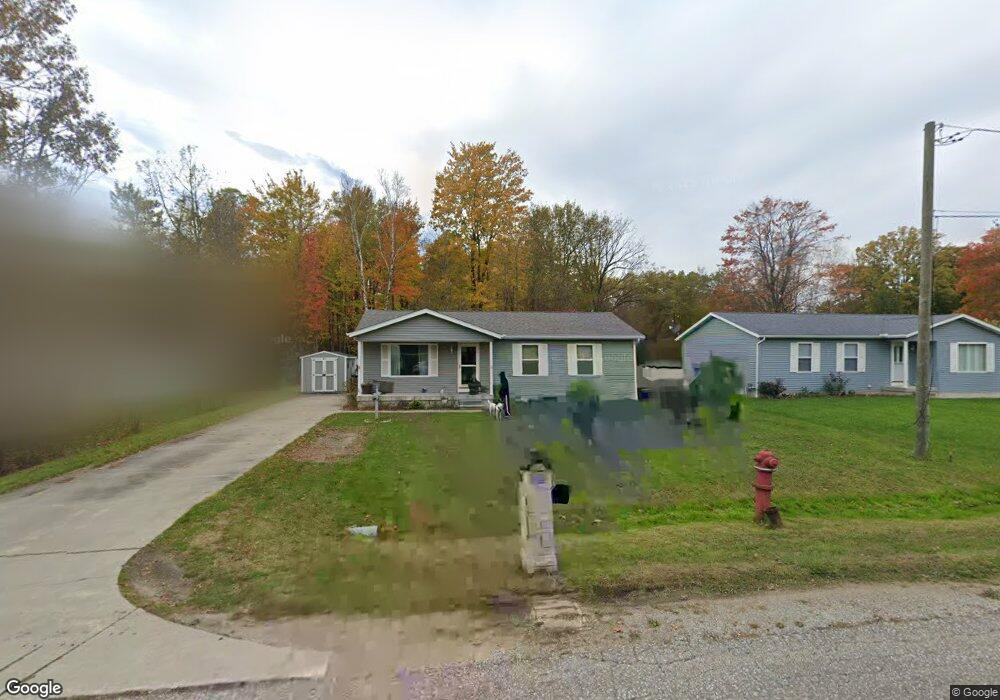
1821 Leland Rd Kimball, MI 48074
Estimated Value: $211,406 - $285,000
3
Beds
1
Bath
1,106
Sq Ft
$217/Sq Ft
Est. Value
About This Home
This home is located at 1821 Leland Rd, Kimball, MI 48074 and is currently estimated at $239,602, approximately $216 per square foot. 1821 Leland Rd is a home located in St. Clair County with nearby schools including Kimball Elementary School, Central Middle School, and Port Huron High School.
Ownership History
Date
Name
Owned For
Owner Type
Purchase Details
Closed on
Apr 28, 2011
Sold by
Crocker Daniel L and Crocker Christine M
Bought by
Evans April A
Current Estimated Value
Purchase Details
Closed on
Apr 11, 2006
Sold by
Varty Daniel J and Varty Anita J
Bought by
Crocker Daniel J and Crocker Christine M
Home Financials for this Owner
Home Financials are based on the most recent Mortgage that was taken out on this home.
Original Mortgage
$111,700
Interest Rate
6.34%
Mortgage Type
New Conventional
Create a Home Valuation Report for This Property
The Home Valuation Report is an in-depth analysis detailing your home's value as well as a comparison with similar homes in the area
Home Values in the Area
Average Home Value in this Area
Purchase History
| Date | Buyer | Sale Price | Title Company |
|---|---|---|---|
| Evans April A | $110,000 | None Available | |
| Crocker Daniel J | $35,000 | Huron Title Company |
Source: Public Records
Mortgage History
| Date | Status | Borrower | Loan Amount |
|---|---|---|---|
| Previous Owner | Crocker Daniel J | $111,700 |
Source: Public Records
Tax History Compared to Growth
Tax History
| Year | Tax Paid | Tax Assessment Tax Assessment Total Assessment is a certain percentage of the fair market value that is determined by local assessors to be the total taxable value of land and additions on the property. | Land | Improvement |
|---|---|---|---|---|
| 2025 | $1,565 | $110,100 | $0 | $0 |
| 2024 | $853 | $99,400 | $0 | $0 |
| 2023 | $781 | $97,200 | $0 | $0 |
| 2022 | $1,345 | $81,700 | $0 | $0 |
| 2021 | $1,238 | $77,000 | $0 | $0 |
| 2020 | $1,238 | $78,000 | $78,000 | $0 |
| 2019 | $1,215 | $64,000 | $0 | $0 |
| 2018 | $1,164 | $53,300 | $0 | $0 |
| 2017 | $1,240 | $54,800 | $0 | $0 |
| 2016 | $636 | $54,800 | $0 | $0 |
| 2015 | -- | $53,200 | $53,200 | $0 |
| 2014 | -- | $44,700 | $44,700 | $0 |
| 2013 | -- | $52,100 | $0 | $0 |
Source: Public Records
Map
Nearby Homes
- 4632 Cloverdale Ln
- V/L Allen
- 1701 Allen Rd
- 1979 Allen Rd
- 1604 Allen Rd
- 4595 Griswold Rd
- 1405 Range Rd
- 00 Range Rd
- 00 Howard Rd
- 0000 Range Rd
- 0 Allen Rd Unit 20250008597
- 0 Allen Rd Unit 20250008612
- 0 Wall Rd Unit 50185999
- 5510 Griswold Rd
- 1091 Allen Rd
- 0 Lapeer Rd Unit 50137357
- 0 Ravenswood Rd Unit 20251017048
- 0000 Ravenswood Rd
- 1876 Morningstar Ave
- 174 Meadow Ln
- 1823 Leland Rd
- 1813 Leland Rd
- 1811 Leland Rd
- 1829 Leland Rd
- 1822 Leland Rd
- 1809 Leland Rd
- 1818 Leland Rd
- 1810 Leland Rd
- 1805 Leland Rd
- 1814 Leland Rd
- 1826 Leland Rd
- 1836 Leland Rd
- 1845 Leland Rd
- 1806 Leland Rd
- 1802 Leland Rd Unit Bldg-Unit
- 1802 Leland Rd
- 1842 Leland Rd
- 1759 Leland Rd
- 1760 Leland Rd
- 1848 Leland Rd