Estimated Value: $441,633 - $460,000
4
Beds
2
Baths
2,212
Sq Ft
$203/Sq Ft
Est. Value
About This Home
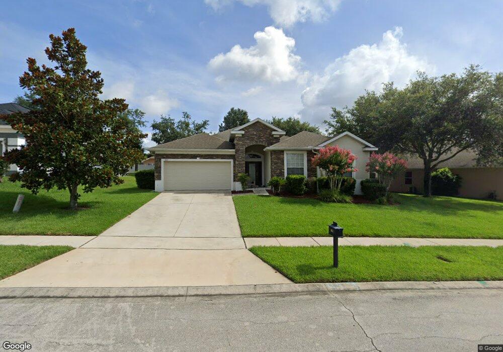
This home is located at 1821 Palmerston Cir, Ocoee, FL 34761 and is currently estimated at $448,658, approximately $202 per square foot. 1821 Palmerston Cir is a home located in Orange County with nearby schools including Prairie Lake Elementary School, Ocoee Middle School, and Wekiva High School.
Ownership History
Date
Name
Owned For
Owner Type
Purchase Details
Closed on
Jul 7, 2009
Sold by
Secretary Of Veterans Affairs
Bought by
Brown Sophia W
Current Estimated Value
Home Financials for this Owner
Home Financials are based on the most recent Mortgage that was taken out on this home.
Original Mortgage
$184,592
Interest Rate
5.03%
Mortgage Type
New Conventional
Purchase Details
Closed on
Dec 18, 2008
Sold by
Suntrust Mortgage Inc
Bought by
Secretary Of Veterans Affairs
Purchase Details
Closed on
Oct 3, 2008
Sold by
Watt Anne Marie and Watt Michael
Bought by
Suntrust Mortgage Inc
Purchase Details
Closed on
May 5, 2006
Sold by
Morrison Homes Inc
Bought by
Watt Michael and Watt Anne Marie
Home Financials for this Owner
Home Financials are based on the most recent Mortgage that was taken out on this home.
Original Mortgage
$352,417
Interest Rate
6.39%
Mortgage Type
VA
Create a Home Valuation Report for This Property
The Home Valuation Report is an in-depth analysis detailing your home's value as well as a comparison with similar homes in the area
Home Values in the Area
Average Home Value in this Area
Purchase History
| Date | Buyer | Sale Price | Title Company |
|---|---|---|---|
| Brown Sophia W | $180,900 | North American Title | |
| Secretary Of Veterans Affairs | $361,200 | Attorney | |
| Suntrust Mortgage Inc | $361,200 | Attorney | |
| Watt Michael | $353,600 | Universal Land Title Inc |
Source: Public Records
Mortgage History
| Date | Status | Borrower | Loan Amount |
|---|---|---|---|
| Previous Owner | Brown Sophia W | $184,592 | |
| Previous Owner | Watt Michael | $352,417 |
Source: Public Records
Tax History Compared to Growth
Tax History
| Year | Tax Paid | Tax Assessment Tax Assessment Total Assessment is a certain percentage of the fair market value that is determined by local assessors to be the total taxable value of land and additions on the property. | Land | Improvement |
|---|---|---|---|---|
| 2025 | $2,591 | $170,285 | -- | -- |
| 2024 | $2,502 | $170,285 | -- | -- |
| 2023 | $2,502 | $160,666 | $0 | $0 |
| 2022 | $2,414 | $155,986 | $0 | $0 |
| 2021 | $2,383 | $151,443 | $0 | $0 |
| 2020 | $2,275 | $149,352 | $0 | $0 |
| 2019 | $2,350 | $145,994 | $0 | $0 |
| 2018 | $2,338 | $143,272 | $0 | $0 |
| 2017 | $2,320 | $193,582 | $22,000 | $171,582 |
| 2016 | $2,323 | $188,353 | $22,000 | $166,353 |
| 2015 | $2,359 | $167,071 | $15,000 | $152,071 |
| 2014 | $2,344 | $164,081 | $20,000 | $144,081 |
Source: Public Records
Map
Nearby Homes
- 2123 Greenwood Oak Dr
- 3409 Briarwood Grove Dr
- 3417 Briarwood Grove Dr
- HARPER Plan at Wynwood
- CAMDEN Plan at Wynwood
- ROBINSON - FOLK VICTORIAN Plan at Wynwood
- ARIA Plan at Wynwood
- ROBIE Plan at Wynwood
- CALI Plan at Wynwood
- HAYDEN Plan at Wynwood
- ALLEX Plan at Wynwood
- DESTIN Plan at Wynwood
- 2123 Greenwood Oak Dr
- 2117 Greenwood Oak Dr
- 2043 Ashwood Bluff Dr
- 2074 Ashwood Bluff Dr
- 2050 Ashwood Bluff Dr
- 9417 Trout Lake Rd
- 3350 Wynwood Forest Dr
- 3331 Wynwood Forest Dr
- 1825 Palmerston Cir
- 1809 Palmerston Cir
- 1729 Palmerston Cir
- 1733 Palmerston Cir
- 1801 Palmerston Cir
- 1822 Palmerston Cir
- 1833 Palmerston Cir
- 1818 Palmerston Cir
- 1826 Palmerston Cir
- 1723 Palmerston Cir
- 1737 Palmerston Cir
- 1841 Palmerston Cir
- 1830 Palmerston Cir
- 1795 Palmerston Cir
- 1806 Palmerston Cir
- 1802 Palmerston Cir
- 1834 Palmerston Cir
- 1728 Palmerston Cir
- 1798 Palmerston Cir
- 1785 Palmerston Cir