Estimated Value: $348,000 - $405,000
3
Beds
3
Baths
2,192
Sq Ft
$173/Sq Ft
Est. Value
About This Home
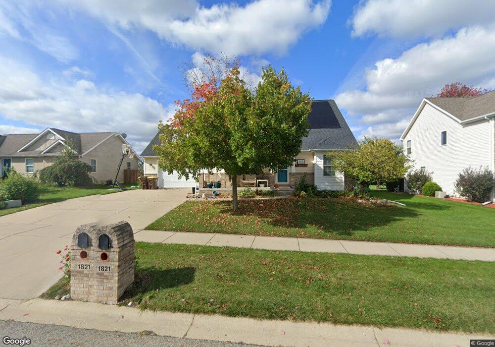
This home is located at 1821 Parakeet, Holt, MI 48842 and is currently estimated at $379,798, approximately $173 per square foot. 1821 Parakeet is a home located in Ingham County with nearby schools including Horizon Elementary School, Washington Woods Middle School, and Holt Junior High School.
Ownership History
Date
Name
Owned For
Owner Type
Purchase Details
Closed on
Mar 21, 2019
Sold by
Gleason Sean M
Bought by
Gleason Sean M and Gleason Amanda E
Current Estimated Value
Purchase Details
Closed on
Sep 7, 2010
Sold by
Chase Home Finance Llc
Bought by
Federal National Mortgage Association
Purchase Details
Closed on
Sep 2, 2010
Sold by
Mcnamara Michael and Mcnamara Melanie S
Bought by
Chase Home Finance Llc
Create a Home Valuation Report for This Property
The Home Valuation Report is an in-depth analysis detailing your home's value as well as a comparison with similar homes in the area
Home Values in the Area
Average Home Value in this Area
Purchase History
| Date | Buyer | Sale Price | Title Company |
|---|---|---|---|
| Gleason Sean M | -- | None Available | |
| Federal National Mortgage Association | -- | None Available | |
| Chase Home Finance Llc | $237,715 | None Available |
Source: Public Records
Tax History Compared to Growth
Tax History
| Year | Tax Paid | Tax Assessment Tax Assessment Total Assessment is a certain percentage of the fair market value that is determined by local assessors to be the total taxable value of land and additions on the property. | Land | Improvement |
|---|---|---|---|---|
| 2025 | $7,274 | $186,200 | $30,400 | $155,800 |
| 2024 | $18 | $184,800 | $27,500 | $157,300 |
| 2023 | $7,680 | $168,700 | $23,100 | $145,600 |
| 2022 | $6,489 | $149,200 | $24,900 | $124,300 |
| 2021 | $6,794 | $143,200 | $17,500 | $125,700 |
| 2020 | $6,967 | $135,900 | $17,500 | $118,400 |
| 2019 | $6,765 | $129,400 | $13,900 | $115,500 |
| 2018 | $6,730 | $119,400 | $13,900 | $105,500 |
| 2017 | $6,134 | $119,400 | $13,900 | $105,500 |
| 2016 | $5,567 | $115,100 | $18,400 | $96,700 |
| 2015 | $5,555 | $114,400 | $36,828 | $77,572 |
| 2014 | $5,555 | $109,800 | $36,828 | $72,972 |
Source: Public Records
Map
Nearby Homes
- 1851 Hollowbrook Dr
- 2145 Aspenwood Dr
- 5386 Auben Ln
- 1972 Gunn Rd
- 5360 Holt Rd
- TBD N Onondaga Rd
- 1463 N Onondaga Rd
- 2340 Washington Rd
- VL Witherspoon Way
- 6355 Holt Rd
- 1511 Antler Cir
- 5071 Haddon Hall Dr
- 5594 Harper Rd
- 1812 Tupelo Trail
- 6454 Pleasant River Dr
- 6820 Richard Rd
- 5041 Willoughby Rd Unit 4
- 2616 Michigan 99
- 6421 S Washington Ave
- 6444 Sommerset Rd
- 1829 Parakeet
- 1815 Parakeet
- 1807 Parakeet
- 1837 Parakeet
- 1826 Parakeet
- 1816 Parakeet
- 1834 Parakeet
- 1801 Parakeet
- 1810 Parakeet
- 1842 Parakeet
- 1802 Parakeet
- 1850 Parakeet
- 1793 Parakeet
- 1827 Hollowbrook Dr
- 1819 Hollowbrook Dr
- 1835 Hollowbrook Dr
- 1811 Hollowbrook Dr
- 1843 Hollowbrook Dr
- 1794 Parakeet
- 1858 Parakeet