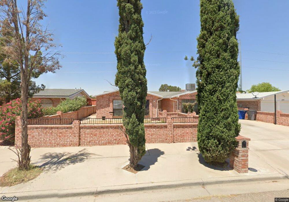
1821 Robert Wynn St El Paso, TX 79936
Vista Del Sol NeighborhoodEstimated Value: $251,605 - $279,000
3
Beds
2
Baths
2,265
Sq Ft
$117/Sq Ft
Est. Value
About This Home
This home is located at 1821 Robert Wynn St, El Paso, TX 79936 and is currently estimated at $265,901, approximately $117 per square foot. 1821 Robert Wynn St is a home located in El Paso County with nearby schools including Tierra Del Sol Elementary School, J M Hanks High School, and EL PASO LEADERSHIP ACADEMY - MIDDLE EAST.
Ownership History
Date
Name
Owned For
Owner Type
Purchase Details
Closed on
Oct 5, 2006
Sold by
Estrada Thomas P and Estrada Norma E
Bought by
Marshall Rocio Astrid and Marshall Alan Jay
Current Estimated Value
Home Financials for this Owner
Home Financials are based on the most recent Mortgage that was taken out on this home.
Original Mortgage
$25,500
Outstanding Balance
$15,059
Interest Rate
6.46%
Mortgage Type
Stand Alone Second
Estimated Equity
$250,842
Create a Home Valuation Report for This Property
The Home Valuation Report is an in-depth analysis detailing your home's value as well as a comparison with similar homes in the area
Home Values in the Area
Average Home Value in this Area
Purchase History
| Date | Buyer | Sale Price | Title Company |
|---|---|---|---|
| Marshall Rocio Astrid | -- | Lone Star Title East |
Source: Public Records
Mortgage History
| Date | Status | Borrower | Loan Amount |
|---|---|---|---|
| Open | Marshall Rocio Astrid | $25,500 | |
| Open | Marshall Rocio Astrid | $102,000 |
Source: Public Records
Tax History Compared to Growth
Tax History
| Year | Tax Paid | Tax Assessment Tax Assessment Total Assessment is a certain percentage of the fair market value that is determined by local assessors to be the total taxable value of land and additions on the property. | Land | Improvement |
|---|---|---|---|---|
| 2025 | $3,181 | $206,975 | -- | -- |
| 2024 | $3,181 | $188,159 | -- | -- |
| 2023 | $2,898 | $171,054 | $0 | $0 |
| 2022 | $4,829 | $155,504 | $0 | $0 |
| 2021 | $4,595 | $153,323 | $20,238 | $133,085 |
| 2020 | $4,059 | $128,515 | $18,370 | $110,145 |
| 2018 | $4,114 | $132,308 | $18,370 | $113,938 |
| 2017 | $3,740 | $122,358 | $18,370 | $103,988 |
| 2016 | $3,740 | $122,358 | $18,370 | $103,988 |
| 2015 | $2,911 | $122,358 | $18,370 | $103,988 |
| 2014 | $2,911 | $128,046 | $18,370 | $109,676 |
Source: Public Records
Map
Nearby Homes
- 1804 Jerry Abbott St
- 1739 Jerry Abbott St
- 1913 Seagull Dr
- 1868 Tom Bolt Dr
- 2101 E Glen Dr
- 1703 Robert Wynn St
- 1700 Jerry Abbott St
- 11204 Bob Mitchell Dr
- 1817 Hugh Royer Place
- 2604 Anise Dr
- 3655 George Dieter Dr
- 1901 Bobby Jones Dr
- 1617 Tommy Aaron Dr
- 1607 Tommy Aaron Dr
- 2001 Bobby Jones Dr Unit A
- 2348 Sea Side Dr
- 11016 Bob Stone Dr
- 2009 Bobby Jones Dr Unit B
- 1935 Bay City Place
- 11012 Bob Stone Dr
- 1823 Robert Wynn St
- 1819 Robert Wynn St
- 1825 Robert Wynn St
- 1817 Robert Wynn St
- 1820 Robert Wynn St
- 1818 Robert Wynn St
- 1822 Robert Wynn St
- 1827 Robert Wynn St
- 1815 Robert Wynn St
- 1816 Robert Wynn St
- 1824 Robert Wynn St
- 1832 Dale Douglas Dr
- 1828 Dale Douglas Dr
- 1824 Dale Douglas Dr
- 1836 Dale Douglas Dr
- 1814 Robert Wynn St
- 1829 Robert Wynn St
- 1813 Robert Wynn St
- 1826 Robert Wynn St
- 1826 Robert Wynn St Unit na