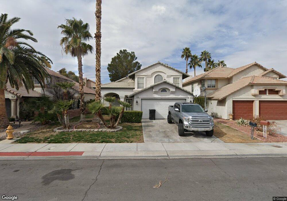
1821 Walker Ln Henderson, NV 89014
Green Valley North NeighborhoodEstimated Value: $517,000 - $548,000
5
Beds
3
Baths
2,465
Sq Ft
$216/Sq Ft
Est. Value
About This Home
This home is located at 1821 Walker Ln, Henderson, NV 89014 and is currently estimated at $533,457, approximately $216 per square foot. 1821 Walker Ln is a home located in Clark County with nearby schools including Estes M Mcdoniel Elementary School, Barbara and Hank Greenspun Junior High School, and Green Valley High School.
Ownership History
Date
Name
Owned For
Owner Type
Purchase Details
Closed on
May 28, 2021
Sold by
Shefa Investment Group Llc
Bought by
Torres Juan and Torres Maria
Current Estimated Value
Purchase Details
Closed on
Jul 28, 2015
Sold by
Capital One Na
Bought by
Shefa Investment Group Llc
Purchase Details
Closed on
Jan 6, 2014
Sold by
Wood Albert L
Bought by
Capital One Na
Purchase Details
Closed on
Oct 11, 2004
Sold by
Harney Timothy and Harney Kathleen
Bought by
Wood Albert L
Home Financials for this Owner
Home Financials are based on the most recent Mortgage that was taken out on this home.
Original Mortgage
$303,200
Interest Rate
5.37%
Mortgage Type
Unknown
Purchase Details
Closed on
Jun 26, 2003
Sold by
Tandy Richard D and Tandy Paulette R
Bought by
Harney Timothy and Harney Kathleen
Home Financials for this Owner
Home Financials are based on the most recent Mortgage that was taken out on this home.
Original Mortgage
$194,850
Interest Rate
5.26%
Mortgage Type
Unknown
Create a Home Valuation Report for This Property
The Home Valuation Report is an in-depth analysis detailing your home's value as well as a comparison with similar homes in the area
Home Values in the Area
Average Home Value in this Area
Purchase History
| Date | Buyer | Sale Price | Title Company |
|---|---|---|---|
| Torres Juan | $420,000 | Netco | |
| Shefa Investment Group Llc | $237,000 | Chicago Title Las Vegas | |
| Capital One Na | $255,000 | Lsi Title Agency Inc | |
| Wood Albert L | $379,000 | Stewart Title Of Nevada | |
| Harney Timothy | $260,000 | Ticor Title Of Nevada Inc |
Source: Public Records
Mortgage History
| Date | Status | Borrower | Loan Amount |
|---|---|---|---|
| Previous Owner | Wood Albert L | $303,200 | |
| Previous Owner | Harney Timothy | $194,850 | |
| Closed | Wood Albert L | $75,800 |
Source: Public Records
Tax History
| Year | Tax Paid | Tax Assessment Tax Assessment Total Assessment is a certain percentage of the fair market value that is determined by local assessors to be the total taxable value of land and additions on the property. | Land | Improvement |
|---|---|---|---|---|
| 2026 | $2,441 | $119,751 | $44,100 | $75,651 |
| 2025 | $2,370 | $129,515 | $51,450 | $78,065 |
| 2024 | $2,301 | $129,515 | $51,450 | $78,065 |
| 2023 | $2,301 | $114,667 | $39,900 | $74,767 |
| 2022 | $2,234 | $103,045 | $33,950 | $69,095 |
| 2021 | $2,268 | $97,661 | $31,500 | $66,161 |
| 2020 | $2,103 | $96,465 | $30,450 | $66,015 |
| 2019 | $1,971 | $91,360 | $25,900 | $65,460 |
| 2018 | $1,881 | $85,731 | $22,400 | $63,331 |
| 2017 | $1,761 | $87,117 | $22,400 | $64,717 |
| 2016 | $1,761 | $86,378 | $21,350 | $65,028 |
| 2015 | $1,757 | $59,636 | $12,250 | $47,386 |
| 2014 | $1,702 | $57,022 | $12,250 | $44,772 |
Source: Public Records
Map
Nearby Homes
- 1741 Saddleback Ct
- 405 Donner Pass Dr
- 1748 Stagecoach Dr
- 1715 Empire Mine Dr
- 446 Mayan Dr
- 1716 Comstock Dr
- 1908 Ginori Ct
- 542 Cervantes Dr
- 509 Brightwater St
- 1658 Britannia Ave
- 1807 Rapier Dr Unit 151
- 2220 Marlboro Dr
- 393 Blanca Springs Dr
- 2329 Richard Dr
- 639 Pepper Tree Cir Unit A
- 2231 Marlboro Dr
- 363 El Pico Dr
- 379 Blanca Springs Dr
- 390 Rosado Springs St
- 1915 Cutlass Dr Unit 104
- 1821 Walker Ln
- 1823 Walker Ln Unit 2
- 1819 Walker Ln Unit 2
- 1825 Walker Ln
- 1822 Ruby Ln
- 1824 Ruby Ln
- 1820 Ruby Ln Unit 2
- 1826 Ruby Ln
- 1520 Ruby Unit 103
- 1827 Walker Ln
- 1822 Walker Ln
- 1820 Walker Ln
- 1824 Walker Ln
- 1818 Walker Ln Unit 2
- 1828 Ruby Ln
- 1810 Walker Ln Unit 2
- 1812 Walker Ln
- 1826 Walker Ln
- 1808 Walker Ln
- 1829 Walker Ln
Your Personal Tour Guide
Ask me questions while you tour the home.