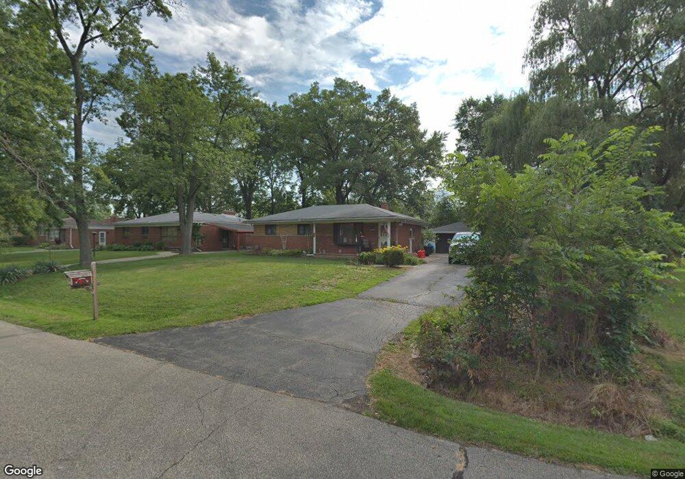
18210 Pershing St Livonia, MI 48152
Estimated Value: $230,603 - $249,000
3
Beds
2
Baths
942
Sq Ft
$254/Sq Ft
Est. Value
About This Home
This home is located at 18210 Pershing St, Livonia, MI 48152 and is currently estimated at $239,651, approximately $254 per square foot. 18210 Pershing St is a home located in Wayne County with nearby schools including Clarenceville High School, David Ellis Academy West, and Distinctive College Prep.
Ownership History
Date
Name
Owned For
Owner Type
Purchase Details
Closed on
May 25, 2023
Sold by
Poupore Franklin D
Bought by
Hojeij Fatima
Current Estimated Value
Home Financials for this Owner
Home Financials are based on the most recent Mortgage that was taken out on this home.
Original Mortgage
$183,330
Outstanding Balance
$178,120
Interest Rate
6.27%
Mortgage Type
New Conventional
Estimated Equity
$61,531
Purchase Details
Closed on
Sep 17, 2008
Sold by
Poupore Franklin D and Poupore Isabelle D
Bought by
Poupore Franklin D
Create a Home Valuation Report for This Property
The Home Valuation Report is an in-depth analysis detailing your home's value as well as a comparison with similar homes in the area
Home Values in the Area
Average Home Value in this Area
Purchase History
| Date | Buyer | Sale Price | Title Company |
|---|---|---|---|
| Hojeij Fatima | $189,000 | Liberty Title | |
| Hojeij Fatima | $189,000 | Liberty Title | |
| Hojeij Fatima | $189,000 | Liberty Title | |
| Poupore Franklin D | -- | None Available |
Source: Public Records
Mortgage History
| Date | Status | Borrower | Loan Amount |
|---|---|---|---|
| Open | Hojeij Fatima | $183,330 | |
| Closed | Hojeij Fatima | $183,330 |
Source: Public Records
Tax History Compared to Growth
Tax History
| Year | Tax Paid | Tax Assessment Tax Assessment Total Assessment is a certain percentage of the fair market value that is determined by local assessors to be the total taxable value of land and additions on the property. | Land | Improvement |
|---|---|---|---|---|
| 2025 | $2,033 | $104,700 | $0 | $0 |
| 2024 | $2,033 | $95,900 | $0 | $0 |
| 2023 | $1,068 | $86,900 | $0 | $0 |
| 2022 | $1,775 | $76,900 | $0 | $0 |
| 2021 | $1,728 | $72,500 | $0 | $0 |
| 2019 | $1,683 | $63,400 | $0 | $0 |
| 2018 | $926 | $62,300 | $0 | $0 |
| 2017 | $1,422 | $54,300 | $0 | $0 |
| 2016 | $1,490 | $54,300 | $0 | $0 |
| 2015 | $3,919 | $46,710 | $0 | $0 |
| 2012 | -- | $41,570 | $11,730 | $29,840 |
Source: Public Records
Map
Nearby Homes
- 18206 Foch St
- 18463 Poinciana
- 18411 Foch St
- 18404 Deering St
- 18626 Inkster Rd
- 18071 Floral St
- 18001 Floral St
- 18570 Pershing St
- 17612 Denby
- 18429 Gillman St
- 18061 Lathers St
- 18646 Indian
- 27030 W 6 Mile Rd
- 18851 Poinciana
- 18496 Brentwood St
- 18268 Delaware Ave
- 18690 Fox
- 26505 Margareta
- 18851 Fox
- 19169 Inkster Rd
- 18222 Pershing St
- 18234 Pershing St
- 18215 Inkster Rd
- 18248 Pershing St
- 18211 Pershing St
- 18249 Inkster Rd
- 18235 Inkster Rd
- 18241 Pershing St
- 17725 Inkster Rd
- 18310 Pershing St
- 18269 Pershing St
- 17651 Dolores St
- 18279 Inkster Rd
- 18204 Foch St
- 18291 Pershing St
- 17663 Dolores St
- 18324 Pershing St
- 17639 Dolores St
- 17675 Dolores St
- 18321 Pershing St