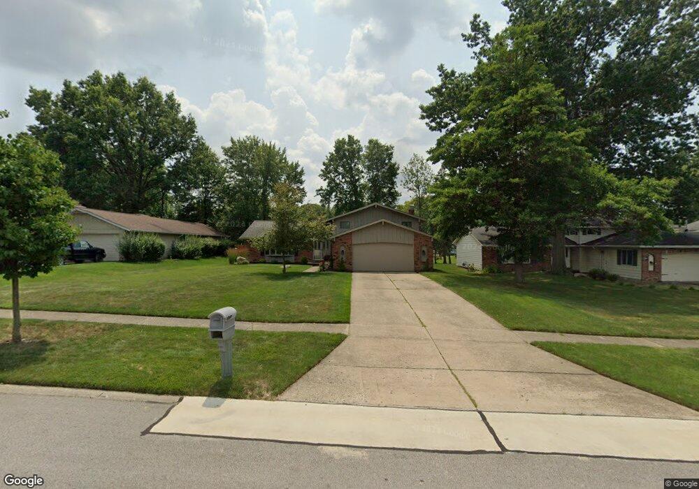
18211 Mallard Cir Strongsville, OH 44136
Estimated Value: $368,227 - $402,000
4
Beds
3
Baths
2,608
Sq Ft
$146/Sq Ft
Est. Value
About This Home
This home is located at 18211 Mallard Cir, Strongsville, OH 44136 and is currently estimated at $380,307, approximately $145 per square foot. 18211 Mallard Cir is a home located in Cuyahoga County with nearby schools including Strongsville High School, Strongsville Academy, and Sts Joseph & John Interparochial School.
Ownership History
Date
Name
Owned For
Owner Type
Purchase Details
Closed on
Mar 15, 2002
Sold by
Pinzone Sharon A
Bought by
Bodziony Daniel J and Bodziony Ellen L
Current Estimated Value
Home Financials for this Owner
Home Financials are based on the most recent Mortgage that was taken out on this home.
Original Mortgage
$158,900
Outstanding Balance
$65,863
Interest Rate
6.95%
Estimated Equity
$314,444
Purchase Details
Closed on
Oct 14, 1975
Bought by
Pinzone Salvatore M
Purchase Details
Closed on
Jan 1, 1975
Bought by
Parkview Corp
Create a Home Valuation Report for This Property
The Home Valuation Report is an in-depth analysis detailing your home's value as well as a comparison with similar homes in the area
Home Values in the Area
Average Home Value in this Area
Purchase History
| Date | Buyer | Sale Price | Title Company |
|---|---|---|---|
| Bodziony Daniel J | $187,000 | City Title Company Agency In | |
| Pinzone Salvatore M | $65,600 | -- | |
| Parkview Corp | -- | -- |
Source: Public Records
Mortgage History
| Date | Status | Borrower | Loan Amount |
|---|---|---|---|
| Open | Bodziony Daniel J | $158,900 |
Source: Public Records
Tax History Compared to Growth
Tax History
| Year | Tax Paid | Tax Assessment Tax Assessment Total Assessment is a certain percentage of the fair market value that is determined by local assessors to be the total taxable value of land and additions on the property. | Land | Improvement |
|---|---|---|---|---|
| 2024 | $4,598 | $97,930 | $22,015 | $75,915 |
| 2023 | $5,170 | $82,570 | $18,590 | $63,980 |
| 2022 | $5,133 | $82,570 | $18,590 | $63,980 |
| 2021 | $5,092 | $82,570 | $18,590 | $63,980 |
| 2020 | $4,717 | $67,660 | $15,230 | $52,430 |
| 2019 | $4,578 | $193,300 | $43,500 | $149,800 |
| 2018 | $4,155 | $67,660 | $15,230 | $52,430 |
| 2017 | $4,001 | $60,310 | $12,250 | $48,060 |
| 2016 | $3,968 | $60,310 | $12,250 | $48,060 |
| 2015 | $4,024 | $60,310 | $12,250 | $48,060 |
| 2014 | $4,024 | $60,310 | $12,250 | $48,060 |
Source: Public Records
Map
Nearby Homes
- 18162 Fawn Cir
- 17069 Partridge Dr
- 18630 Shurmer Rd
- 19311 Bradford Ct
- 19297 Lauren Way
- 19513 Lunn Rd
- 17024 Bear Creek Ln
- 17259 Woodshire Dr
- 18294 Drake Rd
- 17682 Drake Rd
- 16650 Lanier Ave
- 17159 Turkey Meadow Ln
- 17934 Cambridge Oval
- 19160 Wheelers Ln
- 19908 Stoughton Dr
- 20393 Wildwood Ln
- 19620 Porters Ln Unit 15F
- 15639 Indianhead Ln
- 14112 Settlers Way
- 15279 Walnut Creek Dr
- 18189 Mallard Cir
- 18255 Mallard Cir
- 18265 Mallard Cir
- 18157 Mallard Cir
- 18200 Raccoon Trail
- 18188 Raccoon Trail
- 18232 Raccoon Trail
- 18212 Mallard Cir
- 18151 Mallard Cir
- 18176 Raccoon Trail
- 18273 Mallard Cir
- 18256 Mallard Cir
- 18190 Mallard Cir
- 18266 Mallard Cir
- 18158 Mallard Cir
- 18256 Raccoon Trail
- 18158 Raccoon Trail
- 18139 Mallard Cir
- 18287 Mallard Cir
- 17111 Partridge Dr