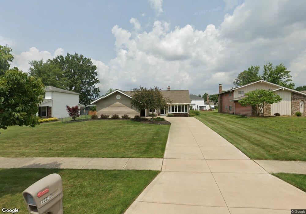
18212 Mallard Cir Strongsville, OH 44136
Estimated Value: $296,705 - $330,000
3
Beds
2
Baths
1,716
Sq Ft
$183/Sq Ft
Est. Value
About This Home
This home is located at 18212 Mallard Cir, Strongsville, OH 44136 and is currently estimated at $313,926, approximately $182 per square foot. 18212 Mallard Cir is a home located in Cuyahoga County with nearby schools including Strongsville High School, Strongsville Academy, and Sts Joseph & John Interparochial School.
Ownership History
Date
Name
Owned For
Owner Type
Purchase Details
Closed on
May 27, 1992
Sold by
Goble Cleopatra
Bought by
Delp Ronald D
Current Estimated Value
Purchase Details
Closed on
Apr 25, 1989
Sold by
Goble George
Bought by
Goble Cleopatra
Purchase Details
Closed on
Apr 18, 1980
Sold by
Saporita Raymond S
Bought by
Goble George
Purchase Details
Closed on
Feb 27, 1979
Sold by
Saporita Stephen S
Bought by
Saporita Raymond S
Purchase Details
Closed on
Dec 3, 1975
Bought by
Saporita Stephen S
Purchase Details
Closed on
Jan 1, 1975
Bought by
Parkview Corp
Create a Home Valuation Report for This Property
The Home Valuation Report is an in-depth analysis detailing your home's value as well as a comparison with similar homes in the area
Home Values in the Area
Average Home Value in this Area
Purchase History
| Date | Buyer | Sale Price | Title Company |
|---|---|---|---|
| Delp Ronald D | $111,000 | -- | |
| Goble Cleopatra | -- | -- | |
| Goble George | $75,000 | -- | |
| Saporita Raymond S | -- | -- | |
| Saporita Stephen S | $47,500 | -- | |
| Parkview Corp | -- | -- |
Source: Public Records
Tax History Compared to Growth
Tax History
| Year | Tax Paid | Tax Assessment Tax Assessment Total Assessment is a certain percentage of the fair market value that is determined by local assessors to be the total taxable value of land and additions on the property. | Land | Improvement |
|---|---|---|---|---|
| 2024 | $4,289 | $91,350 | $22,295 | $69,055 |
| 2023 | $4,387 | $70,070 | $18,830 | $51,240 |
| 2022 | $4,356 | $70,070 | $18,830 | $51,240 |
| 2021 | $4,321 | $70,070 | $18,830 | $51,240 |
| 2020 | $4,004 | $57,440 | $15,440 | $42,000 |
| 2019 | $3,887 | $164,100 | $44,100 | $120,000 |
| 2018 | $3,471 | $57,440 | $15,440 | $42,000 |
| 2017 | $3,479 | $52,440 | $12,430 | $40,010 |
| 2016 | $3,451 | $52,440 | $12,430 | $40,010 |
| 2015 | $3,499 | $52,440 | $12,430 | $40,010 |
| 2014 | $3,499 | $52,440 | $12,430 | $40,010 |
Source: Public Records
Map
Nearby Homes
- 18162 Fawn Cir
- 17069 Partridge Dr
- 18630 Shurmer Rd
- 19311 Bradford Ct
- 19513 Lunn Rd
- 19297 Lauren Way
- 17024 Bear Creek Ln
- 18294 Drake Rd
- 17259 Woodshire Dr
- 17682 Drake Rd
- 16650 Lanier Ave
- 19160 Wheelers Ln
- 17159 Turkey Meadow Ln
- 17934 Cambridge Oval
- 19908 Stoughton Dr
- 19620 Porters Ln Unit 15F
- 15639 Indianhead Ln
- 20393 Wildwood Ln
- 14112 Settlers Way
- 14703 Lenox Dr Unit 103
- 18190 Mallard Cir
- 18256 Mallard Cir
- 18247 Fox Hollow Dr
- 18158 Mallard Cir
- 18203 Fox Hollow Dr
- 18266 Mallard Cir
- 18263 Fox Hollow Dr
- 18171 Fox Hollow Dr
- 18211 Mallard Cir
- 18189 Mallard Cir
- 18255 Mallard Cir
- 18142 Mallard Cir
- 18274 Mallard Cir
- 18147 Fox Hollow Dr
- 18271 Fox Hollow Dr
- 18157 Mallard Cir
- 18265 Mallard Cir
- 18151 Mallard Cir
- 18273 Mallard Cir
- 18279 Fox Hollow Dr