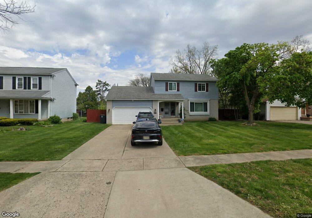
1822 Laurel Oak Dr Flint, MI 48507
Westgate NeighborhoodEstimated Value: $162,000 - $209,831
4
Beds
3
Baths
1,815
Sq Ft
$103/Sq Ft
Est. Value
About This Home
This home is located at 1822 Laurel Oak Dr, Flint, MI 48507 and is currently estimated at $187,708, approximately $103 per square foot. 1822 Laurel Oak Dr is a home located in Genesee County with nearby schools including Neithercut Elementary School, Flint Southwestern Classical Academy, and International Academy of Flint (K-12).
Ownership History
Date
Name
Owned For
Owner Type
Purchase Details
Closed on
Oct 8, 2008
Sold by
Malone Stevan L
Bought by
Malone Darla I
Current Estimated Value
Purchase Details
Closed on
May 2, 2002
Sold by
Malone Darla I and Curenton Darla I
Bought by
Malone Stevan L and Malone Darla I
Home Financials for this Owner
Home Financials are based on the most recent Mortgage that was taken out on this home.
Original Mortgage
$127,800
Interest Rate
10.7%
Create a Home Valuation Report for This Property
The Home Valuation Report is an in-depth analysis detailing your home's value as well as a comparison with similar homes in the area
Home Values in the Area
Average Home Value in this Area
Purchase History
| Date | Buyer | Sale Price | Title Company |
|---|---|---|---|
| Malone Darla I | -- | Cislo Title Company | |
| Malone Stevan L | -- | Guaranty Title Company |
Source: Public Records
Mortgage History
| Date | Status | Borrower | Loan Amount |
|---|---|---|---|
| Previous Owner | Malone Stevan L | $127,800 |
Source: Public Records
Tax History Compared to Growth
Tax History
| Year | Tax Paid | Tax Assessment Tax Assessment Total Assessment is a certain percentage of the fair market value that is determined by local assessors to be the total taxable value of land and additions on the property. | Land | Improvement |
|---|---|---|---|---|
| 2025 | $2,052 | $95,300 | $0 | $0 |
| 2024 | $1,822 | $92,400 | $0 | $0 |
| 2023 | $1,768 | $70,800 | $0 | $0 |
| 2022 | $0 | $61,200 | $0 | $0 |
| 2021 | $1,862 | $53,200 | $0 | $0 |
| 2020 | $1,642 | $41,900 | $0 | $0 |
| 2019 | $1,576 | $40,900 | $0 | $0 |
| 2018 | $1,657 | $35,000 | $0 | $0 |
| 2017 | $1,602 | $0 | $0 | $0 |
| 2016 | $1,590 | $0 | $0 | $0 |
| 2015 | -- | $0 | $0 | $0 |
| 2014 | -- | $0 | $0 | $0 |
| 2012 | -- | $35,200 | $0 | $0 |
Source: Public Records
Map
Nearby Homes
- 1902 Rockcreek Ln
- 1818 Rockcreek Ln
- Lot 57 Walnut Creek Dr
- 1905 Greenbriar Ln
- 4101 Greenbrook Ln
- 1409 Lynton Ave
- 1933 Greenbriar Ln
- 2107 Stoney Brook Ct
- 4107 Park Forest Dr
- 4518 Huckleberry Ln
- 4020 Park Forest Dr
- 1826 Greenbrook Ln
- 1902 Crestbrook Ln
- 1247 Catalina Dr
- 1607 Mulberry Ln
- 1741 Carmanbrook Pkwy
- 1416 Blackberry Ln
- 1329 Huron St
- 1418 Blueberry Ln
- 1318 Ingleside Ave
- 1828 Laurel Oak Dr
- 1816 Laurel Oak Dr
- 1808 Laurel Oak Dr
- 1834 Laurel Oak Dr
- 1812 Laurel Oak Dr
- 1833 Lynbrook Dr
- 1825 Lynbrook Dr
- 1821 Laurel Oak Dr
- 1819 Laurel Oak Dr
- 1817 Laurel Oak Dr
- 1823 Laurel Oak Dr
- 1815 Laurel Oak Dr
- 1837 Lynbrook Dr
- 1813 Laurel Oak Dr
- 1827 Laurel Oak Dr
- 1840 Laurel Oak Dr
- 1829 Laurel Oak Dr
- 1831 Laurel Oak Dr
- 1807 Laurel Oak Dr
- 1817 Lynbrook Dr