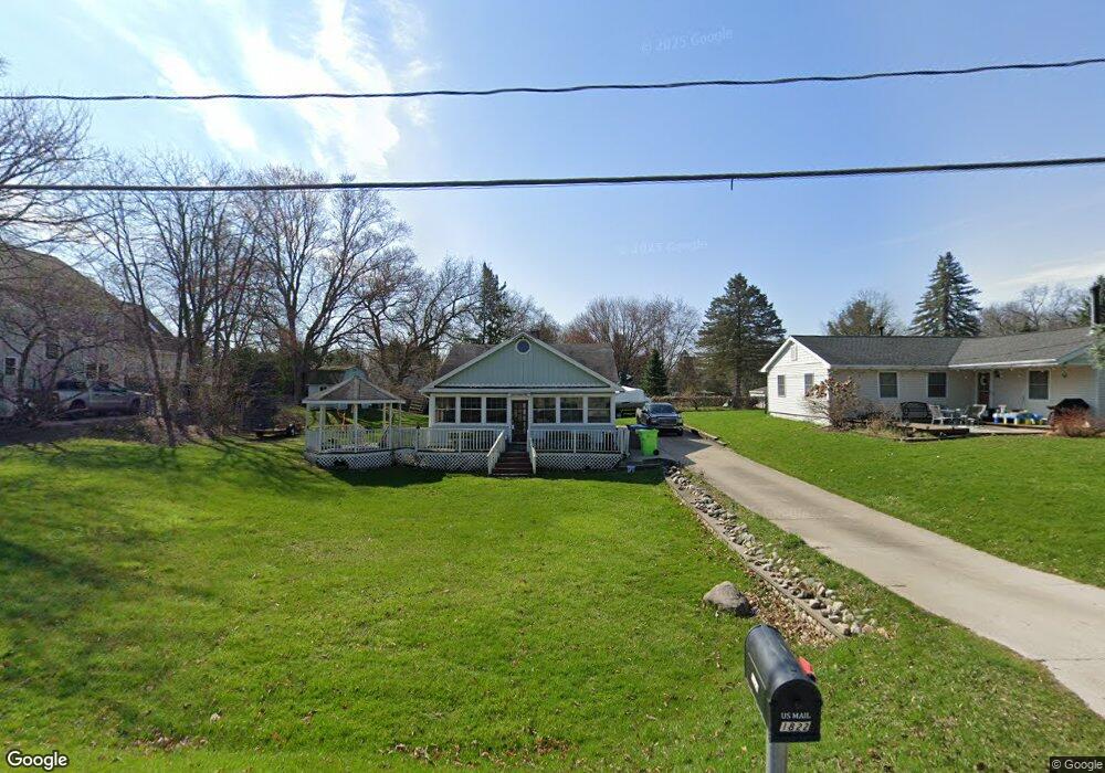
1822 Maxfield Rd Hartland, MI 48353
Estimated Value: $244,000 - $311,000
3
Beds
2
Baths
1,335
Sq Ft
$211/Sq Ft
Est. Value
About This Home
This home is located at 1822 Maxfield Rd, Hartland, MI 48353 and is currently estimated at $282,191, approximately $211 per square foot. 1822 Maxfield Rd is a home located in Livingston County with nearby schools including Hartland High School, Charyl Stockwell Academy, and Our Savior Evangelical Lutheran School.
Ownership History
Date
Name
Owned For
Owner Type
Purchase Details
Closed on
Aug 3, 2022
Sold by
David Gramlich
Bought by
Stefan Krystal and Hyvonen Tierney
Current Estimated Value
Purchase Details
Closed on
Mar 15, 2011
Sold by
Wells Fargo Bank Na
Bought by
Gramlich David and Golden Kevin
Purchase Details
Closed on
Apr 7, 2010
Sold by
Miller Patricia L
Bought by
Wells Fargo Bank Na
Purchase Details
Closed on
Mar 28, 2001
Sold by
Gowan Todd and Cowan Cheryle L
Bought by
Hedman Patricia
Create a Home Valuation Report for This Property
The Home Valuation Report is an in-depth analysis detailing your home's value as well as a comparison with similar homes in the area
Home Values in the Area
Average Home Value in this Area
Purchase History
| Date | Buyer | Sale Price | Title Company |
|---|---|---|---|
| Stefan Krystal | -- | None Listed On Document | |
| Gramlich David | $43,500 | -- | |
| Wells Fargo Bank Na | $99,000 | -- | |
| Hedman Patricia | -- | Metropolitan Title Company |
Source: Public Records
Tax History Compared to Growth
Tax History
| Year | Tax Paid | Tax Assessment Tax Assessment Total Assessment is a certain percentage of the fair market value that is determined by local assessors to be the total taxable value of land and additions on the property. | Land | Improvement |
|---|---|---|---|---|
| 2025 | $2,786 | $109,500 | $0 | $0 |
| 2024 | $1,098 | $103,100 | $0 | $0 |
| 2023 | $1,049 | $83,700 | $0 | $0 |
| 2022 | $2,543 | $66,500 | $0 | $0 |
| 2021 | $2,452 | $77,200 | $0 | $0 |
| 2020 | $2,434 | $76,100 | $0 | $0 |
| 2019 | $2,324 | $66,500 | $0 | $0 |
| 2018 | $2,270 | $56,900 | $0 | $0 |
| 2017 | $2,229 | $56,900 | $0 | $0 |
| 2016 | $2,217 | $56,300 | $0 | $0 |
| 2014 | $2,953 | $47,200 | $0 | $0 |
| 2012 | $2,953 | $54,900 | $0 | $0 |
Source: Public Records
Map
Nearby Homes
- 11639 Island Ct
- 1560 Odette
- 1441 Remsing St Unit 4
- 12002 Renfrew Ct
- 2.03 Acres Highland Rd
- 12071 Highland Rd
- 2581 Pepper Ct
- 1020 Woods Edge Dr
- V/L Highland Rd
- 2255 Clark Rd
- 2933 Bullard Rd
- 1163 Long Lake Dr
- 1412 North Ct
- 000 Highland Rd
- V/L Parcels C & D Old Us-23 Hwy
- V/L Parcel D Old Us-23 Hwy
- V/L Parcel C Old Us-23 Hwy
- 10456 Viewtop Ct
- 10484 Northvalley Ct Unit 14
- Chase Plan at Hunters Ridge - Landings 5
- 1834 Maxfield Rd
- 1834 Maxfield Lake Rd
- 1812 Maxfield Rd
- 1840 Maxfield Rd
- 1770 Maxfield Rd
- 1781 Doris Jean St
- 1833 Maxfield Rd
- 1821 Maxfield Rd
- 1811 Maxfield Rd
- 1855 Maxfield Rd
- 1860 Maxfield Rd
- 1769 Doris Jean St
- 11693 Timberlane Trail
- 1861 Maxfield Rd
- 11835 Clair St
- 1760 Maxfield Rd
- 11843 Clair St
- 1873 Maxfield Rd
- 1757 Doris Jean St
- 11677 Timberlane Trail