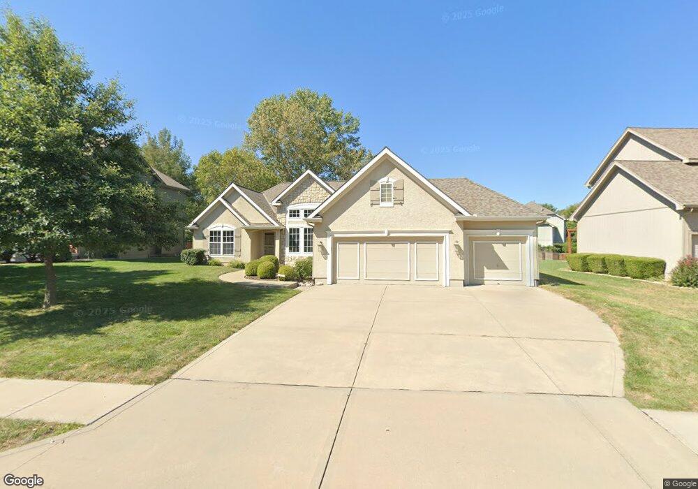
1822 Parkside Dr Liberty, MO 64068
Estimated Value: $401,756 - $438,000
3
Beds
2
Baths
1,836
Sq Ft
$231/Sq Ft
Est. Value
About This Home
This home is located at 1822 Parkside Dr, Liberty, MO 64068 and is currently estimated at $424,189, approximately $231 per square foot. 1822 Parkside Dr is a home located in Clay County with nearby schools including Alexander Doniphan Elementary School, Liberty Middle School, and Liberty High School.
Ownership History
Date
Name
Owned For
Owner Type
Purchase Details
Closed on
Nov 7, 2019
Sold by
Shepard Dorothy E
Bought by
Shepard Stanley K
Current Estimated Value
Purchase Details
Closed on
May 3, 2004
Sold by
K & D Builders Inc
Bought by
Shepard Stanley K
Home Financials for this Owner
Home Financials are based on the most recent Mortgage that was taken out on this home.
Original Mortgage
$130,000
Interest Rate
5.38%
Mortgage Type
Balloon
Purchase Details
Closed on
Jun 19, 2003
Sold by
South Liberty Development Llc
Bought by
K & D Builders Inc
Create a Home Valuation Report for This Property
The Home Valuation Report is an in-depth analysis detailing your home's value as well as a comparison with similar homes in the area
Home Values in the Area
Average Home Value in this Area
Purchase History
| Date | Buyer | Sale Price | Title Company |
|---|---|---|---|
| Shepard Stanley K | -- | None Available | |
| Shepard Stanley K | -- | -- | |
| K & D Builders Inc | -- | United Title Company Inc |
Source: Public Records
Mortgage History
| Date | Status | Borrower | Loan Amount |
|---|---|---|---|
| Closed | Shepard Stanley K | $130,000 |
Source: Public Records
Tax History Compared to Growth
Tax History
| Year | Tax Paid | Tax Assessment Tax Assessment Total Assessment is a certain percentage of the fair market value that is determined by local assessors to be the total taxable value of land and additions on the property. | Land | Improvement |
|---|---|---|---|---|
| 2025 | $4,488 | $65,760 | -- | -- |
| 2024 | $4,488 | $58,350 | -- | -- |
| 2023 | $4,564 | $58,350 | $0 | $0 |
| 2022 | $3,972 | $50,140 | $0 | $0 |
| 2021 | $3,941 | $50,141 | $7,980 | $42,161 |
| 2020 | $3,865 | $46,170 | $0 | $0 |
| 2019 | $3,864 | $46,170 | $0 | $0 |
| 2018 | $3,720 | $43,640 | $0 | $0 |
| 2017 | $3,557 | $43,640 | $6,650 | $36,990 |
| 2016 | $3,557 | $42,120 | $6,650 | $35,470 |
| 2015 | $3,557 | $42,120 | $6,650 | $35,470 |
| 2014 | $3,503 | $41,150 | $7,220 | $33,930 |
Source: Public Records
Map
Nearby Homes
- 1836 Green Meadow Dr
- 1824 Arbor Trail
- 1845 Arbor Trail
- 1916 Longview Dr
- 1985 Longview Dr
- 1989 Longview Dr
- 1912 Longview Dr
- 1841 Vintage Ln
- 1852 Vintage Ln
- 2188 Heritage Ct
- 1920 Longview Dr
- 1709 Homestead Dr
- 1979 Harvest Rd
- 1983 Harvest Rd
- 1975 Harvest Rd
- 1971 Harvest Rd
- Redbud Plan at Homestead of Liberty - Homestead
- Spruce Plan at Homestead of Liberty - Homestead
- Cypress Plan at Homestead of Liberty - Homestead
- Monroe Plan at Homestead of Liberty - Homestead
- 1826 Parkside Dr
- 1818 Parkside Dr
- 1547 Carriage Cir
- 1830 Parkside Dr
- 1814 Parkside Dr
- 1551 Carriage Cir
- 1834 Parkside Dr
- 1810 Parkside Dr
- 1546 Carriage Cir
- 1555 Carriage Cir
- 1829 Parkside Dr
- 1833 Parkside Dr
- 1817 Parkside Dr
- 1838 Parkside Dr
- 1806 Parkside Dr
- 1550 Carriage Cir
- 1837 Parkside Dr
- 1559 Carriage Cir
- 1813 Parkside Dr
- 1554 Carriage Cir