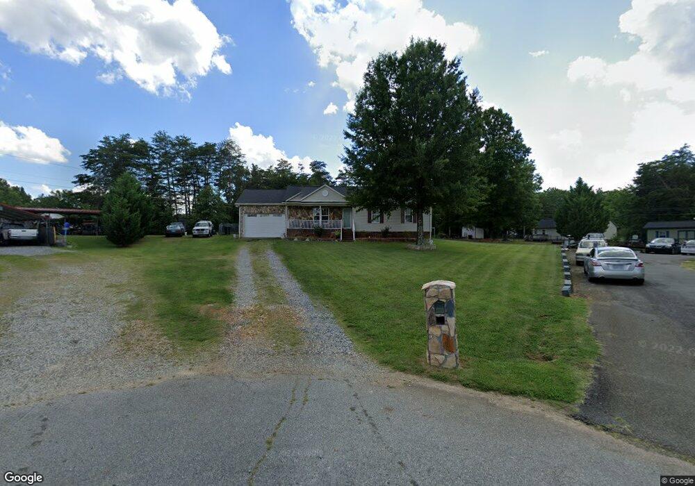
1822 S Cosby Ct Burlington, NC 27217
North Burlington NeighborhoodEstimated Value: $208,000 - $306,000
3
Beds
2
Baths
1,120
Sq Ft
$224/Sq Ft
Est. Value
About This Home
This home is located at 1822 S Cosby Ct, Burlington, NC 27217 and is currently estimated at $251,137, approximately $224 per square foot. 1822 S Cosby Ct is a home located in Alamance County with nearby schools including Pleasant Grove Elementary School, Western Alamance Middle School, and Western Alamance High School.
Ownership History
Date
Name
Owned For
Owner Type
Purchase Details
Closed on
Jul 23, 2002
Sold by
Herron Const Inc
Bought by
Mcghee Sylvester
Current Estimated Value
Home Financials for this Owner
Home Financials are based on the most recent Mortgage that was taken out on this home.
Original Mortgage
$113,200
Outstanding Balance
$47,852
Interest Rate
6.67%
Estimated Equity
$203,285
Create a Home Valuation Report for This Property
The Home Valuation Report is an in-depth analysis detailing your home's value as well as a comparison with similar homes in the area
Home Values in the Area
Average Home Value in this Area
Purchase History
| Date | Buyer | Sale Price | Title Company |
|---|---|---|---|
| Mcghee Sylvester | $115,000 | -- |
Source: Public Records
Mortgage History
| Date | Status | Borrower | Loan Amount |
|---|---|---|---|
| Open | Mcghee Sylvester | $113,200 |
Source: Public Records
Tax History Compared to Growth
Tax History
| Year | Tax Paid | Tax Assessment Tax Assessment Total Assessment is a certain percentage of the fair market value that is determined by local assessors to be the total taxable value of land and additions on the property. | Land | Improvement |
|---|---|---|---|---|
| 2025 | $1,140 | $230,744 | $22,800 | $207,944 |
| 2024 | $1,082 | $230,744 | $22,800 | $207,944 |
| 2023 | $2,102 | $230,744 | $22,800 | $207,944 |
| 2022 | $1,334 | $107,486 | $15,000 | $92,486 |
| 2021 | $1,345 | $107,486 | $15,000 | $92,486 |
| 2020 | $1,355 | $107,486 | $15,000 | $92,486 |
| 2019 | $1,359 | $107,486 | $15,000 | $92,486 |
| 2018 | $639 | $107,486 | $15,000 | $92,486 |
| 2017 | $620 | $107,486 | $15,000 | $92,486 |
| 2016 | $1,343 | $115,760 | $20,000 | $95,760 |
| 2015 | $668 | $115,760 | $20,000 | $95,760 |
| 2014 | -- | $115,760 | $20,000 | $95,760 |
Source: Public Records
Map
Nearby Homes
- 129 Carriage Loop
- 1852 N Carolina 62
- 1812 N Nc Highway 62
- 109 W Old Glencoe Rd
- 123 W Old Glencoe Rd
- 129 W Old Glencoe Rd
- 2022 N Carolina 62
- 2032 N Carolina 62
- 137 W Old Glencoe Rd
- Irvine Plan at Brassfield Meadows
- Greensboro Plan at Brassfield Meadows
- Dayton Plan at Brassfield Meadows
- Southport Plan at Brassfield Meadows
- Vermont Plan at Brassfield Meadows
- Burlington Plan at Brassfield Meadows
- 00 Lower Hopedale Rd
- 261 Plains Dr
- 261 Plains Dr Unit Lot 263
- 258 Plains Dr
- 258 Plains Dr Unit Lot 315
- 1828 S Cosby Ct
- 1821 S Cosby Ct
- 114 Carriage Loop
- 110 Carriage Loop
- 1811 Margaret Ln
- 1832 S Cosby Ct
- 1815 Margaret Ln
- 1827 N Cosby Ct
- 120 Carriage Loop
- 304 Carriage Loop
- 140 Carriage Loop
- 306 Carriage Loop
- 302 Carriage Loop
- 1034 Carriage Loop
- 936 Carriage Loop
- 310 Carriage Loop
- Lot 49 Carriage Loop
- 49 Carriage Loop
- 00 Carriage Loop Unit 57
- 0 Carriage Loop