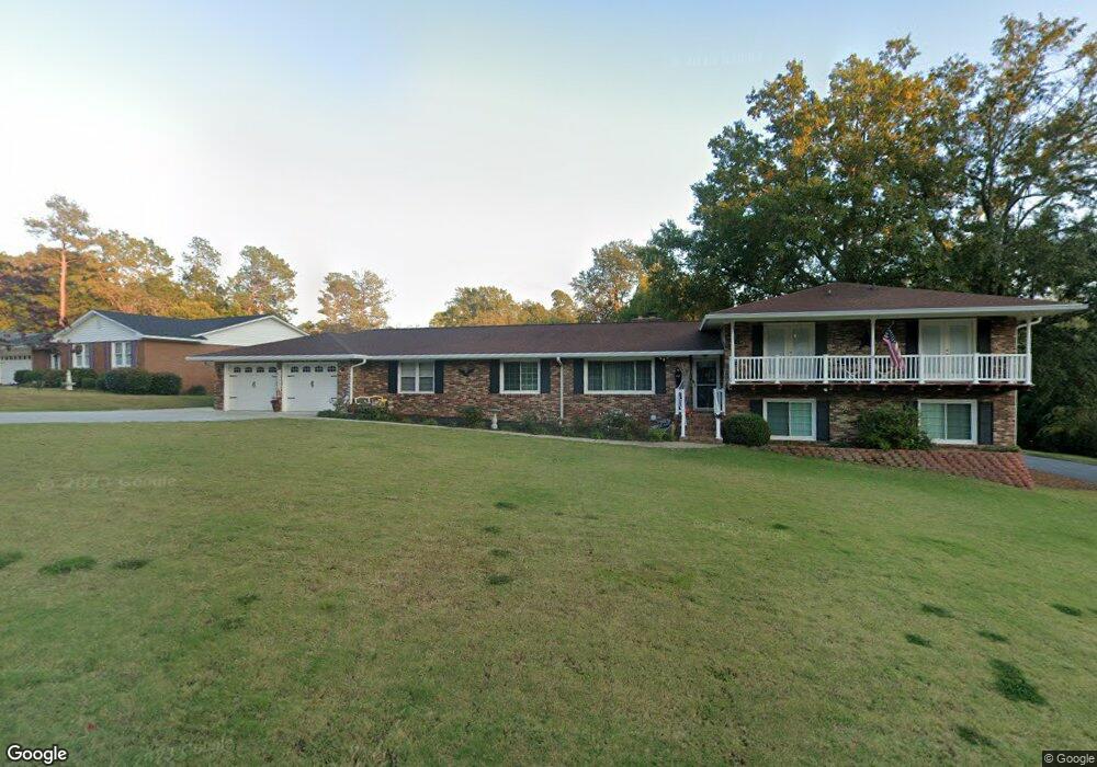
1823 Bolin Rd North Augusta, GA 29841
Estimated Value: $322,000 - $437,323
4
Beds
3
Baths
2,838
Sq Ft
$134/Sq Ft
Est. Value
About This Home
This home is located at 1823 Bolin Rd, North Augusta, GA 29841 and is currently estimated at $379,081, approximately $133 per square foot. 1823 Bolin Rd is a home located in Aiken County with nearby schools including Hammond Hill Elementary School, Paul Knox Middle School, and North Augusta High School.
Ownership History
Date
Name
Owned For
Owner Type
Purchase Details
Closed on
Mar 26, 2019
Sold by
Nichols Michael T
Bought by
Nichols Michael T and Nichols Laura M
Current Estimated Value
Purchase Details
Closed on
Feb 24, 2005
Sold by
United Guaranty Residential Ins Co Of Nc
Bought by
Nichols Michael T and Nichols Laura M
Home Financials for this Owner
Home Financials are based on the most recent Mortgage that was taken out on this home.
Original Mortgage
$27,600
Outstanding Balance
$20,473
Interest Rate
5.6%
Mortgage Type
Credit Line Revolving
Estimated Equity
$358,608
Purchase Details
Closed on
Oct 11, 2004
Sold by
Turner Lanny and Bank Of America Na
Bought by
United Guaranty Residential Ins Co Of Nc
Create a Home Valuation Report for This Property
The Home Valuation Report is an in-depth analysis detailing your home's value as well as a comparison with similar homes in the area
Home Values in the Area
Average Home Value in this Area
Purchase History
| Date | Buyer | Sale Price | Title Company |
|---|---|---|---|
| Nichols Michael T | -- | None Available | |
| Nichols Michael T | $138,000 | -- | |
| United Guaranty Residential Ins Co Of Nc | $75,001 | -- |
Source: Public Records
Mortgage History
| Date | Status | Borrower | Loan Amount |
|---|---|---|---|
| Open | Nichols Michael T | $27,600 | |
| Open | Nichols Michael T | $110,400 |
Source: Public Records
Tax History Compared to Growth
Tax History
| Year | Tax Paid | Tax Assessment Tax Assessment Total Assessment is a certain percentage of the fair market value that is determined by local assessors to be the total taxable value of land and additions on the property. | Land | Improvement |
|---|---|---|---|---|
| 2023 | $1,098 | $10,940 | $1,582 | $248,480 |
| 2022 | $1,069 | $10,940 | $0 | $0 |
| 2021 | $1,071 | $10,940 | $0 | $0 |
| 2020 | $3,375 | $14,270 | $0 | $0 |
| 2019 | $944 | $9,520 | $0 | $0 |
| 2018 | $946 | $9,520 | $1,050 | $8,470 |
| 2017 | $795 | $0 | $0 | $0 |
| 2016 | $796 | $0 | $0 | $0 |
| 2015 | $723 | $0 | $0 | $0 |
| 2014 | $724 | $0 | $0 | $0 |
| 2013 | -- | $0 | $0 | $0 |
Source: Public Records
Map
Nearby Homes
- 1833 Pisgah Rd
- 1926 Robin Rd
- 1425 Brookgreen Dr
- 793 Big Pine Rd
- 5093 Anna Creek Way
- 4011 Jane Ln Unit 11B
- 1575 Plan at Forrest Bluff
- Parkwood Plan at Forrest Bluff
- 1888 Plan at Forrest Bluff
- 1313 Plan at Forrest Bluff
- 1580 Plan at Forrest Bluff
- Athens 3-Bedroom Plan at Forrest Bluff
- 2078 Plan at Forrest Bluff
- 1807 Plan at Forrest Bluff
- 1486 Plan at Forrest Bluff
- 1772 Plan at Forrest Bluff
- Dublin II Plan at Forrest Bluff
- Dublin Plan at Forrest Bluff
- 1570 Plan at Forrest Bluff
- 1714 Plan at Forrest Bluff
- 1827 Bolin Rd
- 1828 Bolin Rd
- 1825 Bolin Rd
- 1829 Bolin Rd
- 1824 Bolin Rd
- 1830 Bolin Rd
- 1823 Bolin Rd
- 1831 Bolin Rd
- 1826 Robinson Dr
- 1806 Mountside Dr
- 1822 Bolin Rd
- 1832 Bolin Rd
- 1818 Robinson Dr
- 1808 Mountside Dr
- 1833 Bolin Rd
- 1828 Robinson Dr
- 0 Bolin Rd
- 1815 Courtney Dr
- 1820 Robinson Dr
- 1813 Courtney Dr