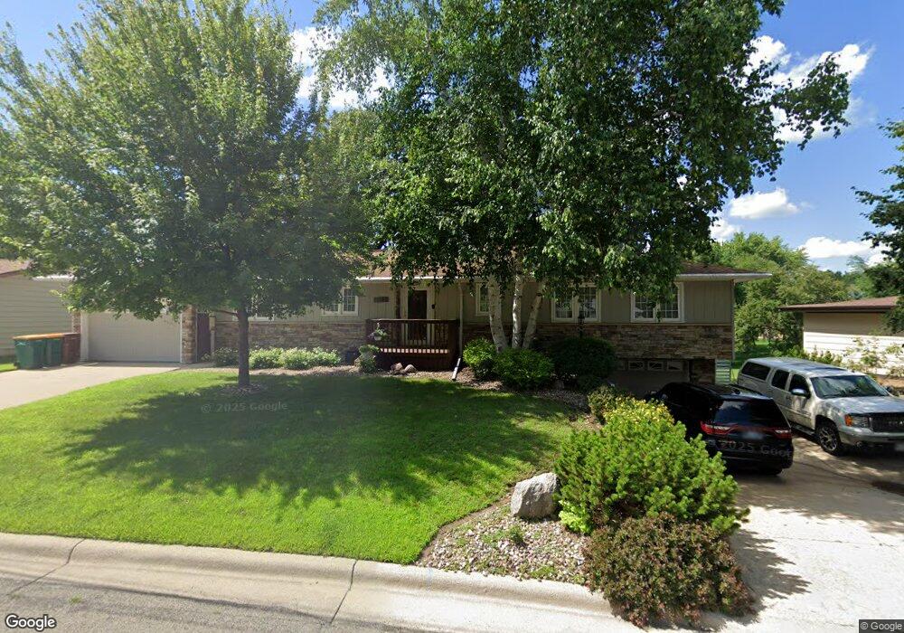
1823 Brookside Cir Albert Lea, MN 56007
Estimated Value: $316,000 - $395,000
4
Beds
3
Baths
3,267
Sq Ft
$108/Sq Ft
Est. Value
About This Home
This home is located at 1823 Brookside Cir, Albert Lea, MN 56007 and is currently estimated at $352,453, approximately $107 per square foot. 1823 Brookside Cir is a home located in Freeborn County with nearby schools including Lakeview Elementary School, Southwest Middle School, and Albert Lea Senior High School.
Ownership History
Date
Name
Owned For
Owner Type
Purchase Details
Closed on
May 28, 2015
Bought by
Lehocky Matthew Matthew
Current Estimated Value
Home Financials for this Owner
Home Financials are based on the most recent Mortgage that was taken out on this home.
Original Mortgage
$209,700
Outstanding Balance
$163,111
Interest Rate
3.87%
Estimated Equity
$189,342
Purchase Details
Closed on
Oct 27, 2011
Sold by
Seedorf Gary W and Seedord Sharon K
Bought by
Seedorf Sharon K and Seedorf Gary W
Create a Home Valuation Report for This Property
The Home Valuation Report is an in-depth analysis detailing your home's value as well as a comparison with similar homes in the area
Home Values in the Area
Average Home Value in this Area
Purchase History
| Date | Buyer | Sale Price | Title Company |
|---|---|---|---|
| Lehocky Matthew Matthew | $210,000 | -- | |
| Seedorf Sharon K | -- | -- |
Source: Public Records
Mortgage History
| Date | Status | Borrower | Loan Amount |
|---|---|---|---|
| Open | Lehocky Matthew Matthew | $209,700 |
Source: Public Records
Tax History
| Year | Tax Paid | Tax Assessment Tax Assessment Total Assessment is a certain percentage of the fair market value that is determined by local assessors to be the total taxable value of land and additions on the property. | Land | Improvement |
|---|---|---|---|---|
| 2025 | $6,462 | $348,100 | $54,400 | $293,700 |
| 2024 | $6,320 | $322,400 | $54,400 | $268,000 |
| 2023 | $5,816 | $325,200 | $54,400 | $270,800 |
| 2022 | $5,662 | $290,900 | $43,500 | $247,400 |
| 2021 | $5,574 | $243,800 | $43,500 | $200,300 |
| 2020 | $5,284 | $223,700 | $43,500 | $180,200 |
| 2019 | $4,928 | $208,000 | $43,500 | $164,500 |
| 2018 | $4,462 | $0 | $0 | $0 |
| 2016 | $3,566 | $0 | $0 | $0 |
| 2015 | $2,540 | $0 | $0 | $0 |
| 2014 | $2,588 | $0 | $0 | $0 |
| 2012 | $2,862 | $0 | $0 | $0 |
Source: Public Records
Map
Nearby Homes
- 1902 Brookside Dr
- 1807 Brookside Dr
- 1814 Brookside Cir
- 1808 Lakewood Ave
- 319 Garden Rd
- 311 Meredith Rd
- 404 Garden Rd
- 406 Robin Rd
- 314 Garden Rd
- 103 W Richway Dr
- 307 Channel Rd
- 307 E Richway Dr
- 210 Lee Place
- 1612 Hale Dr
- 1609 Country Club Rd
- 1609 Keystone Dr
- 1626 Keystone Dr
- 705 Glenview Dr
- 2141 Harmony Ave
- 2021 Bridge Ave
- 1821 Brookside Cir
- 1825 Brookside Cir
- 1824 Brookside Cir
- 1905 Brookside Dr
- 1819 Brookside Cir
- 1820 Brookside Cir
- 1815 Brookside Dr
- 1909 Brookside Dr
- 1818 Brookside Cir
- 1817 Brookside Cir
- 1906 Brookside Dr
- 1822 Brookside Dr
- 1811 Brookside Dr
- 1910 Brookside Dr
- 1913 Brookside Dr
- 1816 Brookside Cir
- 1818 Brookside Dr
- 1815 Brookside Cir
- 1905 Brookside Cir
- 1914 Brookside Dr
Your Personal Tour Guide
Ask me questions while you tour the home.