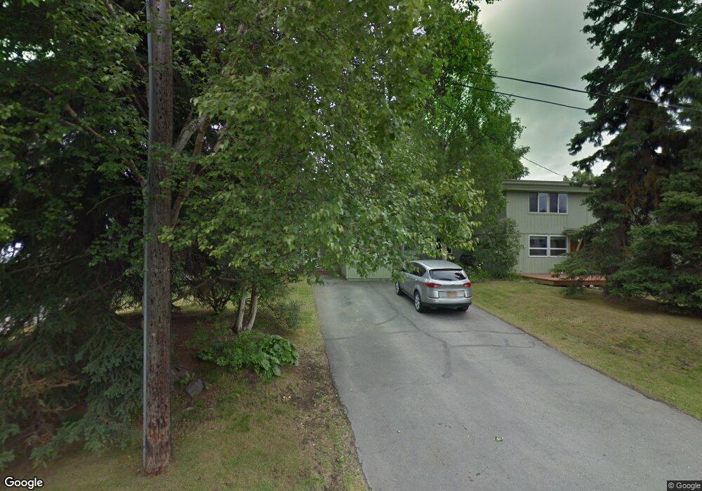
1823 Bunker St Unit 19 Anchorage, AK 99503
North Star NeighborhoodEstimated Value: $234,000 - $251,580
3
Beds
2
Baths
1,226
Sq Ft
$198/Sq Ft
Est. Value
About This Home
This home is located at 1823 Bunker St Unit 19, Anchorage, AK 99503 and is currently estimated at $242,790, approximately $198 per square foot. 1823 Bunker St Unit 19 is a home located in Anchorage Municipality with nearby schools including North Star Elementary School, Romig Middle School, and West High School.
Ownership History
Date
Name
Owned For
Owner Type
Purchase Details
Closed on
Jun 11, 2010
Sold by
Benson Carl M and Benson Carole E
Bought by
Benson Carl Michael and Benson Carole Frances
Current Estimated Value
Purchase Details
Closed on
Aug 6, 2008
Sold by
Benson C M and Benson Carole F
Bought by
Benson C M and Benson Carole F
Purchase Details
Closed on
Jan 10, 2007
Sold by
Adrian Michael and Adrian Heather
Bought by
Benson Carl M and Benson Carole F
Purchase Details
Closed on
Jul 21, 2003
Sold by
Richards Sharon O
Bought by
Adrian Michael and Adrian Heather
Home Financials for this Owner
Home Financials are based on the most recent Mortgage that was taken out on this home.
Original Mortgage
$133,917
Interest Rate
5.15%
Mortgage Type
FHA
Purchase Details
Closed on
Dec 17, 1992
Sold by
Ruskin Evelyn G
Bought by
Richards Sharon O
Home Financials for this Owner
Home Financials are based on the most recent Mortgage that was taken out on this home.
Original Mortgage
$47,700
Interest Rate
8.28%
Mortgage Type
New Conventional
Create a Home Valuation Report for This Property
The Home Valuation Report is an in-depth analysis detailing your home's value as well as a comparison with similar homes in the area
Home Values in the Area
Average Home Value in this Area
Purchase History
| Date | Buyer | Sale Price | Title Company |
|---|---|---|---|
| Benson Carl Michael | -- | None Available | |
| Benson C M | -- | None Available | |
| Benson Carl M | -- | None Available | |
| Adrian Michael | -- | -- | |
| Richards Sharon O | -- | -- |
Source: Public Records
Mortgage History
| Date | Status | Borrower | Loan Amount |
|---|---|---|---|
| Previous Owner | Adrian Michael | $133,917 | |
| Previous Owner | Richards Sharon O | $47,700 |
Source: Public Records
Tax History
| Year | Tax Paid | Tax Assessment Tax Assessment Total Assessment is a certain percentage of the fair market value that is determined by local assessors to be the total taxable value of land and additions on the property. | Land | Improvement |
|---|---|---|---|---|
| 2025 | $216 | $230,000 | -- | $230,000 |
| 2024 | $216 | $238,400 | $0 | $238,400 |
| 2023 | $3,936 | $231,100 | $0 | $231,100 |
| 2022 | $406 | $217,600 | $0 | $217,600 |
| 2021 | $3,736 | $207,300 | $0 | $207,300 |
| 2020 | $27 | $190,900 | $0 | $190,900 |
| 2019 | $0 | $187,300 | $0 | $187,300 |
| 2018 | -- | $154,600 | $0 | $154,600 |
| 2017 | -- | $156,300 | $0 | $156,300 |
| 2016 | -- | $170,100 | $0 | $170,100 |
| 2015 | $351 | $176,400 | $0 | $176,400 |
| 2014 | $351 | $193,100 | $0 | $193,100 |
Source: Public Records
Map
Nearby Homes
- 827 W 20th Ave
- 800 W 21st Ave
- 1024 Potlatch Cir Unit 23
- 511 W 17th Ave
- 1434 I St
- 816 W 23rd Ave Unit 6
- 1945 Spenard Rd
- 2140 Dawson St
- 913 W 14th Ave
- 1001 W Fireweed Ln
- 1310 G St
- 1113 W Fireweed Ln Unit 505
- 1113 W Fireweed Ln Unit 204
- 1113 W Fireweed Ln Unit 503
- 1200 I St Unit 503
- 2201 Romig Place Unit 105
- 957 W 12th Ave Unit 1
- 1327 W 25th Ave Unit 218
- 1110 F St
- 2607 Arctic Blvd
- 1805 Bunker St Unit 24
- 1807 Bunker St Unit 23
- 1813 Bunker St Unit 22
- 1815 Bunker St Unit 21
- 1821 Bunker St Unit 20
- 1829 Bunker St Unit 18
- 1831 Bunker St Unit 17
- 1806 Arctic Blvd Unit 4
- 1804 Arctic Blvd Unit 3
- 1802 Arctic Blvd Unit 2
- 1800 Arctic Blvd Unit 1
- 1800 Arctic Blvd
- 833 W 19th Ave Unit 16
- 831 W 19th Ave Unit 15
- 1832 Bunker St Unit 2
- 1832 Bunker St
- 1830 Bunker St Unit 1
- 825 W 19th Ave Unit 14
- 1818 Arctic Blvd Unit 10
- 1816 Arctic Blvd Unit 9
Your Personal Tour Guide
Ask me questions while you tour the home.