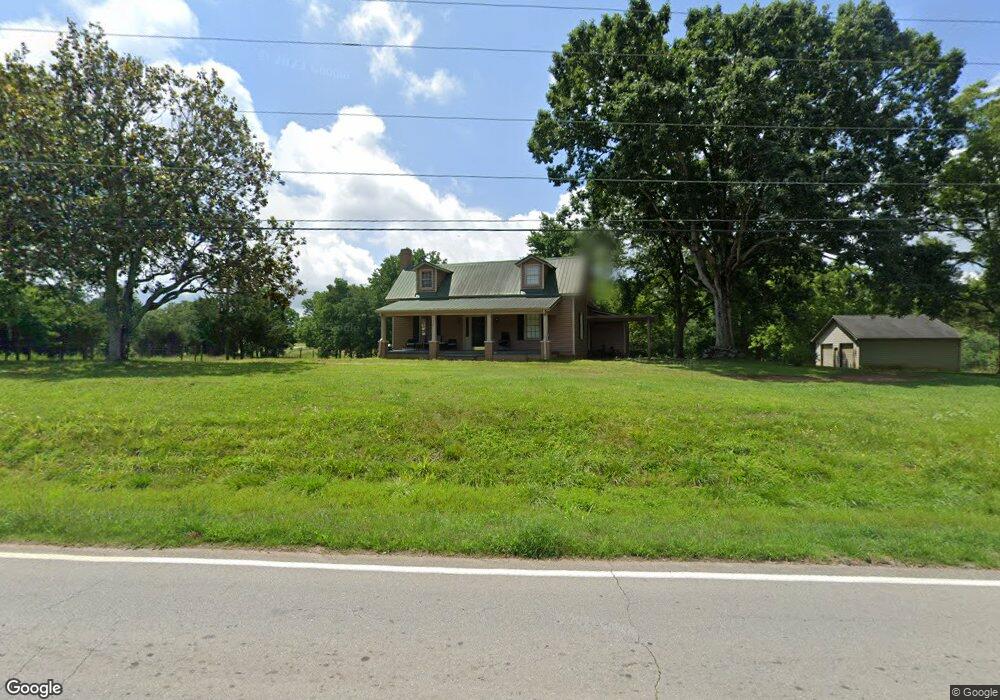
1823 Highway 82 Statham, GA 30666
Estimated Value: $342,559 - $375,000
2
Beds
1
Bath
2,246
Sq Ft
$160/Sq Ft
Est. Value
About This Home
This home is located at 1823 Highway 82, Statham, GA 30666 and is currently estimated at $359,890, approximately $160 per square foot. 1823 Highway 82 is a home located in Barrow County with nearby schools including Statham Elementary School, Bear Creek Middle School, and Winder-Barrow High School.
Ownership History
Date
Name
Owned For
Owner Type
Purchase Details
Closed on
Oct 15, 2024
Sold by
Covarrubias Atanacio
Bought by
Covarrubias Beatriz Adriana Trust and Covarrubias Beatriz A Tr
Current Estimated Value
Purchase Details
Closed on
Feb 22, 2007
Sold by
Covarrubias Santiago And
Bought by
Covarrubias Santiago And
Purchase Details
Closed on
Dec 12, 1996
Sold by
Harwell Helen J
Bought by
Gay Doy O
Purchase Details
Closed on
Nov 22, 1996
Sold by
Jackson Eddie C
Bought by
Harwell Helen J
Purchase Details
Closed on
Aug 2, 1980
Bought by
Jackson Eddie C
Create a Home Valuation Report for This Property
The Home Valuation Report is an in-depth analysis detailing your home's value as well as a comparison with similar homes in the area
Home Values in the Area
Average Home Value in this Area
Purchase History
| Date | Buyer | Sale Price | Title Company |
|---|---|---|---|
| Covarrubias Beatriz Adriana Trust | -- | -- | |
| Covarrubias Santiago And | -- | -- | |
| Gay Doy O | $176,000 | -- | |
| Harwell Helen J | -- | -- | |
| Jackson Eddie C | $50,000 | -- |
Source: Public Records
Mortgage History
| Date | Status | Borrower | Loan Amount |
|---|---|---|---|
| Closed | Gay Doy O | $0 |
Source: Public Records
Tax History Compared to Growth
Tax History
| Year | Tax Paid | Tax Assessment Tax Assessment Total Assessment is a certain percentage of the fair market value that is determined by local assessors to be the total taxable value of land and additions on the property. | Land | Improvement |
|---|---|---|---|---|
| 2024 | $2,212 | $89,416 | $16,000 | $73,416 |
| 2023 | $2,200 | $89,416 | $16,000 | $73,416 |
| 2022 | $1,830 | $63,689 | $16,000 | $47,689 |
| 2021 | $1,699 | $55,850 | $12,000 | $43,850 |
| 2020 | $1,576 | $51,564 | $11,552 | $40,012 |
| 2019 | $1,604 | $51,564 | $11,552 | $40,012 |
| 2018 | $1,585 | $51,590 | $11,552 | $40,038 |
| 2017 | $1,305 | $44,820 | $11,552 | $33,268 |
| 2016 | $1,371 | $44,870 | $11,552 | $33,318 |
| 2015 | $1,379 | $44,902 | $11,552 | $33,350 |
| 2014 | $1,243 | $39,060 | $5,660 | $33,400 |
| 2013 | -- | $36,906 | $5,660 | $31,246 |
Source: Public Records
Map
Nearby Homes
- 1916 Hearthstone Ct
- 1914 Hearthstone Ct
- 1917 Hearthstone Ct
- 310 Jacobs Ln
- 1642 White Oak Dr
- 0 Georgia 330
- 1423 Red Oak Way
- 2075 Georgia Highway 211
- 2075 Highway 211 NE
- 1415 Red Oak Way
- 1593 Highway 82
- 315 Paige Way
- 2141 Kirkland Dr
- 29 Nunnally Rd SE
- 162 Ashton Ln
- 3036 Johnson-Hale Rd
- 133 2nd St
- 532 Hemlock Dr
- The Baxley Plan at Statham Place
- The Landon II Plan at Statham Place
- 0 Hwy 211 and 82 Unit 7226020
- 0 Hwy 211 and 82 Unit 2522139
- 0 Hwy 211ne
- 000 Highway 211 NE
- 0 Highway 82
- 1804 Georgia 82
- 1804 Highway 82
- 1850 Highway 211 NE
- 1886 Highway 211 NE
- 1839 Highway 82
- 1839 Georgia 82
- 1851 Highway 211 NE
- 1838 Georgia 82
- 1907 Highway 211 NE
- 1846 Georgia 82
- 1908 Highway 211 NE
- 1846 Highway 82
- 1849 Highway 82
- 1849 Highway 211 NE
- 1915 Highway 211 NE