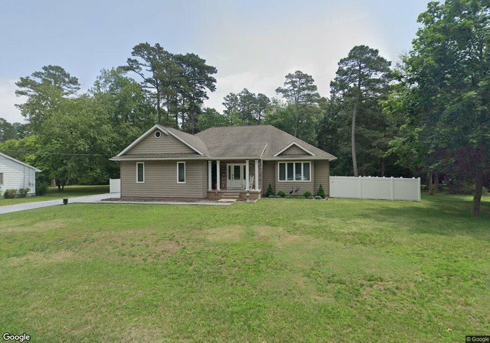
1823 Hubbard Ln Vineland, NJ 08360
Estimated Value: $311,138 - $442,000
--
Bed
--
Bath
2,071
Sq Ft
$178/Sq Ft
Est. Value
About This Home
This home is located at 1823 Hubbard Ln, Vineland, NJ 08360 and is currently estimated at $369,285, approximately $178 per square foot. 1823 Hubbard Ln is a home located in Cumberland County with nearby schools including Marie D. Durand Elementary School, T.W. Wallace Middle School, and Vineland Senior High School.
Ownership History
Date
Name
Owned For
Owner Type
Purchase Details
Closed on
Nov 16, 2018
Sold by
Ramirez Arturo and Ramirez Amy
Bought by
Ramirez Amy
Current Estimated Value
Home Financials for this Owner
Home Financials are based on the most recent Mortgage that was taken out on this home.
Original Mortgage
$193,960
Interest Rate
4.3%
Mortgage Type
New Conventional
Purchase Details
Closed on
Apr 19, 2008
Sold by
Tomasso Stephen Alfred and Tomasso Gay C
Bought by
Ramirez Arturo and Ramirez Amy
Purchase Details
Closed on
Oct 25, 2000
Sold by
Estate Of Elsie Marion Mole
Bought by
Tomasso Stephen Alfred and Tomasso Gay C
Create a Home Valuation Report for This Property
The Home Valuation Report is an in-depth analysis detailing your home's value as well as a comparison with similar homes in the area
Home Values in the Area
Average Home Value in this Area
Purchase History
| Date | Buyer | Sale Price | Title Company |
|---|---|---|---|
| Ramirez Amy | -- | -- | |
| Ramirez Arturo | -- | -- | |
| Tomasso Stephen Alfred | $17,500 | -- | |
| Tomasso Stephen Alfred | $17,500 | -- |
Source: Public Records
Mortgage History
| Date | Status | Borrower | Loan Amount |
|---|---|---|---|
| Previous Owner | Ramirez Amy | $193,960 |
Source: Public Records
Tax History Compared to Growth
Tax History
| Year | Tax Paid | Tax Assessment Tax Assessment Total Assessment is a certain percentage of the fair market value that is determined by local assessors to be the total taxable value of land and additions on the property. | Land | Improvement |
|---|---|---|---|---|
| 2025 | $6,686 | $210,000 | $31,100 | $178,900 |
| 2024 | $6,686 | $210,000 | $31,100 | $178,900 |
| 2023 | $6,642 | $210,000 | $31,100 | $178,900 |
| 2022 | $6,445 | $210,000 | $31,100 | $178,900 |
| 2021 | $6,320 | $210,000 | $31,100 | $178,900 |
| 2020 | $6,691 | $228,600 | $31,100 | $197,500 |
| 2019 | $6,600 | $228,600 | $31,100 | $197,500 |
| 2018 | $6,426 | $228,600 | $31,100 | $197,500 |
| 2017 | $6,104 | $228,600 | $31,100 | $197,500 |
| 2016 | $5,889 | $228,600 | $31,100 | $197,500 |
| 2015 | $5,672 | $228,600 | $31,100 | $197,500 |
| 2014 | $5,363 | $228,600 | $31,100 | $197,500 |
Source: Public Records
Map
Nearby Homes
- 1811 N Delsea Dr Unit 4
- 1489 N Delsea Dr
- 1887 N Delsea Dr Unit 135 HOLLY HOCK DR.
- 1887 N Delsea Dr Unit 19
- 1887 N Delsea Dr Unit 39
- 829 W Garden Rd
- 811 W Garden Rd
- 663 Wayne Ave
- 2246 N West Ave
- 1050 W Oak Rd
- 1032 W Oak Rd
- 1020 W Oak Rd
- 1632 W Garden Rd
- 1252 W Oak Rd
- 1469 N Mill Rd
- 1392 W Oak Rd
- 1111 N Orchard Rd
- 1378 Venus Dr
- 0 Firerize Ave Unit NJCB2020972
- 659 W Forest Grove Rd
- 1843 Hubbard Ln
- 1795 Hubbard Ln
- 1863 Hubbard Ln
- 1777 Hubbard Ln
- 1038 W Wheat Rd
- 1832 Hubbard Ln
- 1802 Hubbard Ln
- 1770 Hubbard Ln
- 1761 Hubbard Ln
- 1860 Hubbard Ln
- 1745 Hubbard Ln
- 1890 Hubbard Ln
- 1746 Hubbard Ln
- 1731 Hubbard Ln
- 1715 Hubbard Ln
- 1756 N Delsea Dr
- 1722 Hubbard Ln
- 1758 N Delsea Dr
- 1701 Hubbard Ln
- 1850 N Delsea Dr