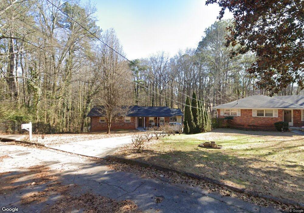
1824 Delphine Dr Decatur, GA 30032
East Lake NeighborhoodEstimated Value: $347,000 - $455,000
3
Beds
2
Baths
1,718
Sq Ft
$223/Sq Ft
Est. Value
About This Home
This home is located at 1824 Delphine Dr, Decatur, GA 30032 and is currently estimated at $383,765, approximately $223 per square foot. 1824 Delphine Dr is a home located in DeKalb County with nearby schools including McNair Middle School, McNair High School, and Charles Drew Charter School.
Ownership History
Date
Name
Owned For
Owner Type
Purchase Details
Closed on
Jun 29, 2016
Sold by
Smith Talmadge H
Bought by
Burgess Richard
Current Estimated Value
Purchase Details
Closed on
Mar 22, 2002
Sold by
Zotalis Gloria H
Bought by
Smith Talmadge H and Smith Rhonda M
Home Financials for this Owner
Home Financials are based on the most recent Mortgage that was taken out on this home.
Original Mortgage
$100,000
Interest Rate
8.25%
Mortgage Type
New Conventional
Create a Home Valuation Report for This Property
The Home Valuation Report is an in-depth analysis detailing your home's value as well as a comparison with similar homes in the area
Home Values in the Area
Average Home Value in this Area
Purchase History
| Date | Buyer | Sale Price | Title Company |
|---|---|---|---|
| Burgess Richard | $97,000 | -- | |
| Smith Talmadge H | $148,000 | -- |
Source: Public Records
Mortgage History
| Date | Status | Borrower | Loan Amount |
|---|---|---|---|
| Previous Owner | Smith Talmadge H | $100,000 |
Source: Public Records
Tax History Compared to Growth
Tax History
| Year | Tax Paid | Tax Assessment Tax Assessment Total Assessment is a certain percentage of the fair market value that is determined by local assessors to be the total taxable value of land and additions on the property. | Land | Improvement |
|---|---|---|---|---|
| 2025 | $913 | $136,000 | $44,560 | $91,440 |
| 2024 | $3,862 | $136,280 | $44,560 | $91,720 |
| 2023 | $3,862 | $125,400 | $44,560 | $80,840 |
| 2022 | $3,344 | $116,280 | $36,240 | $80,040 |
| 2021 | $2,959 | $99,600 | $35,200 | $64,400 |
| 2020 | $2,610 | $84,240 | $35,200 | $49,040 |
| 2019 | $2,473 | $79,320 | $6,960 | $72,360 |
| 2018 | $2,468 | $63,760 | $6,960 | $56,800 |
| 2017 | $2,144 | $38,788 | $3,788 | $35,000 |
| 2016 | $1,784 | $32,800 | $6,960 | $25,840 |
| 2014 | $1,640 | $28,840 | $3,520 | $25,320 |
Source: Public Records
Map
Nearby Homes
- 1830 Delphine Dr
- 1836 Delphine Dr
- 453 Carter Ave SE
- 1837 Delphine Dr
- 451 Carter Ave SE
- 1842 Delphine Dr
- 449 Carter Ave SE
- 455 Carter Ave SE
- 457 Carter Ave SE Unit 23
- 457 Carter Ave SE
- 565 Parker Ave
- 1839 Delphine Dr
- 447 Carter Ave SE
- 1850 Delphine Dr
- 551 Parker Ave
- 459 Carter Ave SE
- 557 Parker Ave
- 445 Carter Ave SE
- 1845 Delphine Dr
- 469 Carter Ave SE