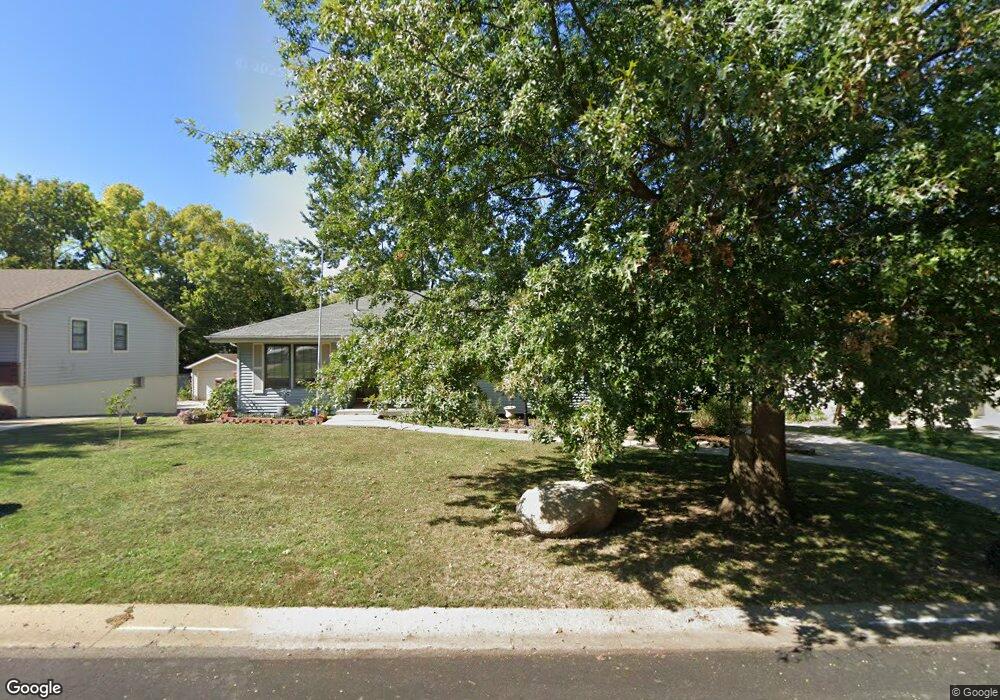
1824 N Lazy Branch Rd Independence, MO 64058
Estimated Value: $257,468 - $310,000
3
Beds
2
Baths
1,570
Sq Ft
$183/Sq Ft
Est. Value
About This Home
This home is located at 1824 N Lazy Branch Rd, Independence, MO 64058 and is currently estimated at $287,617, approximately $183 per square foot. 1824 N Lazy Branch Rd is a home located in Jackson County with nearby schools including Fort Osage High School.
Ownership History
Date
Name
Owned For
Owner Type
Purchase Details
Closed on
Jun 7, 2021
Sold by
Davis Sherry A and Shively Jeffrey
Bought by
Sander Nathan
Current Estimated Value
Purchase Details
Closed on
Mar 29, 1996
Sold by
Davis William C
Bought by
Davis William C and Davis Virginia L
Create a Home Valuation Report for This Property
The Home Valuation Report is an in-depth analysis detailing your home's value as well as a comparison with similar homes in the area
Home Values in the Area
Average Home Value in this Area
Purchase History
| Date | Buyer | Sale Price | Title Company |
|---|---|---|---|
| Sander Nathan | -- | Meridiantitle Co | |
| Davis William C | -- | -- |
Source: Public Records
Tax History Compared to Growth
Tax History
| Year | Tax Paid | Tax Assessment Tax Assessment Total Assessment is a certain percentage of the fair market value that is determined by local assessors to be the total taxable value of land and additions on the property. | Land | Improvement |
|---|---|---|---|---|
| 2025 | $3,644 | $36,936 | $6,171 | $30,765 |
| 2024 | $3,644 | $40,736 | $4,340 | $36,396 |
| 2023 | $3,611 | $40,736 | $4,153 | $36,583 |
| 2022 | $2,613 | $27,930 | $3,304 | $24,626 |
| 2021 | $2,616 | $27,930 | $3,304 | $24,626 |
| 2020 | $2,416 | $25,421 | $3,304 | $22,117 |
| 2019 | $2,367 | $25,421 | $3,304 | $22,117 |
| 2018 | $2,069 | $22,125 | $2,876 | $19,249 |
| 2017 | $2,069 | $22,125 | $2,876 | $19,249 |
| 2016 | $1,773 | $20,543 | $2,811 | $17,732 |
| 2014 | $1,746 | $20,140 | $2,756 | $17,384 |
Source: Public Records
Map
Nearby Homes
- 2006 N Concord Rd
- 2015 N Lazy Branch Rd
- 1713 N Arapaho Ct
- 18901 E Lynchburg Place N
- 18104 E 17th St N
- 2100 N York St
- 1511 Osage Trail
- 17800 E Whitney Rd
- 18108 E Shoshone Dr
- 2023 N Ethan Ln
- 19204 E 15th St N
- 19706 E 20th St N
- 19117 E 14th St N
- 18729 E 13th Terrace Ct N
- 19201 E 13th Terrace N
- 0 E 24 Highway Cir
- 1620 N Belvidere Ave
- 1801 N Davidson Rd
- 19704 E 14th Terrace N
- 19706 E 14th St N
- 1824 N Lazy Branch Rd
- 1826 N Lazy Branch Rd
- 1822 N Lazy Branch Rd
- 1823 N Lazy Branch Rd
- 1825 N Lazy Branch Rd
- 1821 N Lazy Branch Rd
- 1820 N Lazy Branch Rd
- 1900 N Lazy Branch Rd
- 1901 N Lazy Branch Rd
- 1819 N Lazy Branch Rd
- 1915 Grove Dr
- 1911 N Grove Dr
- 1818 N Lazy Branch Rd
- 1902 N Lazy Branch Rd
- 1917 Grove Dr
- 1903 N Lazy Branch Rd
- 1817 N Lazy Branch Rd
- 1909 N Grove Dr
- 1824 N Concord Rd
- 1826 N Concord Rd