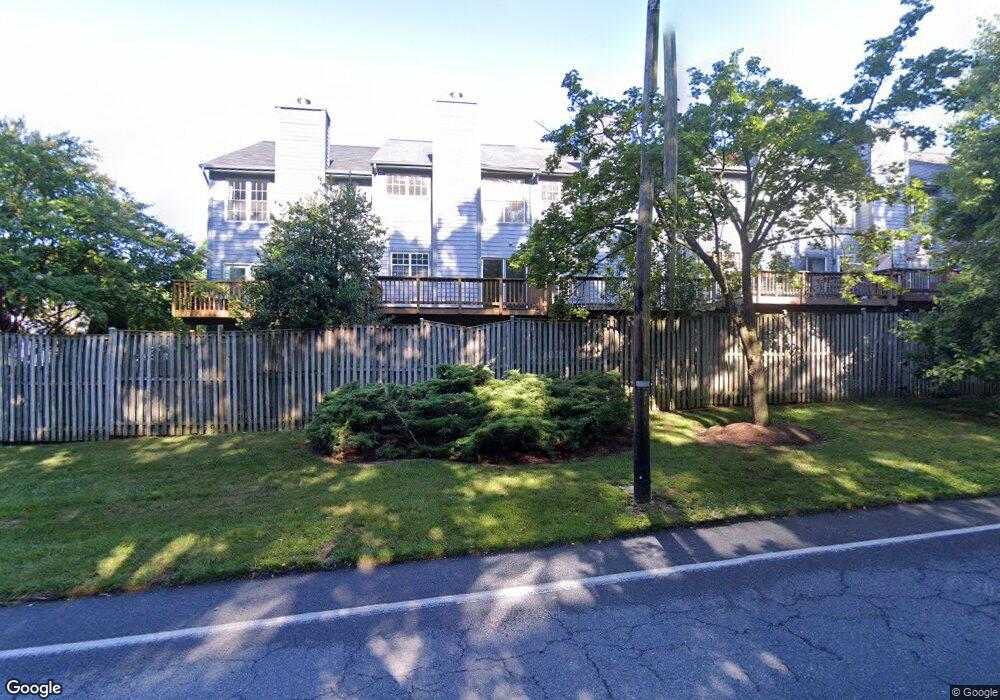
1824 Whites Ferry Place Unit 2 Crofton, MD 21114
Estimated Value: $443,000 - $461,000
3
Beds
3
Baths
2,157
Sq Ft
$210/Sq Ft
Est. Value
About This Home
This home is located at 1824 Whites Ferry Place Unit 2, Crofton, MD 21114 and is currently estimated at $452,408, approximately $209 per square foot. 1824 Whites Ferry Place Unit 2 is a home located in Anne Arundel County with nearby schools including Crofton Meadows Elementary School, Crofton Middle School, and Crofton High School.
Ownership History
Date
Name
Owned For
Owner Type
Purchase Details
Closed on
Apr 25, 2012
Sold by
Cooper Allison K and Fistere Allison K
Bought by
Fistere Allison K and Fistere Evan M
Current Estimated Value
Home Financials for this Owner
Home Financials are based on the most recent Mortgage that was taken out on this home.
Original Mortgage
$215,000
Outstanding Balance
$30,720
Interest Rate
4%
Mortgage Type
New Conventional
Estimated Equity
$421,688
Purchase Details
Closed on
Jul 31, 2009
Sold by
Woodall Kevin B
Bought by
Cooper Allison K
Purchase Details
Closed on
Oct 21, 1999
Sold by
Moore Michael
Bought by
Woodall Kevin B and Woodall Jennifer W
Purchase Details
Closed on
Nov 8, 1996
Sold by
Secretary Of Veterans Affairs
Bought by
Moore Michael and Moore Christina
Purchase Details
Closed on
Jul 25, 1996
Sold by
Kidwell Curtis A
Bought by
Secretary Of Veterans Affairs
Create a Home Valuation Report for This Property
The Home Valuation Report is an in-depth analysis detailing your home's value as well as a comparison with similar homes in the area
Home Values in the Area
Average Home Value in this Area
Purchase History
| Date | Buyer | Sale Price | Title Company |
|---|---|---|---|
| Fistere Allison K | -- | Excel Title Corporation | |
| Cooper Allison K | $308,500 | -- | |
| Woodall Kevin B | $157,000 | -- | |
| Moore Michael | $150,000 | -- | |
| Secretary Of Veterans Affairs | $166,950 | -- |
Source: Public Records
Mortgage History
| Date | Status | Borrower | Loan Amount |
|---|---|---|---|
| Open | Fistere Allison K | $215,000 | |
| Closed | Moore Michael | -- |
Source: Public Records
Tax History Compared to Growth
Tax History
| Year | Tax Paid | Tax Assessment Tax Assessment Total Assessment is a certain percentage of the fair market value that is determined by local assessors to be the total taxable value of land and additions on the property. | Land | Improvement |
|---|---|---|---|---|
| 2025 | $4,175 | $377,533 | -- | -- |
| 2024 | $4,175 | $356,267 | $0 | $0 |
| 2023 | $4,050 | $335,000 | $140,000 | $195,000 |
| 2022 | $3,494 | $334,400 | $0 | $0 |
| 2021 | $7,462 | $333,800 | $0 | $0 |
| 2020 | $3,632 | $333,200 | $140,000 | $193,200 |
| 2019 | $6,971 | $321,500 | $0 | $0 |
| 2018 | $3,141 | $309,800 | $0 | $0 |
| 2017 | $3,306 | $298,100 | $0 | $0 |
| 2016 | -- | $291,433 | $0 | $0 |
| 2015 | -- | $284,767 | $0 | $0 |
| 2014 | -- | $278,100 | $0 | $0 |
Source: Public Records
Map
Nearby Homes
- 1711 Denton Ct
- 1822 Foxdale Ct
- 1745 Leisure Way
- 1721 Leisure Way
- 1764 Sharwood Place
- 1804 Aberdeen Cir
- 1677 Hart Ct
- 2103 Higher Ct
- 2241 Aberdeen Dr
- 2508 Stow Ct
- 2173 Johns Hopkins Rd
- 1217 Birchleaf Ct
- 0 Davidsonville Rd Unit MDAA2109106
- 1557 Farlow Ave
- 930 Truro Ln
- 1523 Ashburnham Dr
- 1782 Shaftsbury Ave
- 2305 Nantucket Dr
- 1604 Tobys Ct
- 1729 Dana St Unit 6
- 1824 Whites Ferry Place
- 1822 Whites Ferry Place Unit 3
- 1822 Whites Ferry Place
- 1826 Whites Ferry Place
- 1820 Whites Ferry Place
- 1818 Whites Ferry Place
- 1816 Whites Ferry Place Unit 6
- 1830 Whites Ferry Place
- 1838 Whites Ferry Place
- 1828 Whites Ferry Place
- 1832 Whites Ferry Place
- 1834 Whites Ferry Place
- 1836 Whites Ferry Place
- 1821 Log Mill Place
- 1819 Log Mill Place
- 1819 Log Mill Place Unit 3
- 1817 Log Mill Place Unit 2
- 1817 Log Mill Place
- 1823 Log Mill Place
- 1825 Log Mill Place