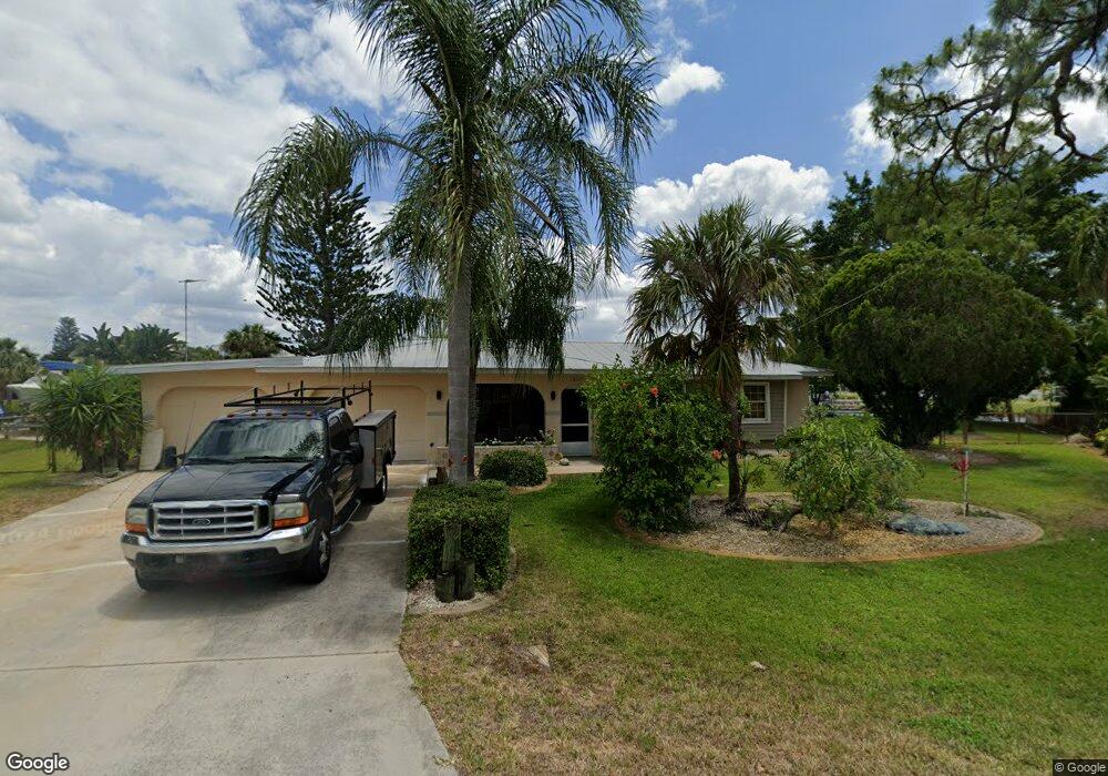
18241 Wolbrette Cir Port Charlotte, FL 33948
Estimated Value: $410,207 - $588,000
3
Beds
2
Baths
1,843
Sq Ft
$264/Sq Ft
Est. Value
About This Home
This home is located at 18241 Wolbrette Cir, Port Charlotte, FL 33948 and is currently estimated at $486,052, approximately $263 per square foot. 18241 Wolbrette Cir is a home located in Charlotte County with nearby schools including Meadow Park Elementary School, Murdock Middle School, and Port Charlotte High School.
Ownership History
Date
Name
Owned For
Owner Type
Purchase Details
Closed on
Jun 4, 2015
Sold by
Phillips Richard
Bought by
Zaleta Tracey and Paige David
Current Estimated Value
Home Financials for this Owner
Home Financials are based on the most recent Mortgage that was taken out on this home.
Original Mortgage
$228,000
Outstanding Balance
$176,718
Interest Rate
3.77%
Mortgage Type
New Conventional
Estimated Equity
$309,334
Purchase Details
Closed on
Aug 7, 2008
Sold by
Phillips Richard and Phillips Eileen
Bought by
Phillips Richard
Create a Home Valuation Report for This Property
The Home Valuation Report is an in-depth analysis detailing your home's value as well as a comparison with similar homes in the area
Home Values in the Area
Average Home Value in this Area
Purchase History
| Date | Buyer | Sale Price | Title Company |
|---|---|---|---|
| Zaleta Tracey | $285,000 | Assure America Title Company | |
| Phillips Richard | -- | Anchor Title & Associates In |
Source: Public Records
Mortgage History
| Date | Status | Borrower | Loan Amount |
|---|---|---|---|
| Open | Zaleta Tracey | $228,000 |
Source: Public Records
Tax History Compared to Growth
Tax History
| Year | Tax Paid | Tax Assessment Tax Assessment Total Assessment is a certain percentage of the fair market value that is determined by local assessors to be the total taxable value of land and additions on the property. | Land | Improvement |
|---|---|---|---|---|
| 2023 | $3,884 | $216,959 | $0 | $0 |
| 2022 | $3,978 | $224,249 | $0 | $0 |
| 2021 | $3,973 | $217,717 | $0 | $0 |
| 2020 | $4,229 | $214,711 | $0 | $0 |
| 2019 | $3,547 | $209,884 | $0 | $0 |
| 2018 | $3,290 | $205,971 | $0 | $0 |
| 2017 | $3,262 | $201,735 | $0 | $0 |
| 2016 | $3,248 | $197,586 | $0 | $0 |
| 2015 | $2,145 | $131,163 | $0 | $0 |
| 2014 | -- | $130,122 | $0 | $0 |
Source: Public Records
Map
Nearby Homes
- 4390 Wischamper St
- 18237 Bracken Cir
- 4468 Sutlive St
- 18124 Wolbrette Cir
- 18305 Wolbrette Cir
- 4477 Harrington St
- 18302 Burkholder Cir
- 18116 Wolbrette Cir
- 18065 Republic Ave
- 18053 Cullman Ave
- 4440 Tatum St
- 18049 Republic Ave
- 18065 Wing Ave
- 18361 Hottelet Cir
- 4377 Durant St
- 18126 Ackerman Ave
- 18286 Burkholder Cir
- 4469 Brintnall St
- 18189 Ohara Dr
- 18093 Ohara Dr
- 18233 Wolbrette Cir
- 18249 Wolbrette Cir
- 18225 Wolbrette Cir
- 18240 Wolbrette Cir
- 18257 Wolbrette Cir
- 18206 Bracken Cir
- 18279 Hottelet Cir
- 18263 Hottelet Cir
- 18217 Wolbrette Cir
- 18216 Wolbrette Cir
- 18198 Bracken Cir
- 18265 Wolbrette Cir
- 18255 Hottelet Cir
- 18266 Wolbrette Cir
- 4398 Wischamper St
- 18209 Wolbrette Cir
- 18190 Bracken Cir
- 18214 Bracken Cir
- 18289 Hottelet Cir
- 18247 Hottelet Cir