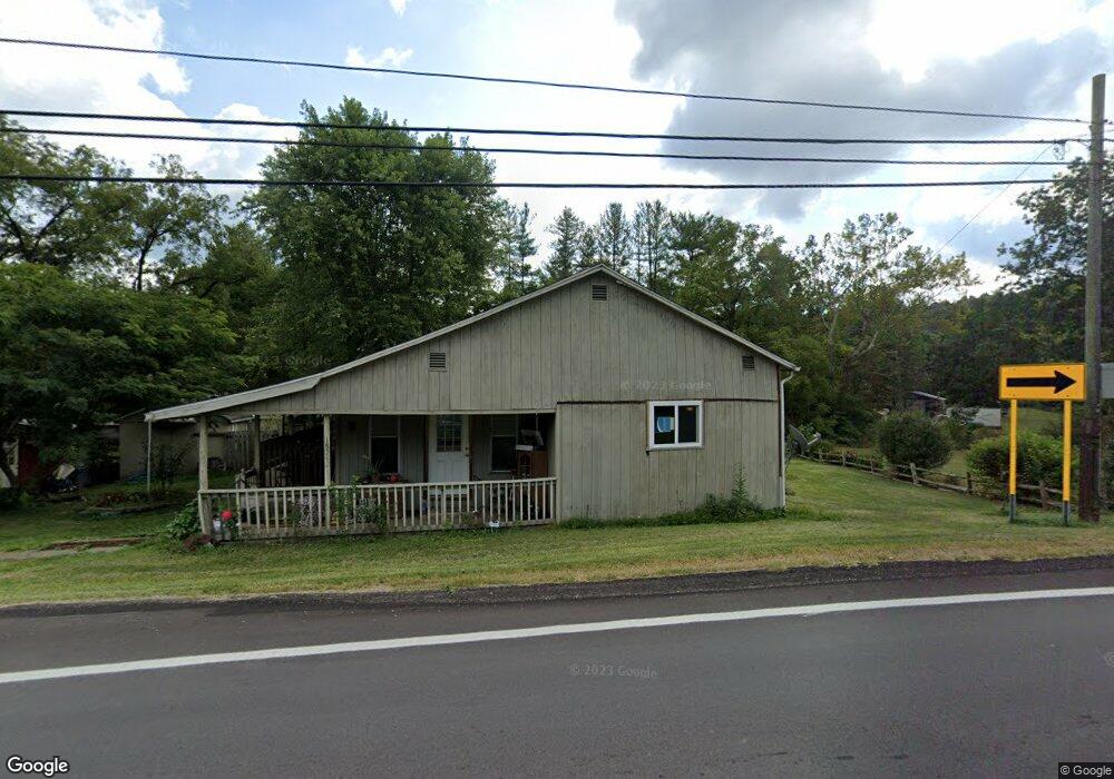
18242 State Route 13 Glouster, OH 45732
Estimated Value: $121,000 - $174,000
2
Beds
1
Bath
1,320
Sq Ft
$107/Sq Ft
Est. Value
About This Home
This home is located at 18242 State Route 13, Glouster, OH 45732 and is currently estimated at $141,347, approximately $107 per square foot. 18242 State Route 13 is a home located in Athens County with nearby schools including Trimble Elementary School, Trimble Middle School, and Trimble High School.
Ownership History
Date
Name
Owned For
Owner Type
Purchase Details
Closed on
Feb 19, 2024
Sold by
Camechis Tony and Camechis Susie E
Bought by
Jordan Tamera
Current Estimated Value
Purchase Details
Closed on
Sep 30, 2014
Sold by
Camechis Susie E and Camechis Tony M
Bought by
Camechis Susie E and Camechis Tony M
Purchase Details
Closed on
Jan 23, 2004
Bought by
Camechis Susie E
Purchase Details
Closed on
Dec 1, 2003
Sold by
Lackey David
Bought by
Citifinancial Mortgage
Purchase Details
Closed on
Mar 18, 1998
Bought by
Lackey David
Purchase Details
Closed on
Feb 2, 1998
Sold by
Blake William E
Bought by
Ford Consumer Finance
Purchase Details
Closed on
Sep 1, 1991
Create a Home Valuation Report for This Property
The Home Valuation Report is an in-depth analysis detailing your home's value as well as a comparison with similar homes in the area
Home Values in the Area
Average Home Value in this Area
Purchase History
| Date | Buyer | Sale Price | Title Company |
|---|---|---|---|
| Jordan Tamera | $57,500 | None Listed On Document | |
| Camechis Susie E | -- | Attorney | |
| Camechis Susie E | $17,500 | -- | |
| Citifinancial Mortgage | $18,000 | -- | |
| Lackey David | $34,500 | -- | |
| Ford Consumer Finance | -- | -- | |
| -- | $19,800 | -- |
Source: Public Records
Tax History Compared to Growth
Tax History
| Year | Tax Paid | Tax Assessment Tax Assessment Total Assessment is a certain percentage of the fair market value that is determined by local assessors to be the total taxable value of land and additions on the property. | Land | Improvement |
|---|---|---|---|---|
| 2024 | $860 | $20,280 | $6,110 | $14,170 |
| 2023 | $845 | $20,280 | $6,110 | $14,170 |
| 2022 | $835 | $19,270 | $5,100 | $14,170 |
| 2021 | $855 | $19,270 | $5,100 | $14,170 |
| 2020 | $856 | $19,270 | $5,100 | $14,170 |
| 2019 | $785 | $17,650 | $4,550 | $13,100 |
| 2018 | $865 | $17,650 | $4,550 | $13,100 |
| 2017 | $1,177 | $17,650 | $4,550 | $13,100 |
| 2016 | $798 | $16,340 | $4,140 | $12,200 |
| 2015 | $1,080 | $16,340 | $4,140 | $12,200 |
| 2014 | $1,080 | $16,340 | $4,140 | $12,200 |
| 2013 | $770 | $13,300 | $4,140 | $9,160 |
Source: Public Records
Map
Nearby Homes
- 18242 Ohio 13
- 18261 Jacksonville Rd
- 6 E Main St
- 19500 Lake Dr
- 19477 Center
- 0 Greens Run Rd
- 0 Oregon Ridge Rd Unit 23564746
- 33 S High St
- 88 Front St
- 31 Locust St
- 93 Main St
- 140 Sycamore St
- 11789 Congress Run Rd
- 14494 Keirns Rd
- 0 Red Rock Rd
- 14611 State Route 13
- Lambert Rd
- 10271 Antle Orchard Rd
- 14500 Wolfe Rd
- 16300 Bryson Rd
- 18252 Ohio 13
- 18243 State Route 13
- 18218 State Route 13
- 18281 State Route 13
- 18242 Swindle Rd
- 18242 Swindle Rd
- 18120 State Route 13
- 18313 State Route 13
- 18225 State Route 13
- 0 Swindell Rd
- 18321 State Route 13
- 18216 Swindle Rd
- 18597 State Route 13
- 18173 State Route 13
- 18302 Hunter Rd
- 10072 Pallo Rd
- 18090 Swindell Rd
- 18286 Hunter Rd
- 18111 State Route 13
- 18224 Taylor Ridge Rd