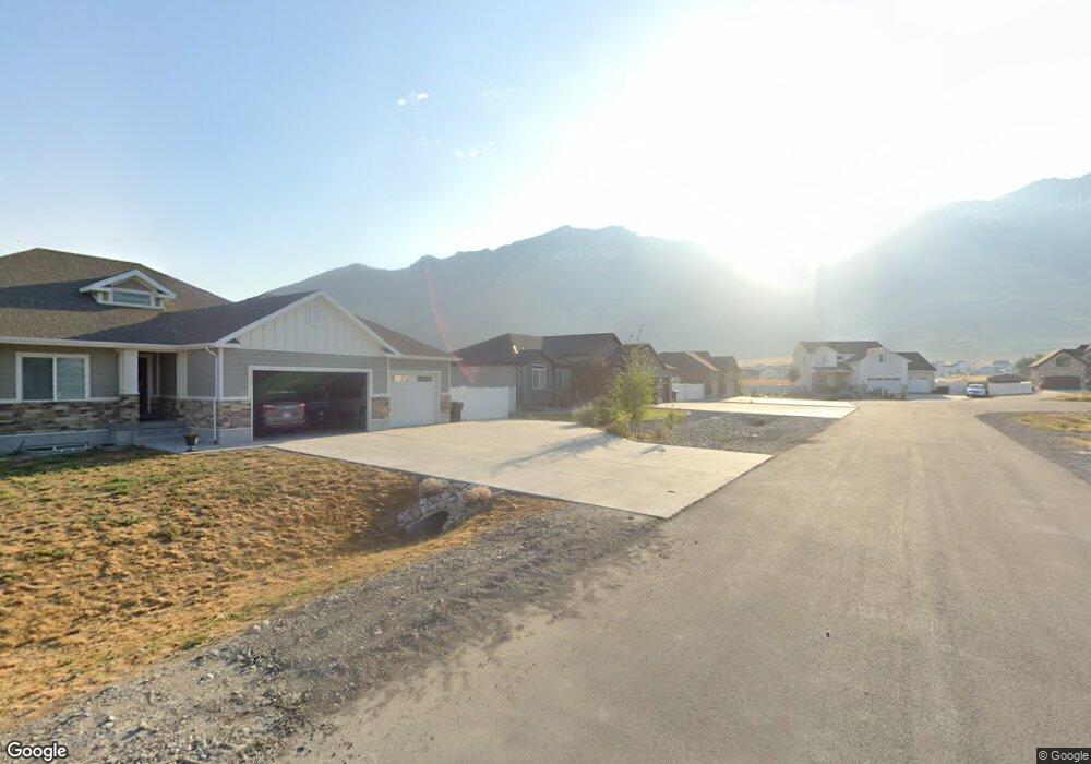
1825 E Davies Place Unit 10 Lake Point, UT 84074
Estimated Value: $570,000 - $666,000
3
Beds
3
Baths
3,010
Sq Ft
$206/Sq Ft
Est. Value
About This Home
This home is located at 1825 E Davies Place Unit 10, Lake Point, UT 84074 and is currently estimated at $620,846, approximately $206 per square foot. 1825 E Davies Place Unit 10 is a home located in Tooele County with nearby schools including Old Mill Elementary School, Clarke N. Johnsen Junior High School, and Stansbury High School.
Ownership History
Date
Name
Owned For
Owner Type
Purchase Details
Closed on
May 21, 2020
Sold by
Randy Young Construction Inc
Bought by
Bennett Joshua T and Bennett Sheena A
Current Estimated Value
Home Financials for this Owner
Home Financials are based on the most recent Mortgage that was taken out on this home.
Original Mortgage
$319,467
Outstanding Balance
$283,092
Interest Rate
3.3%
Mortgage Type
New Conventional
Estimated Equity
$337,754
Purchase Details
Closed on
Nov 21, 2019
Sold by
Saddleback Pastures Lc
Bought by
Randy Young Construction Inc
Create a Home Valuation Report for This Property
The Home Valuation Report is an in-depth analysis detailing your home's value as well as a comparison with similar homes in the area
Home Values in the Area
Average Home Value in this Area
Purchase History
| Date | Buyer | Sale Price | Title Company |
|---|---|---|---|
| Bennett Joshua T | -- | Inwest Title Tooele Office | |
| Randy Young Construction Inc | -- | First Amer Ttl Salt Lake Esc |
Source: Public Records
Mortgage History
| Date | Status | Borrower | Loan Amount |
|---|---|---|---|
| Open | Bennett Joshua T | $319,467 |
Source: Public Records
Tax History Compared to Growth
Tax History
| Year | Tax Paid | Tax Assessment Tax Assessment Total Assessment is a certain percentage of the fair market value that is determined by local assessors to be the total taxable value of land and additions on the property. | Land | Improvement |
|---|---|---|---|---|
| 2025 | $3,351 | $517,862 | $168,000 | $349,862 |
| 2024 | $3,657 | $284,807 | $92,400 | $192,407 |
| 2023 | $3,657 | $281,332 | $94,875 | $186,457 |
| 2022 | $3,283 | $290,234 | $108,735 | $181,499 |
| 2021 | $2,817 | $208,355 | $56,265 | $152,090 |
| 2020 | $1,105 | $79,000 | $79,000 | $0 |
| 2019 | $0 | $0 | $0 | $0 |
Source: Public Records
Map
Nearby Homes
- 8537 N Tiffany Ln
- 2080 E Colette St
- 8483 N Colette St
- 2056 E Dolan Dr Unit 1334
- 2056 E Dolan Dr
- 2068 E Dolan Dr
- 2068 E Dolan Dr Unit 1333
- 8636 N Weston Way Unit 1321
- 8636 N Weston Way
- 2080 E Dolan Dr Unit 1332
- 2080 E Dolan Dr
- 1885 E Burger St Unit 1415
- 8645 N Halloran Ct
- 8645 N Halloran Ct Unit 1323
- 1992 E Burger St Unit 1234
- 1992 E Burger St
- 8622 N Halloran Ct Unit 1330
- 8622 N Halloran Ct
- 8655 N Halloran Ct Unit 1324
- 8655 N Haloran Ct
- 1809 E Davies Place
- 1843 E Davies Place
- 1808 E Davies Place
- 1865 E Davies Place
- 1795 E Davies Place Unit 12
- 1866 E Davies Place
- 1794 E Davies Place
- 1842 E Davies Place
- 8472 Mountain View Rd
- 1779 E Davies Place Unit 13
- 1778 E Davies Place
- 1825 E Sunset Rd
- 1807 E Sunset Rd
- 1857 E Sunset Rd
- 1755 E Sunset Rd
- 51710 Sunset Ln
- 1401 Sunset Rd
- 1850 E Sunset Rd
- 1905 E Sunset Rd
- 373 E 1970 N