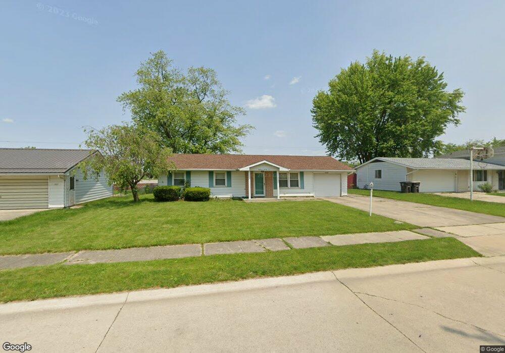
1825 Gladstone Dr Fort Wayne, IN 46816
Victoria Park NeighborhoodEstimated Value: $129,000 - $175,000
3
Beds
2
Baths
1,128
Sq Ft
$142/Sq Ft
Est. Value
About This Home
This home is located at 1825 Gladstone Dr, Fort Wayne, IN 46816 and is currently estimated at $159,853, approximately $141 per square foot. 1825 Gladstone Dr is a home located in Allen County with nearby schools including Southwick Elementary School, Prince Chapman Academy, and East Allen University.
Ownership History
Date
Name
Owned For
Owner Type
Purchase Details
Closed on
Feb 12, 2003
Sold by
Allen Dallas and Allen Linda K
Bought by
Woods Tonia R
Current Estimated Value
Home Financials for this Owner
Home Financials are based on the most recent Mortgage that was taken out on this home.
Original Mortgage
$65,100
Outstanding Balance
$35,801
Interest Rate
10%
Estimated Equity
$124,052
Create a Home Valuation Report for This Property
The Home Valuation Report is an in-depth analysis detailing your home's value as well as a comparison with similar homes in the area
Home Values in the Area
Average Home Value in this Area
Purchase History
| Date | Buyer | Sale Price | Title Company |
|---|---|---|---|
| Woods Tonia R | -- | -- |
Source: Public Records
Mortgage History
| Date | Status | Borrower | Loan Amount |
|---|---|---|---|
| Open | Woods Tonia R | $65,100 |
Source: Public Records
Tax History Compared to Growth
Tax History
| Year | Tax Paid | Tax Assessment Tax Assessment Total Assessment is a certain percentage of the fair market value that is determined by local assessors to be the total taxable value of land and additions on the property. | Land | Improvement |
|---|---|---|---|---|
| 2024 | $913 | $111,100 | $13,200 | $97,900 |
| 2023 | $913 | $112,800 | $13,200 | $99,600 |
| 2022 | $574 | $85,900 | $13,200 | $72,700 |
| 2021 | $407 | $70,700 | $13,200 | $57,500 |
| 2020 | $362 | $63,700 | $13,200 | $50,500 |
| 2019 | $355 | $61,100 | $13,200 | $47,900 |
| 2018 | $355 | $59,300 | $13,200 | $46,100 |
| 2017 | $327 | $53,900 | $13,200 | $40,700 |
| 2016 | $317 | $52,800 | $13,200 | $39,600 |
| 2014 | $293 | $50,400 | $13,200 | $37,200 |
| 2013 | $325 | $54,700 | $13,200 | $41,500 |
Source: Public Records
Map
Nearby Homes
- 2022 Montford Dr
- 1932 Embassy Dr
- 6522 S Anthony Blvd
- 1319 Farwood Ave
- 1620 Seddlemeyer Ave
- 2612 Oakwood Dr
- 2630 Chandler Dr
- 6130 Hystone Dr
- 5714 Smith St
- 5217 Holton Ave
- 1612 Elmrow Dr
- 4915 Plaza Dr
- 2824 Ashcroft Dr
- 3109 E Tillman Rd
- 6418 Melville Dr
- 6125 Chaddsford Dr
- 4821 Oliver St
- 409 Corwin Ln
- 5031 Salem Ln
- 7075 Starks Blvd Unit Lot 30
- 1883 Gladstone Dr
- 1817 Gladstone Dr
- 1833 Gladstone Dr
- 1907 Gladstone Dr
- 1809 Gladstone Dr
- 1826 Gladstone Dr
- 1834 Gladstone Dr
- 1818 Gladstone Dr
- 1915 Gladstone Dr
- 1908 Gladstone Dr
- 1810 Gladstone Dr
- 1916 Gladstone Dr
- 1923 Gladstone Dr
- 1825 Embassy Dr
- 1817 Embassy Dr
- 1833 Embassy Dr
- 1907 Embassy Dr
- 1924 Gladstone Dr
- 1809 Embassy Dr
- 1931 Gladstone Dr