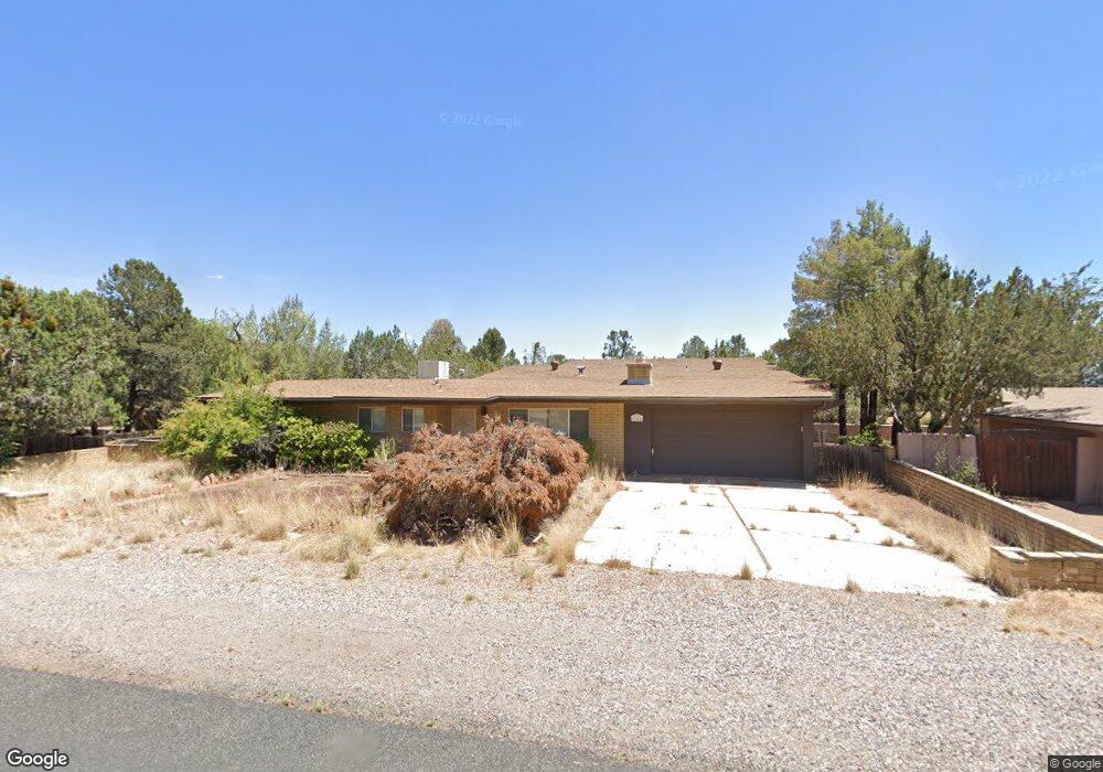
1825 Gun Fury Rd Sedona, AZ 86336
Estimated Value: $764,396 - $1,012,000
--
Bed
--
Bath
2,137
Sq Ft
$408/Sq Ft
Est. Value
About This Home
This home is located at 1825 Gun Fury Rd, Sedona, AZ 86336 and is currently estimated at $872,849, approximately $408 per square foot. 1825 Gun Fury Rd is a home located in Yavapai County with nearby schools including West Sedona Elementary School, Sedona Red Rock Junior/Senior High School, and Sedona Charter School.
Ownership History
Date
Name
Owned For
Owner Type
Purchase Details
Closed on
Nov 30, 2023
Sold by
Barbara P Wadhams Revocable Living Trust
Bought by
La Montania Llc
Current Estimated Value
Home Financials for this Owner
Home Financials are based on the most recent Mortgage that was taken out on this home.
Original Mortgage
$600,000
Outstanding Balance
$590,582
Interest Rate
7.79%
Mortgage Type
New Conventional
Estimated Equity
$282,267
Purchase Details
Closed on
Aug 26, 2022
Sold by
Barbara P Wadhams Revocable Living Trust
Bought by
Barbara P Wadhams Revocable Living Trust and Wadhams
Purchase Details
Closed on
Mar 26, 2009
Sold by
Wadhams Barbara P
Bought by
Wadhams Barbara P and Wadhams Sharon L
Create a Home Valuation Report for This Property
The Home Valuation Report is an in-depth analysis detailing your home's value as well as a comparison with similar homes in the area
Home Values in the Area
Average Home Value in this Area
Purchase History
| Date | Buyer | Sale Price | Title Company |
|---|---|---|---|
| La Montania Llc | $750,000 | Great American Title | |
| Barbara P Wadhams Revocable Living Trust | -- | None Listed On Document | |
| Barbara P Wadhams Revocable Living Trust | -- | -- | |
| Wadhams Barbara P | -- | Accommodation |
Source: Public Records
Mortgage History
| Date | Status | Borrower | Loan Amount |
|---|---|---|---|
| Open | La Montania Llc | $600,000 |
Source: Public Records
Tax History Compared to Growth
Tax History
| Year | Tax Paid | Tax Assessment Tax Assessment Total Assessment is a certain percentage of the fair market value that is determined by local assessors to be the total taxable value of land and additions on the property. | Land | Improvement |
|---|---|---|---|---|
| 2026 | $3,145 | $61,349 | -- | -- |
| 2024 | $2,835 | $66,705 | -- | -- |
| 2023 | $2,835 | $46,037 | $12,685 | $33,352 |
| 2022 | $2,711 | $37,125 | $10,562 | $26,563 |
| 2021 | $2,783 | $35,290 | $9,091 | $26,199 |
| 2020 | $2,781 | $0 | $0 | $0 |
| 2019 | $2,760 | $0 | $0 | $0 |
| 2018 | $2,625 | $0 | $0 | $0 |
| 2017 | $2,563 | $0 | $0 | $0 |
| 2016 | $2,513 | $0 | $0 | $0 |
| 2015 | -- | $0 | $0 | $0 |
| 2014 | -- | $0 | $0 | $0 |
Source: Public Records
Map
Nearby Homes
- 460 Coffee Pot Dr
- 55 Stations Dr W
- 310 Mountain Shadows Dr Unit 89
- 145 Grounds Dr
- 747 Mountain Shadows Dr
- 160 Budd Way
- 260 Coffee Pot Dr Unit 17
- 260 Coffee Pot Dr Unit 6
- 260 Coffee Pot Dr Unit 20
- 25 Santa Barbara Dr
- 2190 Sanborn Dr
- 280 Goodrow Ln
- 30 Schimberg Rd
- 2200 Buckboard Rd
- 25 Edgewood Cir
- 1670 W State Route 89a
- 1483 Vista Montana Rd
- 240 Goodrow Ln
- 1445 Cline Rd
- 1403 Vista Montana Rd Unit 56