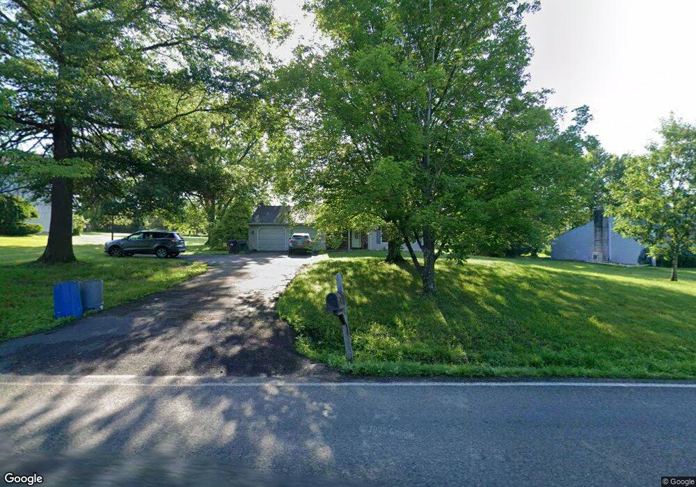
1825 Krammes Rd Quakertown, PA 18951
Milford-Quakertown NeighborhoodEstimated Value: $532,622 - $614,000
4
Beds
3
Baths
2,400
Sq Ft
$236/Sq Ft
Est. Value
About This Home
This home is located at 1825 Krammes Rd, Quakertown, PA 18951 and is currently estimated at $567,156, approximately $236 per square foot. 1825 Krammes Rd is a home located in Bucks County with nearby schools including Pfaff Elementary School, Quakertown Community Senior High School, and Faith Christian Academy 7-12th.
Ownership History
Date
Name
Owned For
Owner Type
Purchase Details
Closed on
Sep 23, 2008
Sold by
Leister William H and Leister Lori A
Bought by
Sanderlin Daniel
Current Estimated Value
Home Financials for this Owner
Home Financials are based on the most recent Mortgage that was taken out on this home.
Original Mortgage
$306,347
Outstanding Balance
$203,958
Interest Rate
6.54%
Mortgage Type
VA
Estimated Equity
$363,198
Purchase Details
Closed on
Mar 17, 1993
Bought by
Leister William H and Leister Lori A
Create a Home Valuation Report for This Property
The Home Valuation Report is an in-depth analysis detailing your home's value as well as a comparison with similar homes in the area
Home Values in the Area
Average Home Value in this Area
Purchase History
| Date | Buyer | Sale Price | Title Company |
|---|---|---|---|
| Sanderlin Daniel | $299,900 | None Available | |
| Leister William H | $159,200 | -- |
Source: Public Records
Mortgage History
| Date | Status | Borrower | Loan Amount |
|---|---|---|---|
| Open | Sanderlin Daniel | $306,347 |
Source: Public Records
Tax History Compared to Growth
Tax History
| Year | Tax Paid | Tax Assessment Tax Assessment Total Assessment is a certain percentage of the fair market value that is determined by local assessors to be the total taxable value of land and additions on the property. | Land | Improvement |
|---|---|---|---|---|
| 2025 | $6,534 | $32,400 | $2,520 | $29,880 |
| 2024 | $6,534 | $32,400 | $2,520 | $29,880 |
| 2023 | $6,469 | $32,400 | $2,520 | $29,880 |
| 2022 | $6,359 | $32,400 | $2,520 | $29,880 |
| 2021 | $6,359 | $32,400 | $2,520 | $29,880 |
| 2020 | $6,359 | $32,400 | $2,520 | $29,880 |
| 2019 | $6,183 | $32,400 | $2,520 | $29,880 |
| 2018 | $5,969 | $32,400 | $2,520 | $29,880 |
| 2017 | $5,784 | $32,400 | $2,520 | $29,880 |
| 2016 | $5,784 | $32,400 | $2,520 | $29,880 |
| 2015 | -- | $32,400 | $2,520 | $29,880 |
| 2014 | -- | $32,400 | $2,520 | $29,880 |
Source: Public Records
Map
Nearby Homes
- 0 Krammes Rd Unit PABU2104522
- 1715 Kumry Rd
- 1690 Kumry Rd
- 1615 Canary Rd
- 1625 Canary Rd
- 1605 Canary Rd
- 1926 Alamingo Dr
- 1813 Sycamore Dr
- 1999 Crossing Way
- 2120 Brinkman Rd
- 2070 Trumbauersville Rd
- 1844 Enclave Dr
- 444 Enclave Dr Unit COVINGTON
- 444 Enclave Dr Unit DEVONSHIRE
- 444 Enclave Dr Unit HAWTHORNE
- 444 Enclave Dr Unit SAVANNAH
- 444 Enclave Dr Unit SEBASTIAN
- 444 Enclave Dr Unit PARKER
- 1832 Enclave Dr
- Kipling Plan at Millstone at Parkside
- 1815 Krammes Rd
- 1835 Krammes Rd
- 1856 Kumry Rd
- 1860 Kumry Rd
- 1854 Kumry Rd
- 1877 Krammes Rd
- 1880 Kumry Rd
- 1875 Kumry Rd
- 1890 Kumry Rd
- 1835 Kumry Rd
- 0 Kumry Rd Unit 6022200
- 0 Kumry Rd Unit 6194114
- 0 Kumry Rd Unit 6194105
- 1895 Kumry Rd
- 1812 Rosenberger Rd
- 1850 Rosenberger Rd
- 1800 Kumry Rd
- 1795 Kumry Rd
- 1830 Walnut Ln
- 1840 Walnut Ln