Estimated payment $356/month
Highlights
- Pond
- No HOA
- Property is Fully Fenced
- Partially Wooded Lot
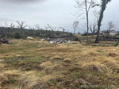
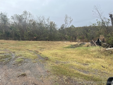
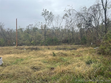
About This Lot
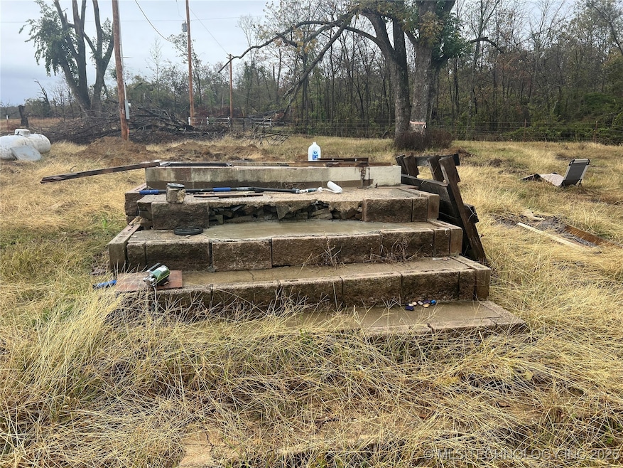
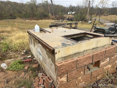
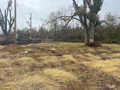
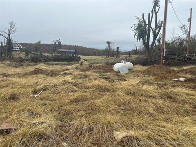
Mobiles READY on this 2.75 acres with water tape from Mayes RWD#4, 2 septic sustems, storm cellar that was used as porch for factory built home that was removed by a storm, CELLER IS STILL GOOD, Electric on the property, concret slabs from sheds, clusters of trees. Seller is related to the listing agent.
Property Details
Property Type
- Land
Est. Annual Taxes
- $278
Lot Details
- 2.75 Acre Lot
- Lot Dimensions are 329x396
- Property is Fully Fenced
- Barbed Wire
- Partially Wooded Lot
- Zoning described as RUAL RES
Mobile Home
- Mobile Home Allowed
Utilities
- Private Water Source
- Septic Tank
Community Details
Overview
- No Home Owners Association
- Mayes Co Unplatted Subdivision
Recreation
- Pond
Map
Home Values in the Area
Average Home Value in this Area
Tax History
| Year | Tax Paid | Tax Assessment Tax Assessment Total Assessment is a certain percentage of the fair market value that is determined by local assessors to be the total taxable value of land and additions on the property. | Land | Improvement |
|---|---|---|---|---|
| 2025 | $287 | $3,801 | $3,801 | $0 |
| 2024 | $278 | $3,620 | $3,620 | $0 |
| 2023 | $278 | $3,448 | $3,358 | $90 |
| 2022 | $255 | $3,284 | $3,194 | $90 |
| 2021 | $246 | $3,128 | $3,038 | $90 |
| 2020 | $229 | $2,979 | $2,889 | $90 |
| 2019 | $414 | $5,254 | $2,642 | $2,612 |
| 2018 | $397 | $5,004 | $2,404 | $2,600 |
| 2017 | $393 | $4,766 | $1,627 | $3,139 |
| 2016 | $388 | $4,766 | $1,627 | $3,139 |
| 2015 | $391 | $4,766 | $1,627 | $3,139 |
| 2014 | -- | $4,661 | $1,522 | $3,139 |
Property History
| Date | Event | Price | List to Sale | Price per Sq Ft |
|---|---|---|---|---|
| 12/01/2025 12/01/25 | For Sale | $63,500 | -- | -- |
Purchase History
| Date | Type | Sale Price | Title Company |
|---|---|---|---|
| Interfamily Deed Transfer | -- | Mayes County Abstract | |
| Warranty Deed | $33,000 | None Available | |
| Contract Of Sale | $33,000 | None Available | |
| Special Warranty Deed | -- | None Available | |
| Sheriffs Deed | $47,573 | None Available | |
| Warranty Deed | $50,000 | -- |
Source: MLS Technology
MLS Number: 2548665
APN: 0000-06-21N-18E-1-004-00
Disclaimer: Certain information contained herein is derived from information provided by parties other than Homes.com. All information provided is deemed reliable, but is not guaranteed to be accurate and should be independently verified.
![]() IDX information is provided exclusively for personal, non-commercial use, and may not be used for any purpose other than to identify prospective properties consumers may be interested in purchasing.
IDX information is provided exclusively for personal, non-commercial use, and may not be used for any purpose other than to identify prospective properties consumers may be interested in purchasing.
Information is deemed reliable but not guaranteed.
- 1523 N 426 Rd
- 9050 W 480
- 240 NW 482 Trail
- 0 E 470 Rd Unit 2537290
- 21095 E Barbara Blvd
- 21870 Morgan Rd
- 21845 Morgan Rd
- 3751 N 427
- 21199 E Renee Rd
- 426 N 426 Rd
- 19854 E 470 Rd
- 175 S 428
- 20005 E Highway 20
- 19305 S Deer Trail Rd
- 1488 N 429
- 16251 S Cedarcrest Dr
- 16185 S Cedarcrest Dr
- 19300 S Timber Acres
- 192 Prairie Dr
- 16400 Hubbard Rd
- 809 SE 14th St
- 3660 W 530 Rd
- 19805 S Lake Dr
- 13856 E Anderson Dr
- 13704 E Anderson Dr
- 210 E Will Rogers Blvd
- 3306 Harbour Town
- 3304 Harbour Town
- 1400 W Blue Starr Dr
- 20430 E 580 Rd
- 1101 W Abilene Rd
- 1903 S Lubbock Dr
- 2107 Cornerstone Ave Unit A
- 2404 Pheasant Dr
- 2500 Frederick Rd
- 10134 E King Place
- 33966 S 4310 Rd
- 13565 U S 169
- 955 Hamilton Falls
- 3029 Spring St
