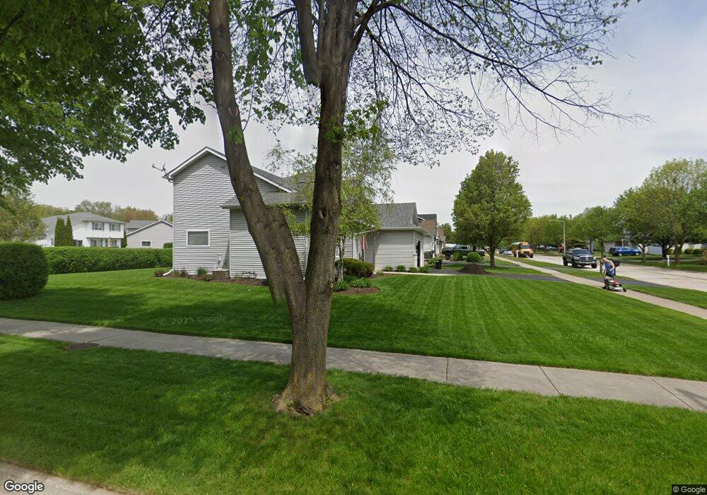
1825 Springside Dr Crest Hill, IL 60403
Estimated Value: $330,000 - $353,000
--
Bed
1
Bath
1,880
Sq Ft
$181/Sq Ft
Est. Value
About This Home
This home is located at 1825 Springside Dr, Crest Hill, IL 60403 and is currently estimated at $340,051, approximately $180 per square foot. 1825 Springside Dr is a home located in Will County with nearby schools including Grand Prairie Elementary School, Timber Ridge Middle School, and Plainfield Central High School.
Ownership History
Date
Name
Owned For
Owner Type
Purchase Details
Closed on
Dec 28, 1998
Sold by
Nlsb
Bought by
Miller Timothy J
Current Estimated Value
Home Financials for this Owner
Home Financials are based on the most recent Mortgage that was taken out on this home.
Original Mortgage
$86,000
Outstanding Balance
$19,947
Interest Rate
6.76%
Estimated Equity
$320,104
Create a Home Valuation Report for This Property
The Home Valuation Report is an in-depth analysis detailing your home's value as well as a comparison with similar homes in the area
Home Values in the Area
Average Home Value in this Area
Purchase History
| Date | Buyer | Sale Price | Title Company |
|---|---|---|---|
| Miller Timothy J | $149,500 | -- |
Source: Public Records
Mortgage History
| Date | Status | Borrower | Loan Amount |
|---|---|---|---|
| Open | Miller Timothy J | $86,000 |
Source: Public Records
Tax History Compared to Growth
Tax History
| Year | Tax Paid | Tax Assessment Tax Assessment Total Assessment is a certain percentage of the fair market value that is determined by local assessors to be the total taxable value of land and additions on the property. | Land | Improvement |
|---|---|---|---|---|
| 2024 | $5,066 | $100,122 | $24,233 | $75,889 |
| 2023 | $5,066 | $90,428 | $21,887 | $68,541 |
| 2022 | $6,390 | $81,216 | $19,657 | $61,559 |
| 2021 | $6,028 | $75,903 | $18,371 | $57,532 |
| 2020 | $5,947 | $73,750 | $17,850 | $55,900 |
| 2019 | $5,674 | $70,271 | $17,008 | $53,263 |
| 2018 | $5,417 | $66,024 | $15,980 | $50,044 |
| 2017 | $5,247 | $62,743 | $15,186 | $47,557 |
| 2016 | $5,122 | $59,841 | $14,484 | $45,357 |
| 2015 | $4,746 | $56,057 | $13,568 | $42,489 |
| 2014 | $4,746 | $54,078 | $13,089 | $40,989 |
| 2013 | $4,746 | $54,078 | $13,089 | $40,989 |
Source: Public Records
Map
Nearby Homes
- 2528 Silver Rock Dr
- 2703 Oak Ridge Ln
- 1810 Foxfield Dr
- 2533 Waterford Dr
- 1804 Maserati Dr
- 1802 Maserati Dr
- 1874 Corregidor St
- 2516 Lotus Ln
- 2505 Lotus Ln
- 2304 Carnation Dr
- 3001 Theodore St
- 1921 Cecily Dr
- 2390 Bicentennial Ave
- 2812 Vimy Ridge Dr
- 1219 Cedarwood Dr Unit B
- 1521 Pioneer Rd Unit 7
- 2385 Jorie Ct
- 2508 Meer Park Ct Unit 151
- 7 Rock Run Dr
- 1945 Calla Dr
- 1829 Springside Dr
- 1817 Springside Dr
- 1833 Springside Dr
- 1812 Wake Island Dr
- 1810 Wake Island Dr
- 1810 Wake Island Dr
- 2532 Silver Rock Dr
- 2545 Silver Rock Dr
- 2541 Silver Rock Dr
- 2602 Silver Rock Dr
- 1837 Springside Dr
- 2537 Silver Rock Dr
- 1814 Wake Island Dr
- 1830 Springside Dr
- 2533 Silver Rock Dr
- 1806 Wake Island Dr
- 1834 Springside Dr
- 1841 Springside Dr
- 1804 Wake Island Dr
- 2529 Silver Rock Dr