Estimated Value: $330,079 - $358,000
3
Beds
3
Baths
2,031
Sq Ft
$168/Sq Ft
Est. Value
About This Home
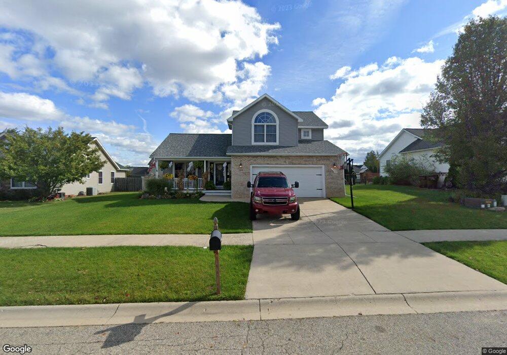
This home is located at 1826 Parakeet, Holt, MI 48842 and is currently estimated at $341,520, approximately $168 per square foot. 1826 Parakeet is a home located in Ingham County with nearby schools including Horizon Elementary School, Washington Woods Middle School, and Holt Junior High School.
Ownership History
Date
Name
Owned For
Owner Type
Purchase Details
Closed on
Mar 14, 2014
Sold by
Wise James and Wise Melinda
Bought by
Wise James and Wise Melinda
Current Estimated Value
Home Financials for this Owner
Home Financials are based on the most recent Mortgage that was taken out on this home.
Original Mortgage
$164,800
Outstanding Balance
$106,143
Interest Rate
4.24%
Mortgage Type
New Conventional
Estimated Equity
$235,377
Purchase Details
Closed on
Jun 15, 2006
Sold by
Titan Building & Development Inc
Bought by
Wise James and Wise Mindy
Home Financials for this Owner
Home Financials are based on the most recent Mortgage that was taken out on this home.
Original Mortgage
$179,920
Interest Rate
6.72%
Mortgage Type
Purchase Money Mortgage
Purchase Details
Closed on
Mar 5, 2004
Sold by
Titan Building & Development Inc
Bought by
Mcnamara Michael
Create a Home Valuation Report for This Property
The Home Valuation Report is an in-depth analysis detailing your home's value as well as a comparison with similar homes in the area
Home Values in the Area
Average Home Value in this Area
Purchase History
| Date | Buyer | Sale Price | Title Company |
|---|---|---|---|
| Wise James | -- | None Available | |
| Wise James | $224,900 | Fatic | |
| Mcnamara Michael | -- | Devon Title | |
| Titan Building & Development Inc | -- | Devon Title |
Source: Public Records
Mortgage History
| Date | Status | Borrower | Loan Amount |
|---|---|---|---|
| Open | Wise James | $164,800 | |
| Closed | Wise James | $179,920 |
Source: Public Records
Tax History
| Year | Tax Paid | Tax Assessment Tax Assessment Total Assessment is a certain percentage of the fair market value that is determined by local assessors to be the total taxable value of land and additions on the property. | Land | Improvement |
|---|---|---|---|---|
| 2025 | $5,752 | $164,600 | $28,200 | $136,400 |
| 2024 | $5,373 | $164,300 | $25,500 | $138,800 |
| 2023 | $5,373 | $149,900 | $21,400 | $128,500 |
| 2022 | $5,068 | $132,700 | $23,200 | $109,500 |
| 2021 | $4,912 | $127,200 | $17,500 | $109,700 |
| 2020 | $5,003 | $121,700 | $17,500 | $104,200 |
| 2019 | $4,891 | $114,700 | $12,900 | $101,800 |
| 2018 | $4,863 | $104,900 | $12,900 | $92,000 |
| 2017 | $4,428 | $104,900 | $12,900 | $92,000 |
| 2016 | $4,391 | $94,800 | $17,100 | $77,700 |
| 2015 | $4,296 | $88,000 | $34,218 | $53,782 |
| 2014 | $4,296 | $86,000 | $34,218 | $51,782 |
Source: Public Records
Map
Nearby Homes
- 1851 Hollowbrook Dr
- 2145 Aspenwood Dr
- 2142 Washington Rd
- 5386 Auben Ln
- 5360 Holt Rd
- 1463 N Onondaga Rd
- 2340 Washington Rd
- VL Witherspoon Way
- 5170 Beaumaris Cir
- 5091 Runnymede Dr
- 5071 Haddon Hall Dr
- 1765 N Eifert Rd
- 2520 Lanier Ct
- 1532 N Eifert Rd
- 5594 Harper Rd
- 2658 Sanibel Hollow
- 2678 Valdez Dr
- 11858 Holt Hwy
- 510 Sawyer Rd
- 5041 E Willoughby Rd Unit 4
- 1834 Parakeet
- 1816 Parakeet
- 1827 Hollowbrook Dr
- 1819 Hollowbrook Dr
- 1835 Hollowbrook Dr
- 1842 Parakeet
- 1810 Parakeet
- 1821 Parakeet
- 1811 Hollowbrook Dr
- 1843 Hollowbrook Dr
- 1829 Parakeet
- 1815 Parakeet
- 1850 Parakeet
- 1802 Parakeet
- 1837 Parakeet
- 1807 Parakeet
- 1803 Hollowbrook Dr
- 1845 Parakeet
- 1820 Hollowbrook Dr
- 1801 Parakeet